Wildfire burns 7,000 hectares in Almería province, Spain
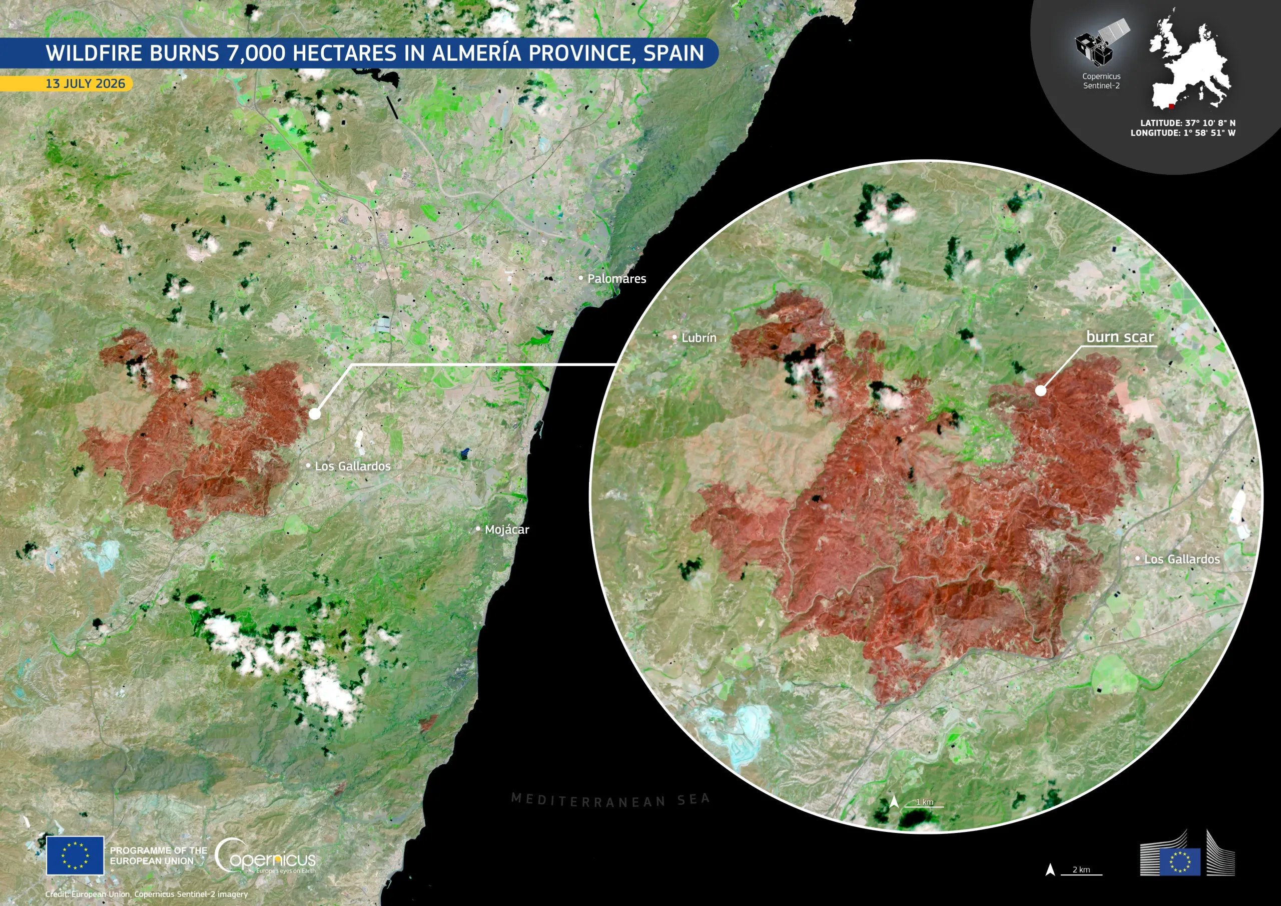
A wildfire broke out near the municipality of Los Gallardos, in the province of Almería, Spain, on 9 July 2026. Strong winds contributed to its rapid spread through dry vegetation. The fire burned approximately 7,000 hectares before it was stabilised on 12 July.
Acquired on 13 July 2026 by one of the Copernicus Sentinel-2 satellites, this false-colour image shows the extensive burn scar in shades of red and brown, while unaffected vegetation appears in bright green. The municipalities of Los Gallardos and Lubrín are visible around the affected area.
Copernicus Sentinel-2 data support emergency response by providing timely information for mapping burned areas, monitoring active fires, and planning recovery operations.