Wildfire in Saumos, France
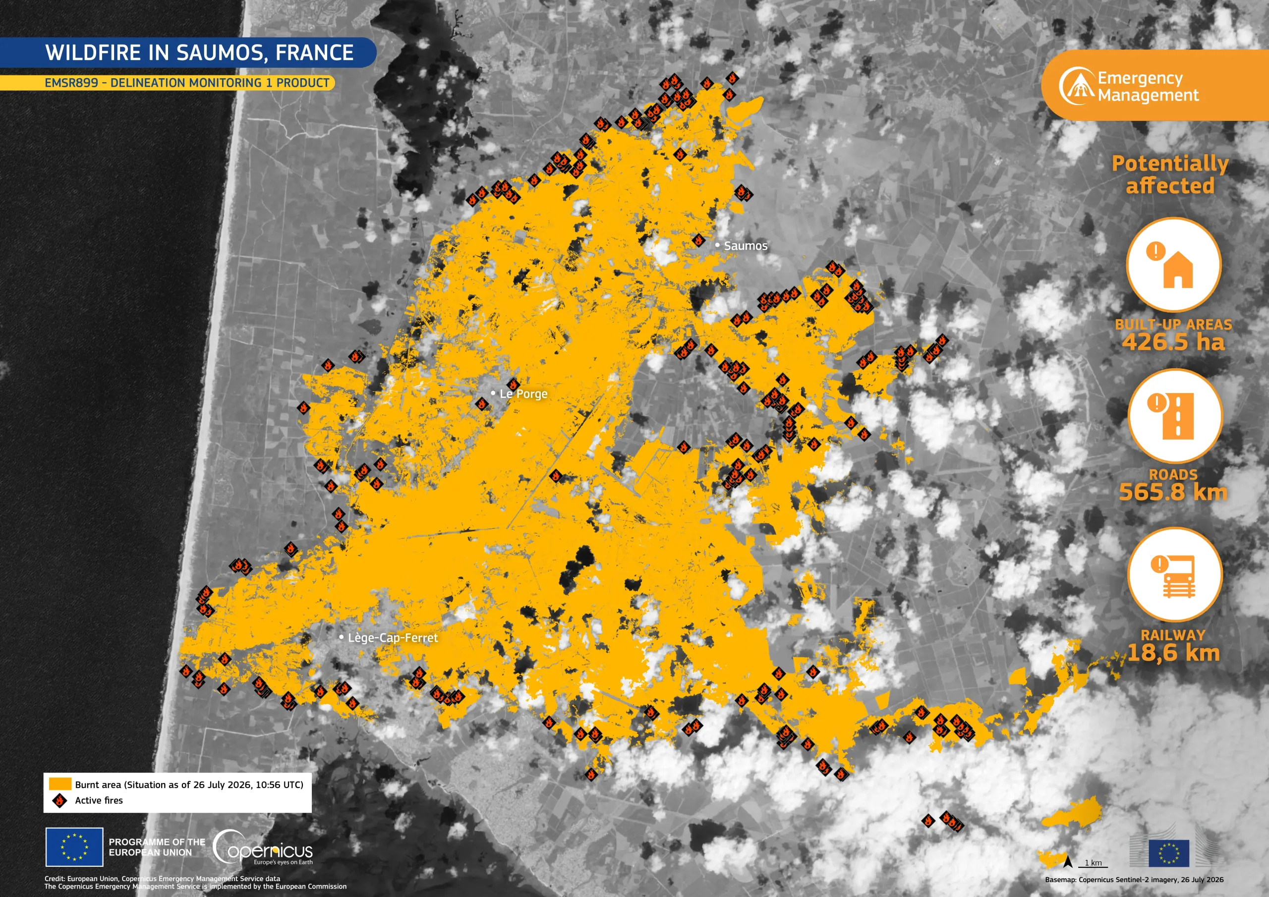
Two wildfires broke out between 22 and 23 July 2026 near the municipalities of Saumos and Biscarrosse in south-western France, affecting extensive pine forests around the Arcachon Bay.
According to official reports, by 27 July, the Saumos fire, had affected approximately 42,000 hectares and prompted the precautionary evacuation of 220,000 people across the region. The Copernicus Emergency Management Service (CEMS) Rapid Mapping component has been activated (EMSR899) to provide wildfire extent and damage assessment emergency mapping.
This data visualisation based on the CEMS Delineation Monitoring 1 product, shows the active fires and the area affected in orange as of 26 July 2026.
Copernicus Sentinel-2 data help map burnt areas, monitor active fire fronts, and support authorities in assessing impacts on forests, settlements, and infrastructure. Open data provided by the Copernicus Sentinel satellites and CEMS support the monitoring and mapping of wildfire extent and impacts worldwide. Additional information on this activation is available here.