Wildfire spreads across western Bosnia and Herzegovina
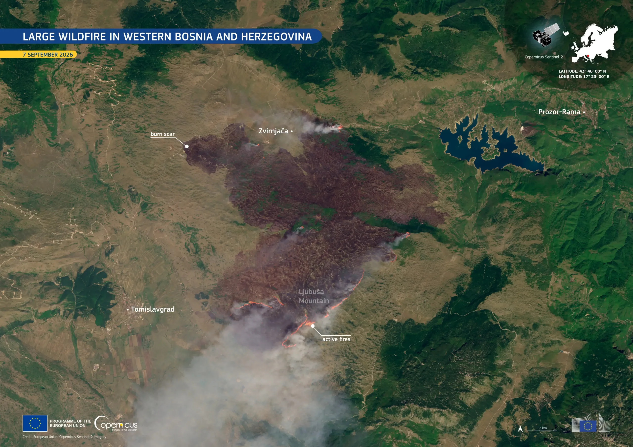
A large wildfire broke out near the village of Zvirnjača, about 85 km west of Sarajevo, Bosnia and Herzegovina, on 4 September 2026. By 7 September, around 14,000 ha had been affected and the active fire front extended over more than 20 km. The fire burned extensive areas around the Ljubuša Mountain and threatened nearby settlements, while smoke was transported across the Adriatic towards the Italian and Croatian coasts. Firefighters, local civil protection teams, and volunteers have been working to contain the blaze, supported by two firefighting aircraft sent by neighbouring Croatia.
This image, acquired by one of the Copernicus Sentinel-2 satellites on 7 September 2026, shows the burn scar on the Ljubuša Mountain. Active fire fronts are visible along parts of its southern edge, while large smoke plumes are visible over the affected area.
Copernicus satellite data provides detailed information for mapping areas affected by wildfires. These observations support the assessment of wildfire impacts and the subsequent monitoring of affected areas and vegetation recovery.