Explore EU Space

Results (1310)
RSS feed of these results
Image of the day
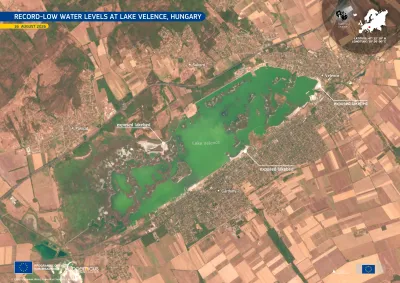
Copernicus Sentinel-2 image acquired on 16 August 2026 showing Lake Velence in central Hungary. The green-coloured lake is surrounded by agricultural land and the settlements of Velence, Gárdony and Sukoró, with shallow shoreline areas visible around parts of the lake.
Earth Observation
Earth Observation
Copernicus
Lake Velence, Hungary’s third-largest lake, located southwest of Budapest, is affected by record-low water levels following prolonged dry conditions. By 1 August 2026, its water level fell below the…
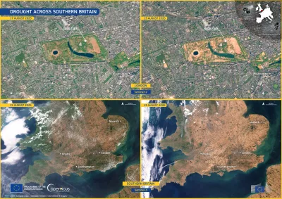
Image of the day
Four-panel satellite comparison showing drought conditions in southern England in August 2026.
Earth Observation
Earth Observation
Copernicus
Over the summer of 2026, dry conditions have been affecting the United Kingdom. According to the European Drought Observatory (EDO), 25% of the territory of England was in Alert conditions and 65% in…
Image of the day
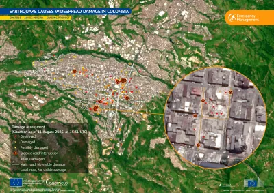
Map of Pereira, Colombia, showing earthquake-related damage identified by the Copernicus Emergency Management Service following the 10 August 2026 magnitude 7.4 earthquake.
Earth Observation
Earth Observation
Copernicus
On 10 August 2026, a magnitude 7.4 earthquake struck western Colombia, causing severe damage across the region. According to the latest reports, the earthquake has resulted in 289 casualties and…
Image of the day
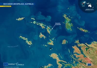
Satellite image of the Buccaneer Archipelago off the Kimberley coast of Western Australia, showing the rugged coastline and numerous islands and waterways.
Earth Observation
Earth Observation
Copernicus
The Buccaneer Archipelago comprises more than 800 islands off the Kimberley coast of north-western Australia. The archipelago is known for its complex coastline, strong tidal currents, rocky islands,…
Image of the day
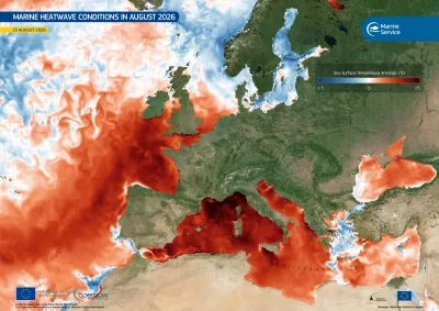
Copernicus Marine data visualisation of sea surface temperature
Earth Observation
Earth Observation
Copernicus
Marine heatwave conditions have been affecting the western Mediterranean Sea and parts of the north-eastern Atlantic through the summer of 2026, and unusually warm sea surface temperatures remained…
Image of the day
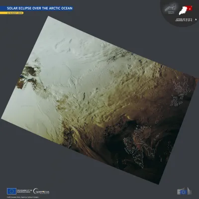
Satellite image of the eclipse shadow , spanning from northern Greenland to the Svalbard Archipelago and Franz Josef Land.
Earth Observation
Earth Observation
Copernicus
On 12 August 2026, a total solar eclipse crossed the Arctic Ocean, eastern Greenland, western Iceland, and the northern half of Spain. The area covered by the full eclipse was at most 294 kilometres…
Image of the day
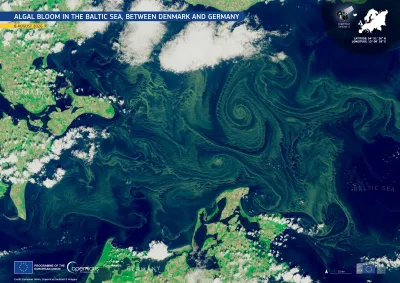
Satellite image of the Baltic Sea between Denmark and Germany on 8 August 2026, showing extensive green algal blooms swirling in large spiral patterns across the dark blue water. Clouds partially cover the surrounding coastlines, with Denmark visible to the northwest and Germany to the south.
Earth Observation
Earth Observation
Copernicus
Cyanobacteria blooms return to the Baltic Sea every summer, when warm water, light winds, and nutrients carried in from land cause this type of algae to multiply. On 11 August, health authorities in…
Image of the day
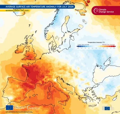
Map of Europe showing average surface air temperature anomalies for July 2026 compared with 1991–2020 average. Western and southern Europe are mostly warmer than average, with the strongest warming in France and the western Mediterranean shown in dark red. Northern and eastern Europe are generally near average to cooler than average, with blue areas around Scandinavia, the Baltic, and eastern Europe. Temperature anomalies range from −6°C to +6°C.
Earth Observation
Earth Observation
Copernicus
The Copernicus Climate Change Service (C3S) has published its latest monthly Climate Bulletin, focusing on key climate trends in July 2026.  July 2026 was the second warmest July on record in western…
Image of the day
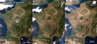
Three side-by-side satellite images of France and surrounding regions in August 2024, 2025, and 2026, showing progressively dry, brown conditions across much of the country. The panels are dated 11 August 2024, 12 August 2025, and 8 August 2026, respectively. Cloud cover varies between the images, while the Atlantic Ocean, Mediterranean Sea, Alps, and Pyrenees are visible. Branding identifies the imagery as from the European Union’s Copernicus Sentinel-3 mission.
Earth Observation
Earth Observation
Copernicus
A severe drought has been affecting large parts of France this summer. According to the European Drought Observatory (EDO), more than 85% of the country was under drought warning or alert conditions…
Image of the day
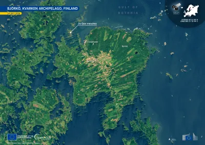
Satellite image of Björkö in Finland’s Kvarken Archipelago, showing a green, elongated island surrounded by the dark blue waters of the Gulf of Bothnia. Patchwork fields, roads, and the settlements of Björköby and Svedjehamn are visible across the island. A label highlights De Geer moraines—parallel, ridge-like landforms extending through the shallow coastal waters.
Earth Observation
Earth Observation
Copernicus
Björkö sits in Finland’s Kvarken Archipelago, part of a UNESCO World Heritage Site. Among the island's most distinctive features are the parallel De Geer moraines, a series of low ridges deposited as…
Image of the day
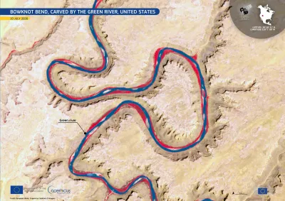
Satellite image of Bowknot Bend on the Green River in the United States, showing the river winding through a series of tight, looping meanders carved into pale desert canyon terrain. The river appears dark blue with bright red margins in the false-color imagery. A label identifies the Green River, with location coordinates and a 500 m scale shown on the map.
Earth Observation
Earth Observation
Copernicus
Bowknot Bend lies in the arid landscape of eastern Utah, north of Canyonlands National Park, in the United States. It marks the point where the Green River flows into a deeply entrenched meander,…
Image of the day
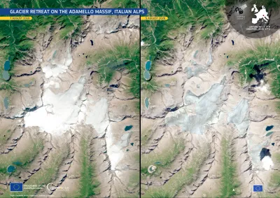
Side-by-side Copernicus Sentinel-2 satellite images of the Adamello Massif in the Italian Alps, comparing 7 August 2016 (left) with 5 August 2026 (right). The 2026 image shows substantial glacier retreat and thinning, with much less continuous white ice and snow and more exposed rock and fragmented glacier surfaces.
Earth Observation
Earth Observation
Copernicus
The Adamello Glacier is the largest in the Italian Alps, centred on the plateau of Pian di Neve between Lombardy and Trentino. The 2025–-2026 winter brought little snow over to the massif, exposing…
Image of the day
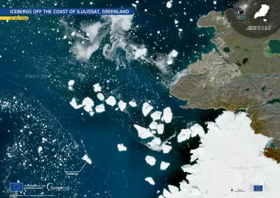
Satellite image of the coast near Ilulissat, Greenland, on 25 July 2026. Dark blue waters of Disko Bay are scattered with dozens of bright white icebergs of varying sizes drifting away from the mouth of Ilulissat Icefjord, which is covered by a large expanse of sea ice at the lower right. The town of Ilulissat appears along the rocky coastline on the right, with labels identifying the bay, icefjord, and icebergs. An inset map marks the location in Greenland, and Copernicus Sentinel-2 branding, coordinates,
Earth Observation
Earth Observation
Copernicus
This natural-colour image, acquired by one of the Copernicus Sentinel-2 satellites on 25 July 2026, shows several icebergs drifting across the dark blue waters of Disko Bay, western Greenland. Dense…
Image of the day
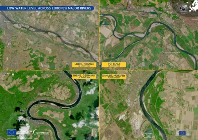
Four-panel satellite image titled “Low Water Level Across Europe’s Major Rivers,”  showing river conditions in early August 2026. The panels show the Loire in France, the Po in Italy, the Rhine in Germany, and the Danube in Hungary. In each image, dark, narrow river channels are bordered by broad light-colored sandbars and exposed riverbeds, illustrating unusually low water levels. Labels identify each river, country, and date, with Copernicus and European Union branding visible.
Earth Observation
Earth Observation
Copernicus
Copernicus Sentinel-2 images acquired between 1 and 3 August 2026 reveal exceptionally low water levels along sections of four of Europe's largest rivers: the Loire near Saumur in France, the Po near…
Image of the day
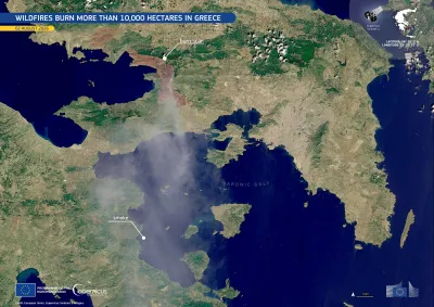
Satellite image of southern Europe centred on Greece, showing a large plume of grey smoke drifting across the mainland and surrounding sea.
Earth Observation
Earth Observation
Copernicus
A major wildfire broke out on 1 August 2026 near Psatha and Porto Germeno, west of Athens, in western Attica. It has burned more than 10,000 hectares, prompting an emergency response involving…
Image of the day
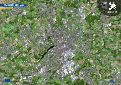
The satellite image shows the city of Munster surrounded by fields in different shades of brown.
Earth Observation
Earth Observation
Copernicus
The city of Münster, in North Rhine-Westphalia, Germany, lies at the heart of the Münsterland region. It is one of Germany’s leading cities for cycling, with more bicycles than residents.
Image of the day
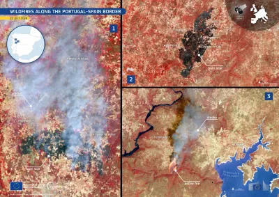
Three satellite images of separate wildfires along the Spain–Portugal border, showing burned areas and smoke in false colours.
Earth Observation
Earth Observation
Copernicus
Several wildfires broke out between 27 and 29 July 2026 across northern and eastern Portugal and the neighbouring province of Zamora in western Spain.
Image of the day
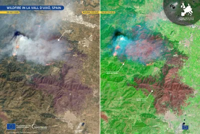
Wildfire in Valencia, Spain
Earth Observation
Earth Observation
Copernicus
A wildfire broke out on 25 July 2026 near la Vall d'Uixó, in the province of Castellón in eastern Spain. By 27 July, the fire had burnt more than 7,200 hectares, prompting the evacuation of  people…

Showing 21-40 of 1310 results