Explore EU Space

Results (1311)
RSS feed of these results
Image of the day
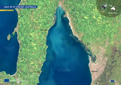
Sentinel-2 image of Gulf of St Vincent Australia Australia
Earth Observation
Earth Observation
Copernicus
The Gulf of St Vincent lies off the coast of South Australia, separating the Yorke Peninsula from the Adelaide metropolitan area. Its sheltered marine waters support coastal ecosystems, including…
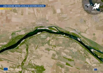
Image of the day
Sentinel-2 image of drought in Romania and Bulgaria
Earth Observation
Earth Observation
Copernicus
The Danube River continues to be affected by exceptionally low water levels as a consequence of the prolonged drought across Central and Eastern Europe.
Image of the day
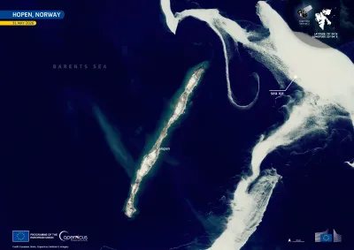
Sentinel-2 imagery of Hopen, Norway
Earth Observation
Earth Observation
Copernicus
Hopen is a narrow island in the Barents Sea, in the south-east of Norway’s Svalbard archipelago. The island and its surrounding waters form the Hopen Nature Reserve, an important habitat for seabirds…
Image of the day
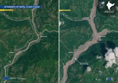
Side-by-side satellite images showing the aftermath of a flash flood near Betrawati and Gerkhu, Nepal. The left image, dated 12 August 2026, shows a narrow river channel. The right image, dated 27 August 2026, shows a much wider, sediment-filled river channel and extensive flood deposits.
Earth Observation
A severe flash flood struck northern Nepal on 26 August 2026, entering Rasuwa District from the Tibet side and travelling downstream through the Bhote Koshi–Trishuli river system. The flood caused…
Image of the day
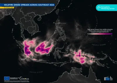
Fire Emissions Watch App showing smoke plumes across southeast Asia
Earth Observation
Earth Observation
Copernicus
Severe fires are affecting parts of Indonesia as a consequence of prolonged dry conditions . Smoke has spread across surrounding areas of Southeast Asia, including neighbouring Malaysia, where…
Image of the day
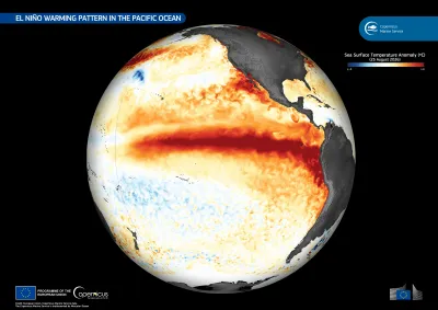
This data visualisation, based on data from the Copernicus Marine Service, shows sea surface temperature anomalies on 25 August 2026
Earth Observation
Earth Observation
Copernicus
El Niño is a recurring climate phenomenon associated with unusually warm surface waters in the central and eastern equatorial Pacific Ocean. As the warm phase of the El Niño–Southern Oscillation…
Image of the day
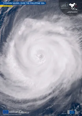
Image of Typhoon Saudel over the Philippine Sea
Earth Observation
Earth Observation
Copernicus
Saudel is a Category 4 typhoon currently tracking across the northwestern Pacific Ocean. On 24 August 2026, it moved across the Philippine Sea, passing southwest of Iwo To, a remote Japanese island,…
Image of the day
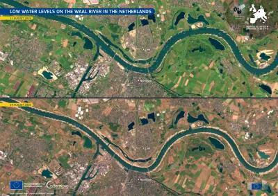
Copernicus Sentinel-2 images showing drought on the Waal river in the Netherlands.
Earth Observation
Earth Observation
Copernicus
The Waal, in eastern Netherlands, is the largest Dutch branch of the Rhine and an important inland shipping route. Prolonged dry conditions across the Rhine basin have reduced flows to exceptionally…
Image of the day
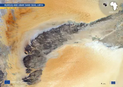
Copernicus Sentinel-2 image of the Murzuq and Ubari Sand Seas in Libya, acquired on 2 and 7 July 2026. Vast orange sand dunes surround the dark, rugged Mesak Settafet plateau, with the settlements of Murzuq and surrounding desert visible to the east.
Earth Observation
Earth Observation
Copernicus
The Murzuq and Ubari Sand Seas are major dune fields in the Sahara Desert in south-western Libya. Their extensive dune systems surround rocky plateaus and escarpments, creating a marked contrast…
Image of the day
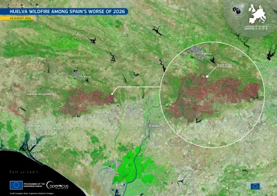
Copernicus Sentinel-2 image showing the Huelva wildfire's burn scar.
Earth Observation
Earth Observation
Copernicus
On 6 August 2026 a major wildfire broke out near Niebla, in the province of Huelva, southern Spain. After more than a week of firefighting operations, authorities declared the blaze stabilised on 16…
Image of the day
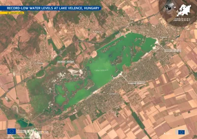
Copernicus Sentinel-2 image acquired on 16 August 2026 showing Lake Velence in central Hungary. The green-coloured lake is surrounded by agricultural land and the settlements of Velence, Gárdony and Sukoró, with shallow shoreline areas visible around parts of the lake.
Earth Observation
Earth Observation
Copernicus
Lake Velence, Hungary’s third-largest lake, located southwest of Budapest, is affected by record-low water levels following prolonged dry conditions. By 1 August 2026, its water level fell below the…
Image of the day
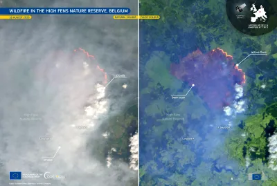
Copernicus Sentinel-2 image of the wildfire in the High Fens Nature Reserve, eastern Belgium, showing a broad plume of grey smoke spreading across the landscape, with bright white clouds nearby and active fire fronts visible in red-orange tones.
Earth Observation
Earth Observation
Copernicus
A wildfire broke out on 14 August 2026 in the High Fens nature reserve, in the province of Liège, in eastern Belgium. By 16 August, around 3,000 hectares had burned, making it Belgium’s largest…
Image of the day
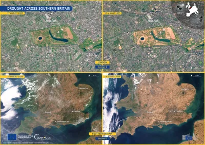
Four-panel satellite comparison showing drought conditions in southern England in August 2026.
Earth Observation
Earth Observation
Copernicus
Over the summer of 2026, dry conditions have been affecting the United Kingdom. According to the European Drought Observatory (EDO), 25% of the territory of England was in Alert conditions and 65% in…
Image of the day
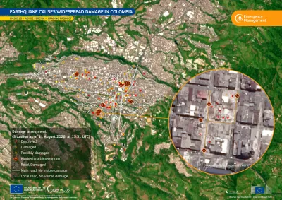
Map of Pereira, Colombia, showing earthquake-related damage identified by the Copernicus Emergency Management Service following the 10 August 2026 magnitude 7.4 earthquake.
Earth Observation
Earth Observation
Copernicus
On 10 August 2026, a magnitude 7.4 earthquake struck western Colombia, causing severe damage across the region. According to the latest reports, the earthquake has resulted in 289 casualties and…
Image of the day
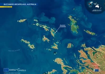
Satellite image of the Buccaneer Archipelago off the Kimberley coast of Western Australia, showing the rugged coastline and numerous islands and waterways.
Earth Observation
Earth Observation
Copernicus
The Buccaneer Archipelago comprises more than 800 islands off the Kimberley coast of north-western Australia. The archipelago is known for its complex coastline, strong tidal currents, rocky islands,…
Image of the day
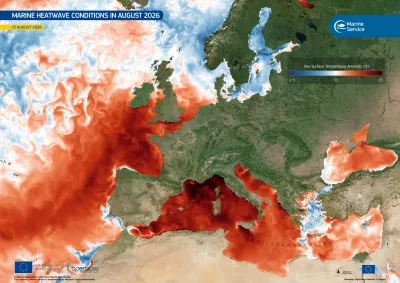
Copernicus Marine data visualisation of sea surface temperature
Earth Observation
Earth Observation
Copernicus
Marine heatwave conditions have been affecting the western Mediterranean Sea and parts of the north-eastern Atlantic through the summer of 2026, and unusually warm sea surface temperatures remained…
Image of the day
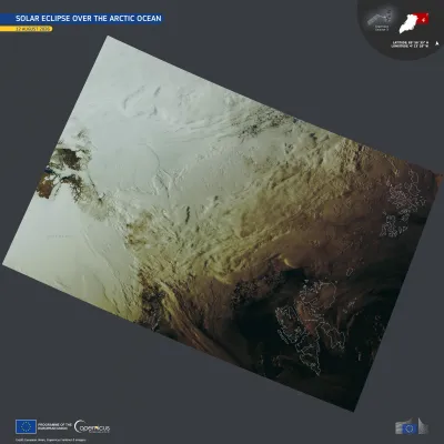
Satellite image of the eclipse shadow , spanning from northern Greenland to the Svalbard Archipelago and Franz Josef Land.
Earth Observation
Earth Observation
Copernicus
On 12 August 2026, a total solar eclipse crossed the Arctic Ocean, eastern Greenland, western Iceland, and the northern half of Spain. The area covered by the full eclipse was at most 294 kilometres…

Showing 61-80 of 1311 results