The Gambier Islands are a small group of volcanic islands and atolls in the south-eastern part of French Polynesia, in the South Pacific Ocean. Surrounded by a large lagoon and fringing coral reefs,…
Results (1953)
The Fucino Plain is a geographical depression in central Italy which was once covered by a lake. It was drained in the 19th century to reclaim arable land and is now among the most intensively…
Once the world’s largest iceberg, A23a calved from Antarctica’s Filchner–Ronne Ice Shelf in 1986. After spending decades grounded, it re-entered circulation, approaching South Georgia island at the…
The Parita Bay in Panama constitutes a key ecosystem for biodiversity and birdlife. It includes protected areas such as the Cenegón del Mangle Wildlife Refuge, Sarigua National Park, Peñón de la…
Recent heavy monsoon rains in Pakistan’s Punjab region have caused the Sutlej, Chenab, and Ravi rivers to overflow. Hundreds of thousands of people and nearly 2,000 villages have been affected by…
In August 2025, multiple wildfires broke out along the border between Spain and Portugal, affecting natural parks and municipalities, particularly in Galicia and León. As visible in this…
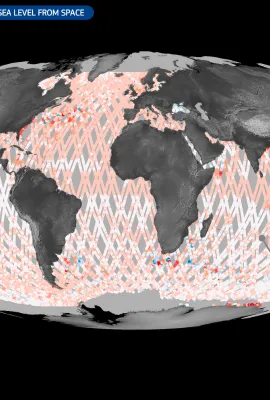
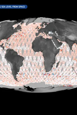
Satellites provide a unique vantage point from above, enabling unparalleled observation of global events. Whether monitoring floods using radar data or providing insights into deforestation through…
The Galápagos National Park, created in 1959, protects 97% of the islands’ unique wildlife, including giant tortoises and marine iguanas. A UNESCO World Heritage Site, it balances conservation with…
The Copernicus Climate Change Service (C3S) has published its latest monthly Climate Bulletin, focused on key climate trends in August 2025. The bulletin reports that August 2025 was the…
Flowing through meandering stretches in south-eastern Austria, the Lafnitz is a dynamic lowland river where erosion and sedimentation continually reshape its middle and lower reaches. Its landscapes…
Ballypatrick Forest, in County Antrim, Northern Ireland (United Kingdom), lies within the rugged Antrim Plateau. The landscape features conifer plantations, mainly Sitka spruce, intermixed with…
Lake Tisza, located in eastern Hungary, is the country’s second-largest lake. Spanning approximately 127 square kilometres, it is known for its diverse ecosystems and popularity for activities such…
The Étang de Montady, located in southern France near the town of Montady, is a remarkable example of medieval land reclamation. Originally a wetland, it was drained in the 13th century using a…
This Copernicus Sentinel-2 image, acquired on 5 September 2024, shows the Žuvinto, Žaltycio ir Amalvo pelkes wetland areas, a Natura 2000 site in Lithuania. Spanning an area over 18,000 hectares,…
Tunis, the capital of Tunisia, lies between the Mediterranean coast and a network of coastal lagoons and wetlands. The largest of these is Lake Tunis, divided into northern and southern basins, along…
Aalborg, one of Denmark’s key northern cities, lies along the Limfjord, a shallow sound connecting the North Sea to the Kattegat strait. The city blends urban development with surrounding farmland…
Uluru, also known as Ayers Rock, is a massive sedimentary rock formation located in the heart of Australia’s Northern Territory. Rising 348 metres above the surrounding plain, Uluru is not only a…
The European Union’s Space Programme is the first integrated framework of its kind, bringing Europe’s investments in Earth Observation, satellite navigation, and secure connectivity under a unified…
27 August is the first-ever World Lake Day, dedicated to tracking and protecting the health of millions of lakes around the globe. This Copernicus Sentinel-2 image from 13 August 2025 shows Lake…
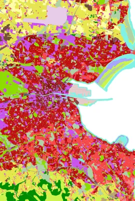
The Copernicus Emergency Management Service Global Human Settlement Layer (GHSL) provides detailed mapping of human presence around the world. This data enables urban planners, researchers, and…
Showing 421-440 of 1953 results