
OBSERVER: The European Civil Protection Forum 2026 brings EU Space closer to its users
Wildfires, floods, and droughts are becoming more frequent and intense, while cascading and cross-border crises test Europe’s response capacity. On 3 and 4 November 2026, the ninth European Civil Protection Forum, organised by the European Commission, brought close to 2,000 participants to Brussels under the theme ‘Preparing today, ready for tomorrow’. At the EU Space booth, visitors discovered how space data and science support civil protection at every phase of the disaster cycle. In this Observer, we look at why EU Space Programme data and services matter to disaster risk reduction and civil protection practitioners and share highlights from the Forum.
Taking place every two years, the European Civil Protection Forum is the flagship event of the European civil protection community, gathering national, regional, and local authorities, first responders, policymakers, and researchers from across Europe and beyond. The ninth edition, opened and closed by Hadja Lahbib, European Commissioner for Equality, Preparedness and Crisis Management, coincided with the 25th anniversary of the EU Civil Protection Mechanism. The Mechanism, a framework, established in October 2001 by the European Commission to strengthen disaster prevention, preparedness, and response cooperation across Europe and globally, brings together the 27 EU Member States and 10 Participating States, and has been activated more than 880 times since 2001.
The Forum took place as the European Union is reshaping its approach to disasters. Adopted in March 2025, the Preparedness Union Strategy marks a shift from reactive crisis management towards a proactive and integrated approach to preparedness and response. Over two days, plenary sessions, panels, and workshops explored how to turn this ambition into practice, covering topics such as population preparedness, risk communication, early warning systems, and civil-military cooperation.

The Civil Protection Village at the centre of the Forum hosted 50 stands representing almost 60 organisations. Its purpose was to showcase innovative solutions to the end users who can take them up. The EU Space Programme already delivers data and services which support civil protection authorities as they anticipate, prepare for, and respond to disasters, and new services are on the way. Their uptake, however, depends on practitioners knowing what is available and how to use it.
Over these two days, one message has come out loud and clear: preparedness must become part of our European culture. But the real test starts when we walk out of this door, when we are actually going to do something with everything we have learned. Take our first From Space to Grassroots dialogue a few days ago. We brought together partners from across the world to explore how our satellites, Copernicus and Galileo, can help us see disasters coming and protect people on the ground.
— Hadja Lahbib
European Commissioner for Equality, Preparedness and Crisis Management
Copernicus for early warning and recovery
Anticipating a disaster starts with seeing it coming, and with knowing which tools to use. Copernicus, the Earth Observation component of the EU Space Programme, provides a dedicated service for emergencies: the Copernicus Emergency Management Service (CEMS). At the joint EU Space – Joint Research Centre (DG JRC) booth, participants could speak directly with the scientists behind CEMS and learn how space and science support civil protection authorities during the different phases of the disaster cycle.
Maps and use cases on floods, droughts, wildfires, and cascading and cross-border crises guided visitors through the full disaster management cycle. Before an event, the CEMS Early Warning and Monitoring systems allow authorities to anticipate the hazard and assess vulnerabilities. CEMS Exposure Mapping data complements this information by indicating where people and built-up areas are located, helping authorities understand who and what may be at risk. During and immediately after a disaster, CEMS Mapping for Emergency estimates the extent and impact of the event within hours of a service request to support situational awareness. CEMS Mapping for Preparedness and Recovery, in turn, supports multi-hazard prevention, preparedness, and recovery, with customised products from local to regional scale.
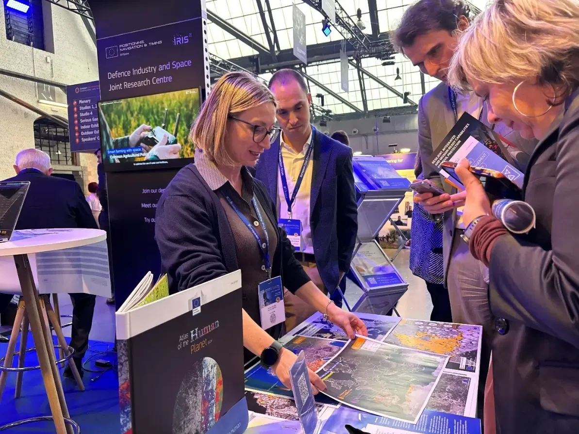
At the booth, civil protection authorities and partners shared feedback on uptake, fitness for purpose, useability, interoperability, and future preparedness needs, and discussed the gaps they still face in their daily work. This feedback allows to identify the situations in which a product or service already makes a difference, how access or interoperability can improve, and which are the emerging needs, helping EU Space data and services evolve thanks to the response from those who rely on them. Events such as the Forum turn users from recipients of information into partners in shaping the services.
The Forum also provided an occasion to present a new European Commission publication, the Discussion document on Guidance for National Risk Assessment. The report aims to support dialogue among EU Member States and Union Civil Protection Mechanism Participating States as they prepare and update their National Risk Assessments. Two of its authors, Christina Corbane and Azzurra Lentini, took part in the workshop ‘From risk assessment to preparedness: connecting perspectives’ on 3 November. The session looked at how European, national, and sectoral risk assessments can better inform preparedness, resilience planning, and investment.
Warning people and connecting responders
Early warning information only protects people if it reaches them in time, and a response is only effective if responders can stay connected. On the other side of the booth, the focus moved to two upcoming EU Space capabilities designed to support crisis management.
The first is the Galileo Emergency Warning Satellite Service (EWSS). Through EWSS, Galileo, the satellite navigation component of the EU Space Programme, will enable to issue rapid public warning alerts via Galileo-enabled devices, giving national civil protection authorities an additional channel to reach people in at-risk areas. Once an authority trigger an alert, the process is fully automated, and high-priority messages can reach devices in around a minute. Receivers which use Galileo’s Open Service Navigation Message Authentication (OSNMA) can also confirm that an alert message has not been subject to spoofing or tampered with.
The second is IRIS² (Infrastructure for Resilience, Interconnectivity and Security by Satellite), the future secure connectivity component of the EU Space Programme, which will provide secure communication for emergency responders and critical infrastructure operators, among others.
Putting EU Space services into practice with SUNSHINE
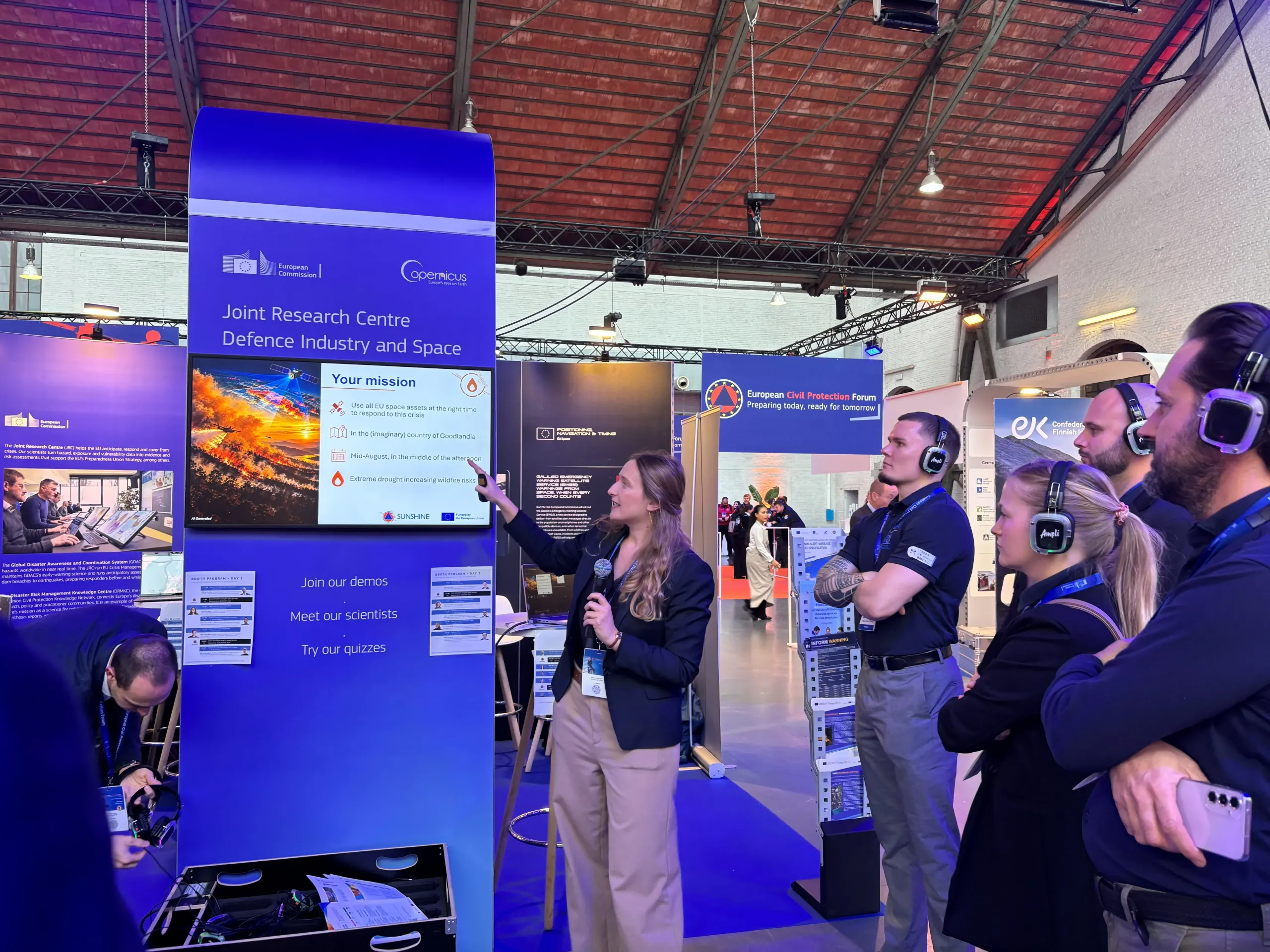
SUNSHINE, a pilot project funded by the European Union, promotes under a single initiative the use of the EU space services by the practitioners of civil protection. At the booth, the project team ran a series of short simulations in which visitors stepped into the shoes of a crisis management operator facing multiple disasters in a fictional country. Over three sessions addressing wildfires, floods, and public alerts, participants could identify which EU Space data and services could best support their response activities. For example, European Drought Observatory (EDO), European Flood Awareness System (EFAS), European Forest Fire Information Service (EFFIS), Rapid Mapping, Risk and Recovery Mapping (RRM), and Emergency Warning Satellite service of Galileo (EWSS) were featured and briefly explained during the conference breaks.
These short simulations concluded the trainings offered by the project to EU civil protection community since its start in January 2025: in total, four training seminars across Europe, two table-top simulation exercises in Brussels, and three technical webinars were organised and delivered, benefitting to more than 300 emergency professionals across Europe. As the project draws to a close in December 2026, all its training materials and recordings will remain available on the Union Civil Protection Knowledge Network.
Looking ahead
The strong EU Space strong presence at the ninth European Civil Protection Forum made clear that space and science are to be considered as an integral part of the European Union’s approach to preparedness. The Copernicus Emergency Management Service supports civil protection authorities today, while the Galileo Emergency Warning Satellite Service and the IRIS² communication infrastructure will strengthen public warning and secure connectivity in the years ahead.
he Forum allowed practitioners to interact with these services and to provide feedback on their features. In the spirit of the Forum’s theme, the EU Space Programme provides Europe’s civil protection community with the means to prepare today with the services already in operation, and to prepare for tomorrow’s challenge with those being prepared for operational deployment.