Image of the day
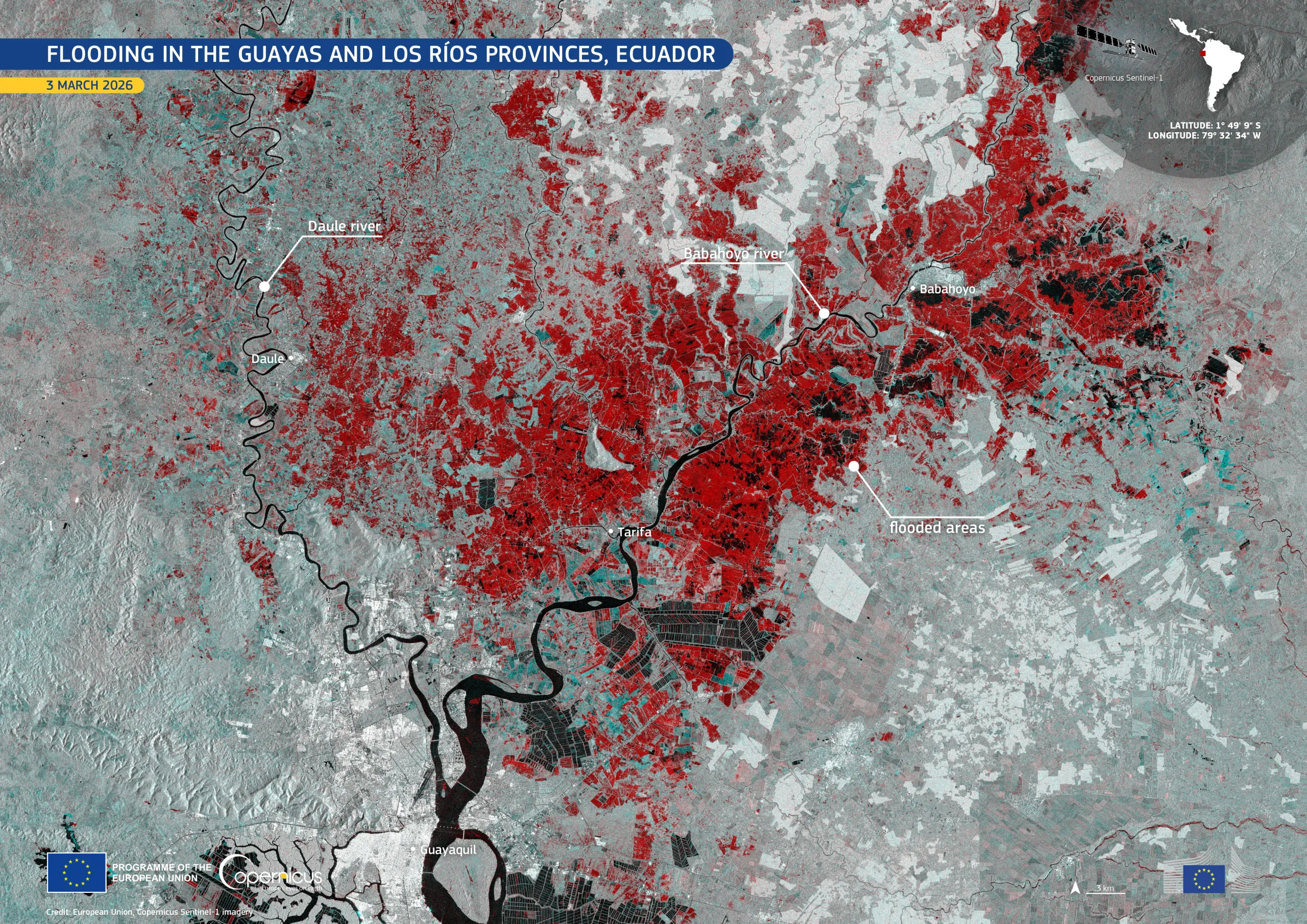
Flooding in the Guayas and Los Ríos Provinces, Ecuador
Earth Observation | Copernicus
Floods
Location: Ecuador
Credit: European Union, Copernicus Sentinel-1 imagery
Heavy rainfall took place on the afternoon of 3 March 2026 in western Ecuador. The intense precipitation caused flooding along the Babahoyo River, which flows north-east of the city of Guayaquil. The flooding affected roads and neighbourhoods in the provinces of Guayas and Los Ríos.
This image, acquired on 3 March 2026 by one of the Copernicus Sentinel-1 satellites, shows flooded areas in red tones along both banks of the Babahoyo River.
Copernicus satellite data enable authorities to detect and map the extent of flooding, supporting emergency services in assessing impacts, coordinating response actions, and informing long-term urban resilience planning in vulnerable coastal cities.


![Download [WEBP, 5.32 MB]](https://eu-space.europa.eu/sites/default/files/2026-03/20260309_Floods%20Guayaquil.webp)