Snow-capped Mount Etna and coastal waters in Sicily, Italy
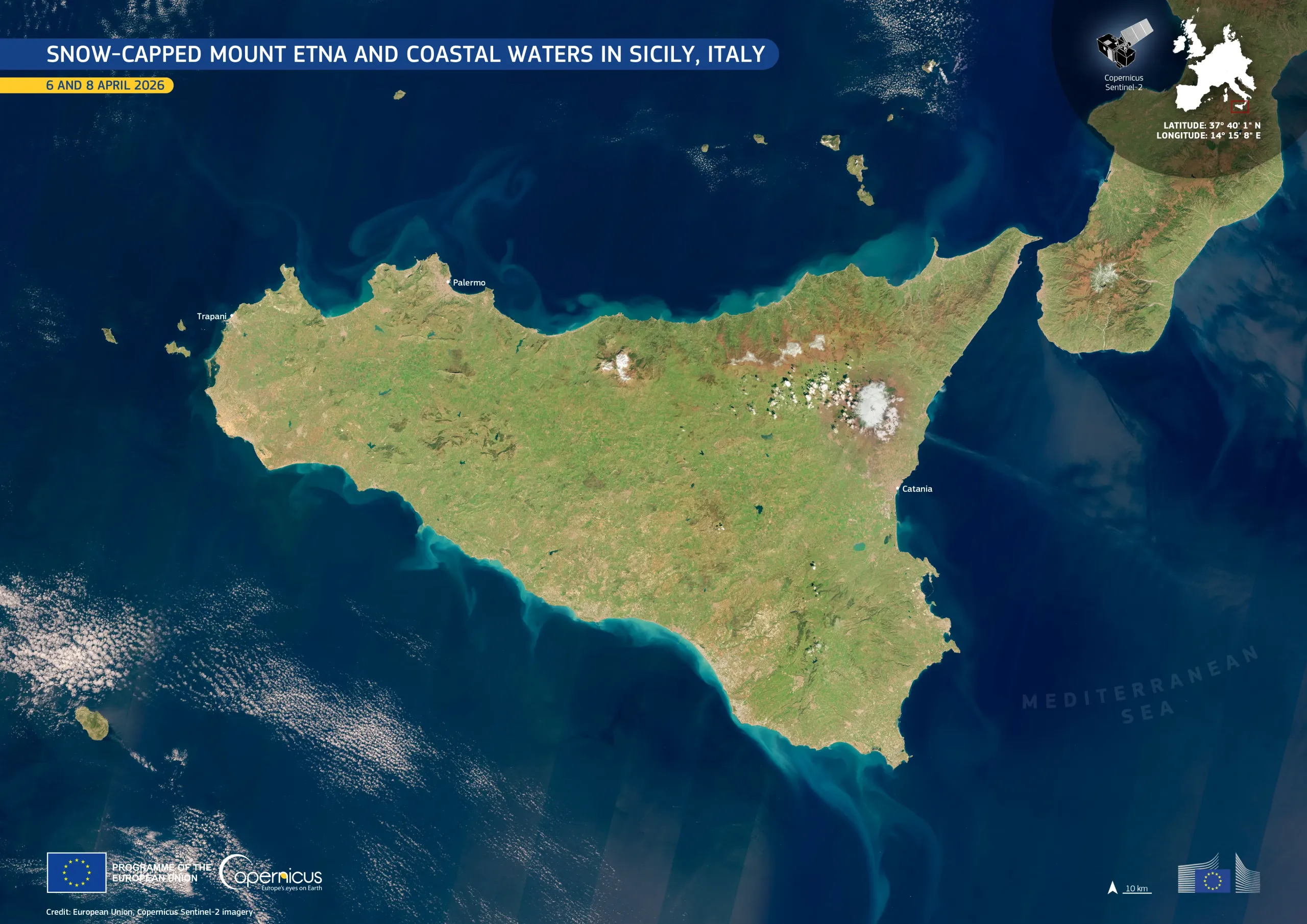
The island of Sicily in southern Italy, the largest in the Mediterranean Sea, lies at the crossroads of significant geological and coastal activity. Its landscapes range from fertile agricultural plains to the slopes of Mount Etna, Europe’s most active volcano.
This composite visualisation, generated from two images acquired by the Copernicus Sentinel-2 satellites on 6 and 8 April 2026, provides a clear view of the island and its coastal waters. Lighter turquoise tones indicate the presence of suspended sediments, particularly along the island’s northern and southern coasts. Mount Etna is visible to the east, near Catania, with snow-covered flanks and a plume emerging from the volcano’s summit.
Copernicus Sentinel-2 data support regular monitoring of coastal water quality, sediment dynamics, and volcanic activity, providing information for environmental management.
![Download [WEBP, 1.16 MB]](https://eu-space.europa.eu/sites/default/files/2026-04/20260421_Sicily%20island.webp)