The Scandinavian Peninsula in April 2026
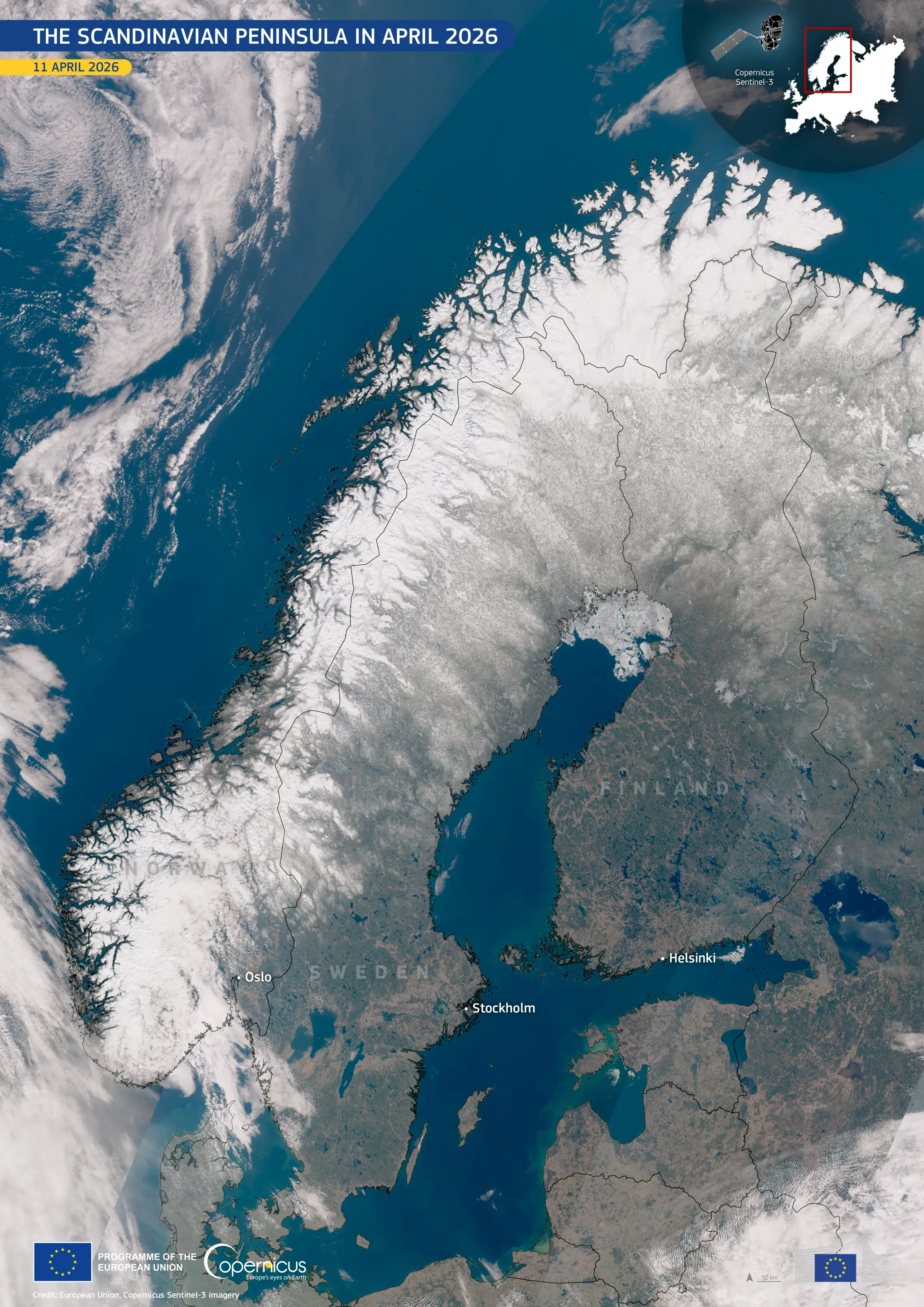
The Scandinavian Peninsula, which comprises Norway, Sweden, and Finland, is characterised by a diverse landscape of rugged mountains, extensive boreal forests, and deeply indented coastlines shaped by ancient glaciers. In early spring, the region undergoes a notable seasonal transition: while winter snow persists in the north and at higher elevations, southern areas begin to thaw, influencing the region's hydrology and ecosystems.
This cloud-free satellite image, acquired on 11 April 2026 by one of the Copernicus Sentinel-3 satellites, shows widespread snow cover across Norway’s mountainous spine, northern Sweden, and Finland. The Norwegian fjords appear as dark, narrow inlets cutting through bright snow-covered terrain, while the Gulf of Bothnia and the broader Baltic Sea display deep blue waters, with residual ice visible along the northern shores. Southern Sweden and Finland show more exposed land, with muted brown and green tones indicating early snowmelt.
Copernicus satellite data support systematic monitoring of snow extent and snowmelt dynamics, which is essential for water resource management, flood forecasting, and understanding seasonal climate variability across northern Europe.
![Download [WEBP, 1.31 MB]](https://eu-space.europa.eu/sites/default/files/2026-04/20260414_Scandinavian%20Peninsula.webp)