Wildfire raging in Andalucia, Spain
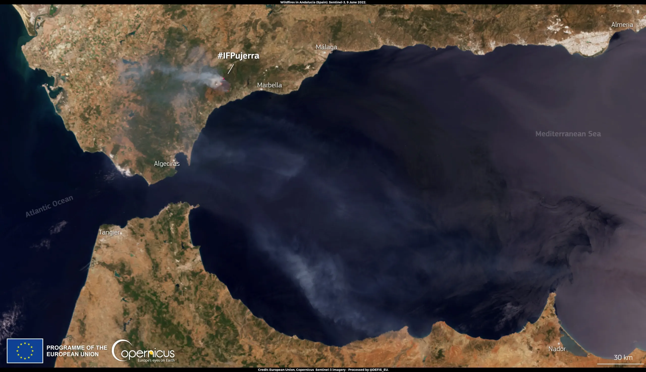
A wildfire in the mountains of Andalucia’s Costa del Sol, in southern Spain, has caused the evacuation of 2000 people from the centre of the town of Benahavis. The fire, which flared up on 8 June 2022, has spread due to adverse winds and dry vegetation.
The smoke cloud generated by the wildfire is visible in this image, acquired by one of the Copernicus Sentinel-3 satellites on 9 June 2022.
As shown in this visualisation published by the Copernicus Emergency Management Service (CEMS), the active wildfire is burning very close to the area of the CEMS Rapid Mapping activation (EMSR545) triggered in September 2021 for the Jubrique wildfire, which left a burn scar of 8,054 hectares. The CEMS Rapid Mapping products provide geospatial information within hours of a service request, in order to support emergency management activities in the immediate aftermath of a disaster.
![Download [WEBP, 1.9 MB]](https://eu-space.europa.eu/sites/default/files/images/migrated/20220610_WildfireInAndalucia.webp)