Desert geology and erosion define Utah’s Henry Mountains
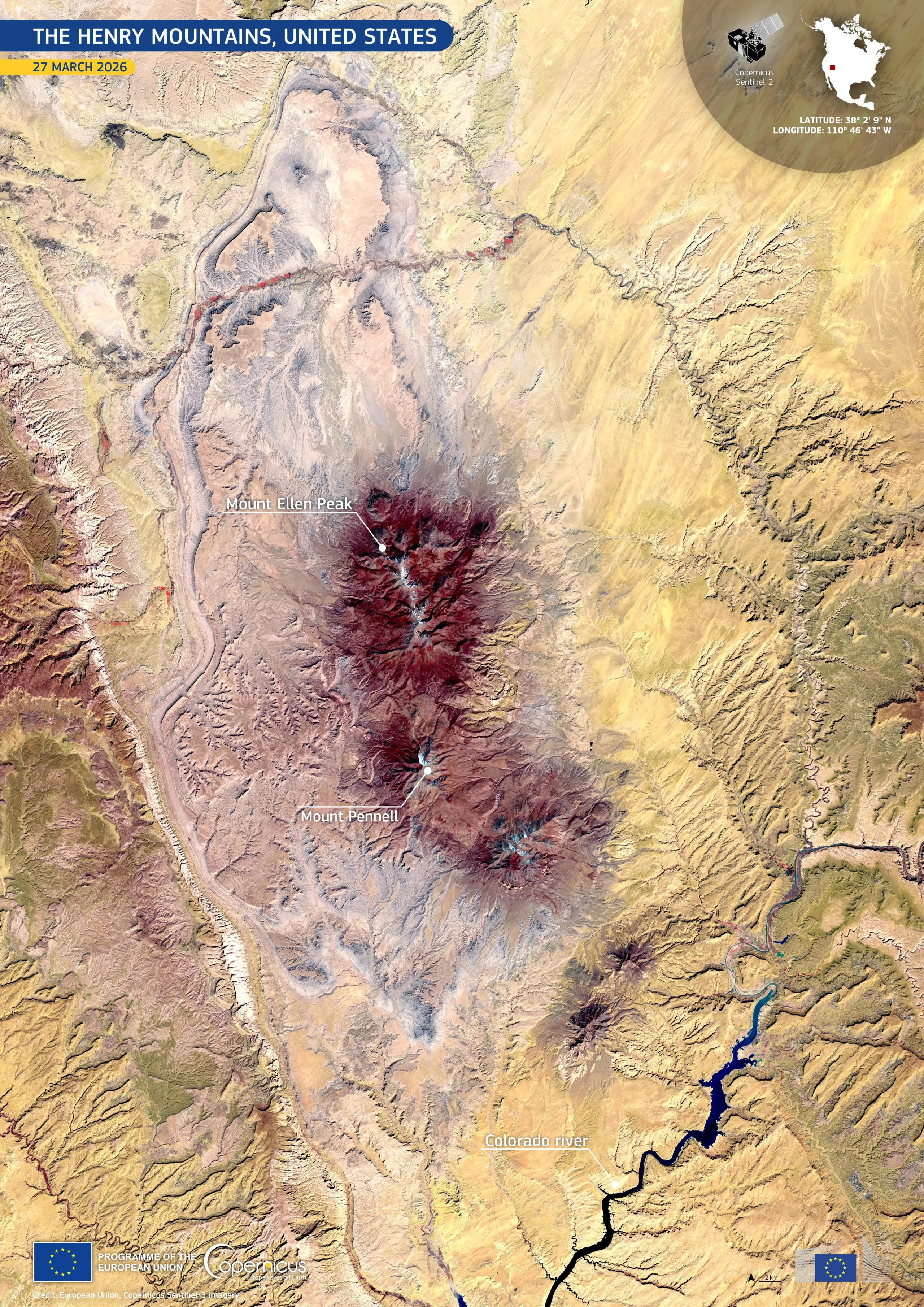
Rising from the arid expanse of southern Utah in the United States, the Henry Mountains provide an important natural laboratory for studying erosion and desert ecosystems.
Acquired on 27 March 2026 by one of the Copernicus Sentinel-2 satellites, this false-colour image highlights the rugged topography around Mount Ellen and Mount Pennell. Deep red tones mark sparse vegetation, while lighter beige and ochre hues dominate the surrounding desert plains and exposed rocks. To the east, the Colorado River cuts a dark, winding path through the surrounding canyons, while small reservoirs appear in deep blue.
Copernicus data support detailed geological mapping, land cover monitoring, and the assessment of erosion and sediment transport in remote environments such as this.
![Download [WEBP, 3.43 MB]](https://eu-space.europa.eu/sites/default/files/2026-05/20260517_Henry%20Mountains.webp)