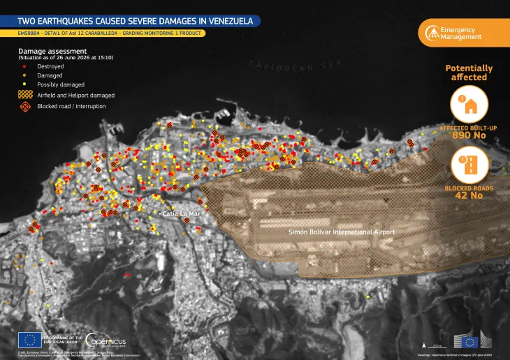
Barbados: Caribbean landscapes from space
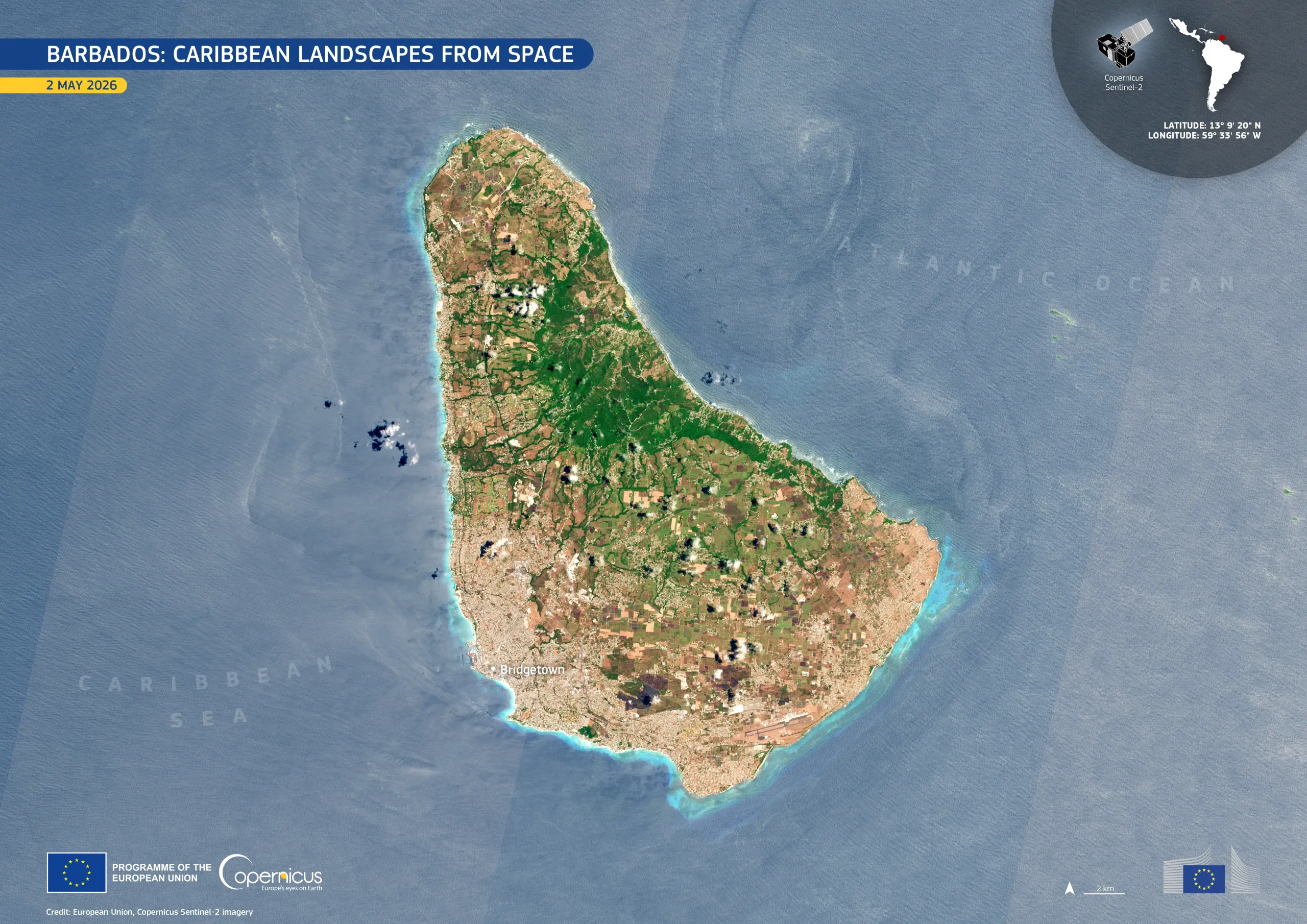
Barbados, the easternmost island in the Caribbean located approximately 180 km east of Saint Vincent and the Grenadines, combines urban development, tourism infrastructure, and fragmented farmland within a small territory. Its surrounding coral reefs and coastal waters host diverse marine life.
This image, acquired by one of the Copernicus Sentinel-2 satellites on 2 May 2026, shows Barbados against the deep blue Atlantic Ocean and Caribbean Sea. Bright turquoise waters trace the island’s fringing reefs and shallow coastal shelves, particularly along the southern and western coasts. Urbanised areas appear in pale grey and beige around Bridgetown and along the southern coastline, while greener zones across the central and northern interior indicate denser vegetation and agricultural land.
Copernicus Sentinel-2 imagery supports coastal monitoring, land-use assessment, and environmental management across small island states, which are vulnerable to coastal erosion, ecosystem degradation, and extreme weather impacts.
![Download [WEBP, 2.43 MB]](https://eu-space.europa.eu/sites/default/files/2026-05/20260515_Barbados.webp)