The Copernicus Emergency Management Service maps flood damages in northern Nepal
A severe flooding event affected northern Nepal and Tibet on 26 August 2026. Initial assessments indicate that the partial collapse of a high-altitude glacier triggered a large avalanche of ice and rock. The material descended approximately 1,200 metres into the Lhende River basin within seconds, generating a powerful flow of water, mud, and debris downstream.
The Copernicus Emergency Management Service (CEMS) Rapid Mapping component has been activated [EMSR927] to map the flood extent and assess damage across four Areas of Interest.
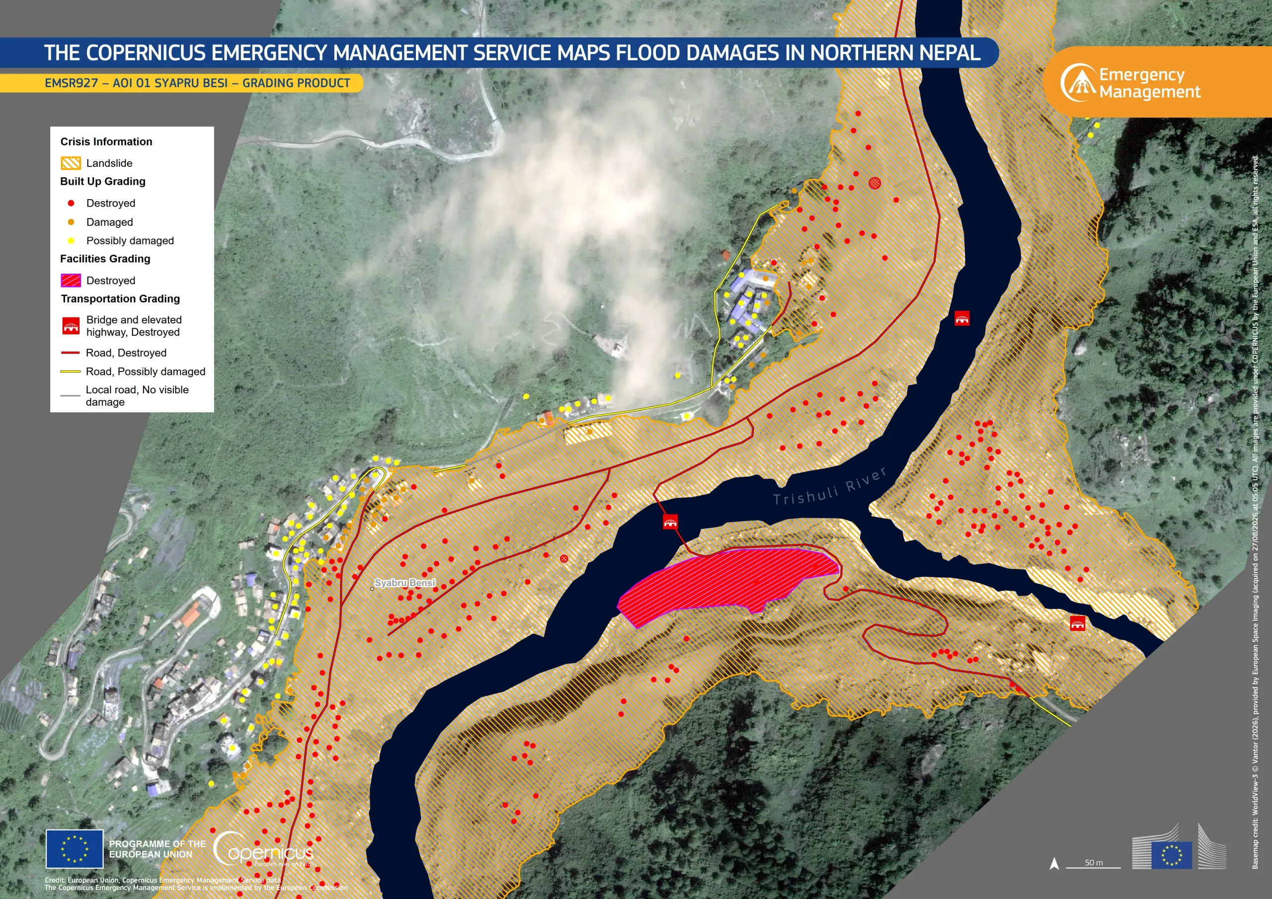
This data visualisation shows the area around the village of Syapru Besi, Nepal and the impact of the event on built-up and roads. CEMS analysis indicates that, within the area shown, more than 240 buildings were destroyed, while 32 were damaged.
Further information on the CEMS activation is available here.
Satellite Image Credit: WorldView-3 © Vantor (2026), provided by European Space Imaging (acquired on 27/08/2026 at 05:05 UTC). All images are provided under COPERNICUS by the European Union and ESA, all rights reserved.