Crops growing on reclaimed seabed in Flevoland, the Netherlands
World Food Day, celebrated every year on 16 October, is an observance established by the Food and Agriculture Organization of the United Nations to raise awareness of global food security and sustainable agriculture. Monitoring which crops are grown, and where, provides useful information for understanding food production and sustainably managing agricultural resources.
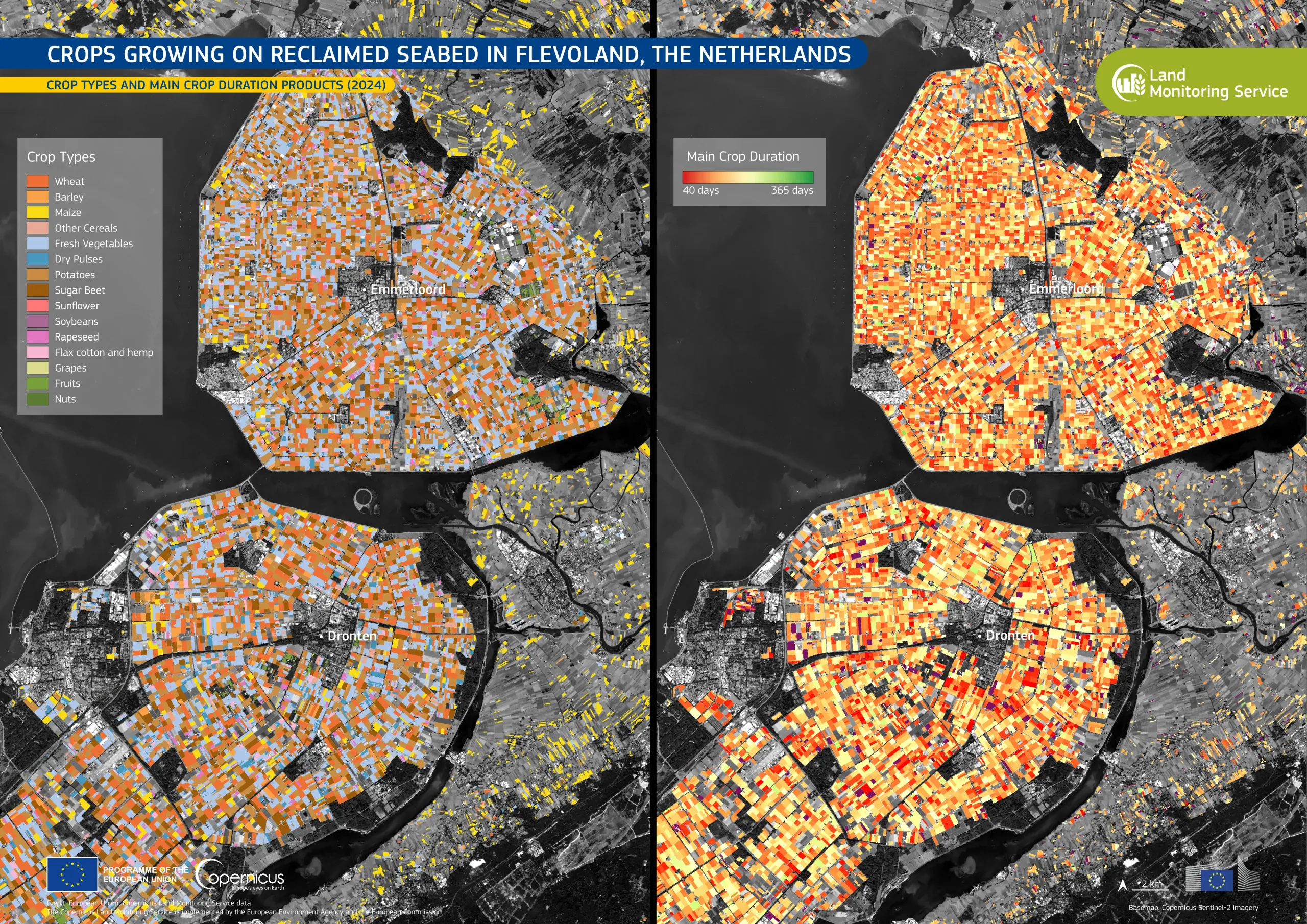
This data visualisation, based on the Copernicus Land Monitoring Service (CLMS) Crop Types and Main Crop Duration products for 2024, shows agricultural fields around Emmeloord and Dronten in Flevoland, a province of the Netherlands largely reclaimed from the sea during the 20th century. The image on the left shows the main crop types, such as wheat, barley, maize, potatoes, and sugar beet, with each crop type visualised in a distinct colour. The image on the right shows main crop duration, the length of time the main crop occupies a field during the year. Colours range from red and orange for shorter durations to green for longer ones.
The Copernicus Land Monitoring Service provides detailed information on land cover, crop distribution, and agricultural land use across Europe. These data support agricultural monitoring, sustainable land management, and the assessment of Europe's food production systems.