First Copernicus Sentinel-3C thermal images show land and sea surface temperatures across Western Australia
Launched on 15 September 2026, Copernicus Sentinel-3C is the latest addition to the Copernicus Sentinel-3 satellite mission, which observes Earth’s oceans, land, ice, and atmosphere. The new satellite is designed to ensure the continuity of these observations. During its commissioning phase, the period of in-orbit testing before the start of routine operations, the Sea and Land Surface Temperature Radiometer instrument onboard Sentinel-3C captured its first thermal images. This first acquisition marks an important milestone for the mission.
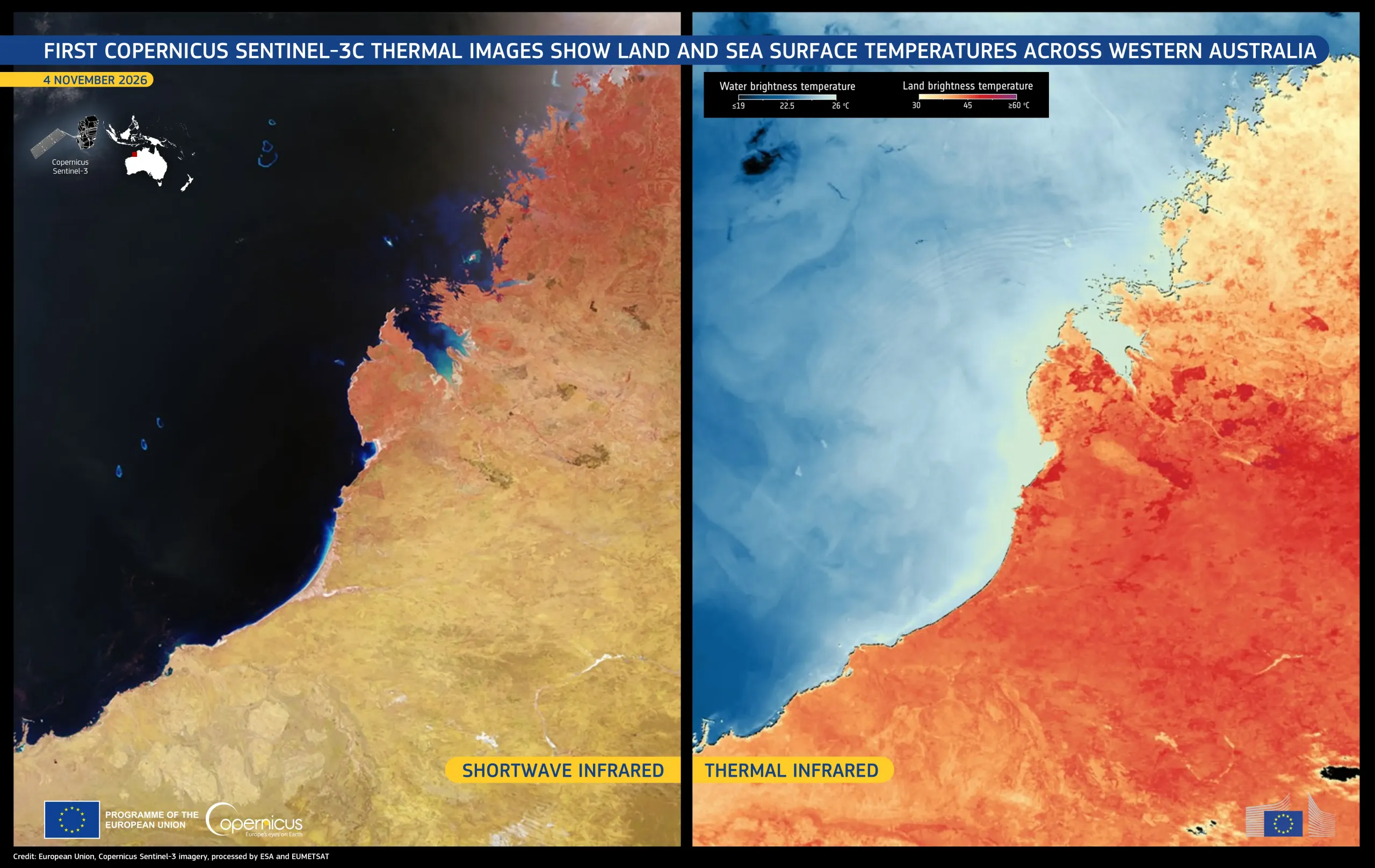
Acquired on 4 November 2026, these two images show the Kimberley region of Western Australia. The region has recently faced heatwave conditions and wildfires, which Australia’s Bureau of Meteorology links to El Niño, a recurring climate pattern marked by warmer-than-usual surface waters in the tropical Pacific Ocean. The town of Broome and the Dampier Peninsula appear near the centre of the images, while the Rowley Shoals, a group of three coral atolls, sit just below the ocean surface west of Broome.
On the left, a false-colour image combining visible and shortwave infrared bands shows vegetation in red tones and wildfire burn scars in dark brown. The Rowley Shoals are visible as small blue shapes in the dark ocean. On the right, a thermal infrared image shows brightness temperatures, a measure of the radiation emitted by land and sea surfaces as detected by the Sentinel-3C radiometer instrument. Brightness temperatures may differ from actual surface temperatures. In this image, they exceed 40°C across much of the inland area, while those over the eastern Indian Ocean are around 20°C.
Copernicus Sentinel-3 data support the monitoring of land and sea surface temperatures, contributing to climate research, marine conservation, and the assessment of extreme heat events.
Explore the full gallery and read more here.