Protected forests line the shores of the Itaipu Reservoir between Brazil and Paraguay
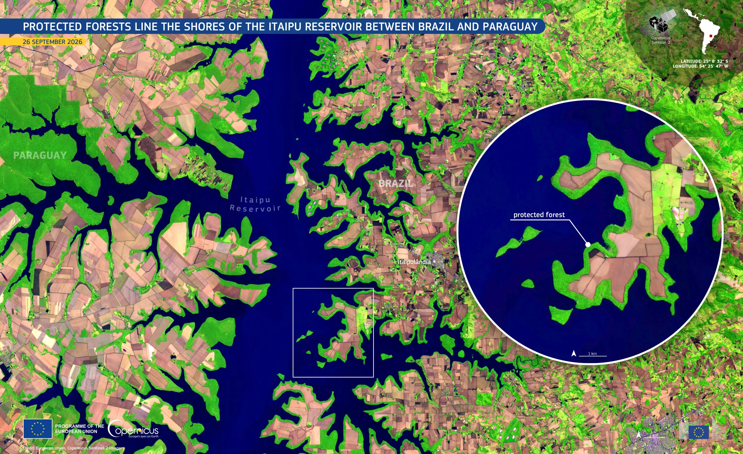
The Itaipu Reservoir was created in 1982 after the Paraná River along the border between Brazil and Paraguay was dammed. It covers about 1,350 km2. A strip of protected forest, about 200 metres wide, follows the reservoir’s Brazilian and Paraguayan shores. The strip is part of a wider network of protected areas, including nature reserves and ecological corridors, which covers about 1,000 km2. The forest helps limit soil erosion, conserve water resources, and connect habitats across the surrounding farmland.
This false-colour image, acquired by one of the Copernicus Sentinel-2 satellites on 26 September 2026, shows the Itaipu Reservoir in shades of blue, with Paraguay to the west and Brazil to the east. The forested areas appear as a vivid green band which traces the irregular shoreline, contrasting with the pink and brown cultivated fields.
Copernicus Sentinel-2 data support the monitoring of vegetation, land cover, and inland water bodies, and is particularly well adapted for the detection of changes in protected areas around water bodies.