Sediment-rich waters along Iceland’s southern coast
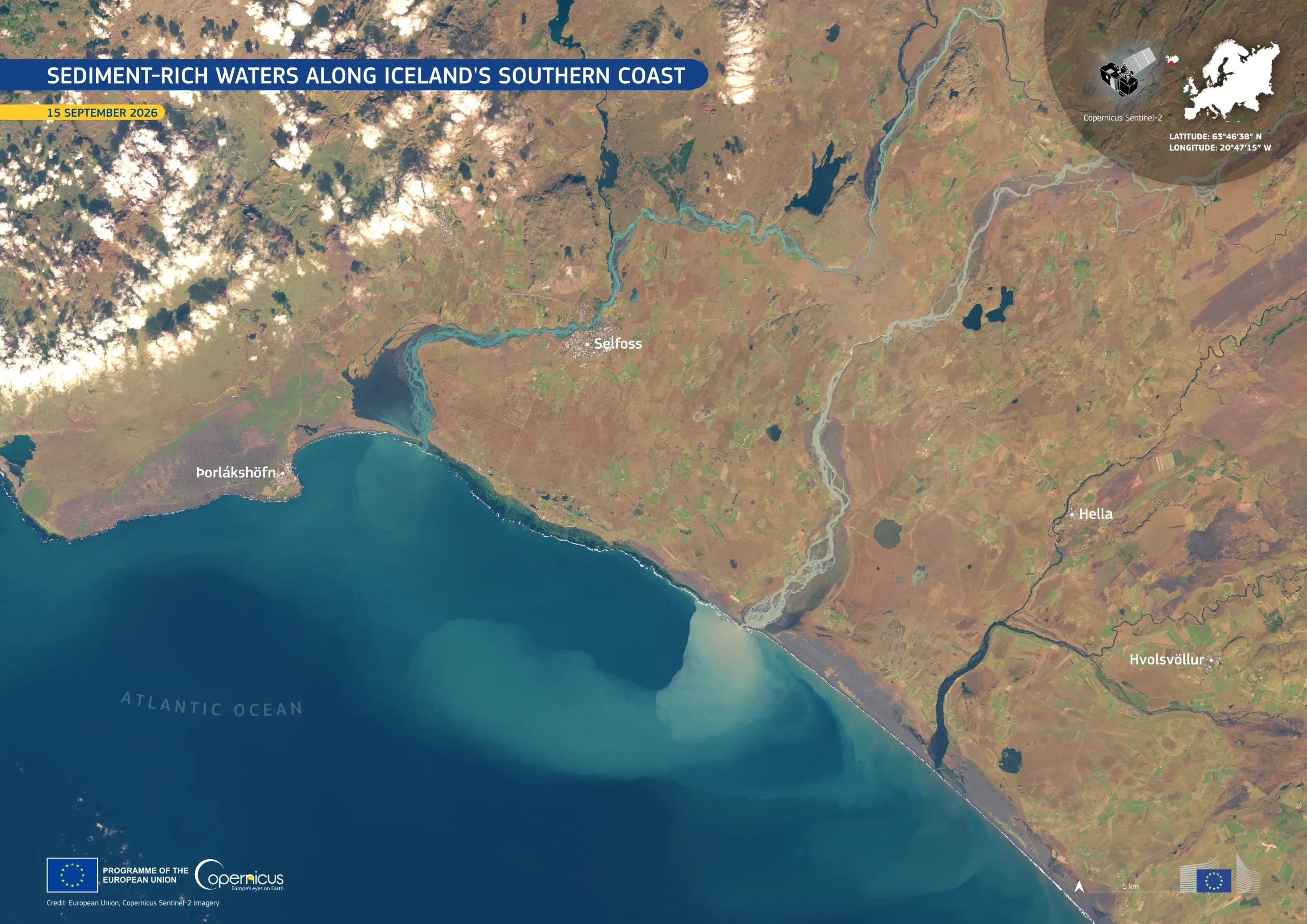
Glacier-fed rivers flow across southern Iceland from the country’s volcanic and glaciated interior towards the North Atlantic Ocean. Glaciers act like giant sandpaper, wearing down the rock underneath into fine particles, known as glacial flour, which meltwater carries downstream. When the rivers reach the coast, this suspended sediment tints the sea pale turquoise and beige.
This image, acquired by one of the Copernicus Sentinel-2 satellites on 15 September 2026, shows the southern coast of Iceland and a large sediment plume extending offshore. Visible as lighter-coloured water spreading into the darker North Atlantic, the plume marks the area in which river water carrying suspended particles mixes with seawater.
Copernicus satellite data provide valuable information for tracking how sediment moves between rivers, coastlines, and the open sea.