Wildfire burns in Fontainebleau Forest, France
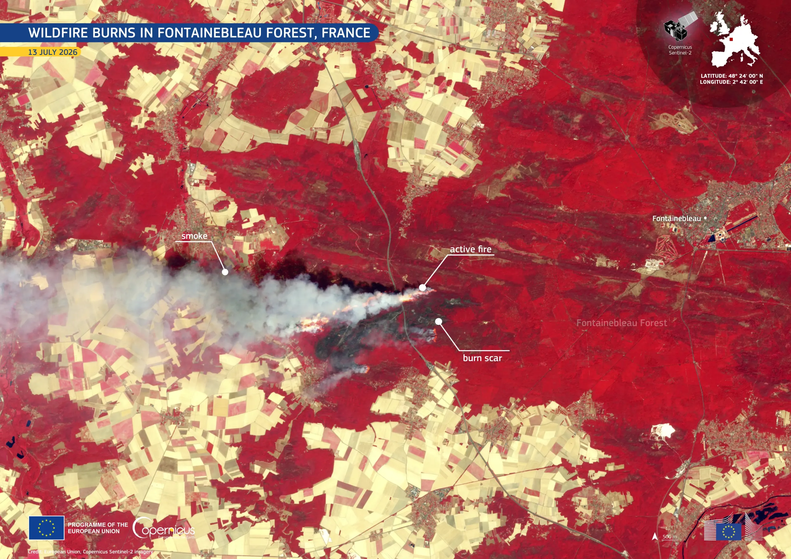
On 12 July 2026, a wildfire spread through part of Fontainebleau Forest in Seine-et-Marne, northern France, approximately 60 kilometres south-east of Paris. The fire prompted evacuations and disrupted nearby road and rail services. By 13 July 2026, it had affected more than 800 hectares, while hundreds of firefighters and water-bombing aircraft worked to contain it.
This false-colour image, acquired by one of the Copernicus Sentinel-2 satellites on 13 July 2026, shows healthy vegetation, including the Fontainebleau Forest, in red tones while surrounding agricultural fields appear in pale beige. A dense, grey-white smoke plume extends westwards from the active fire, shown in bright orange. A dark burn scar marks recently affected woodland near the forest’s western edge.
Copernicus Sentinel-2 provides high-resolution observations which support authorities and analysts in monitoring wildfire activity, mapping affected areas, and carrying out post-event damage assessments.