Atlantic winds shape sea-surface patterns around the Faroe Islands
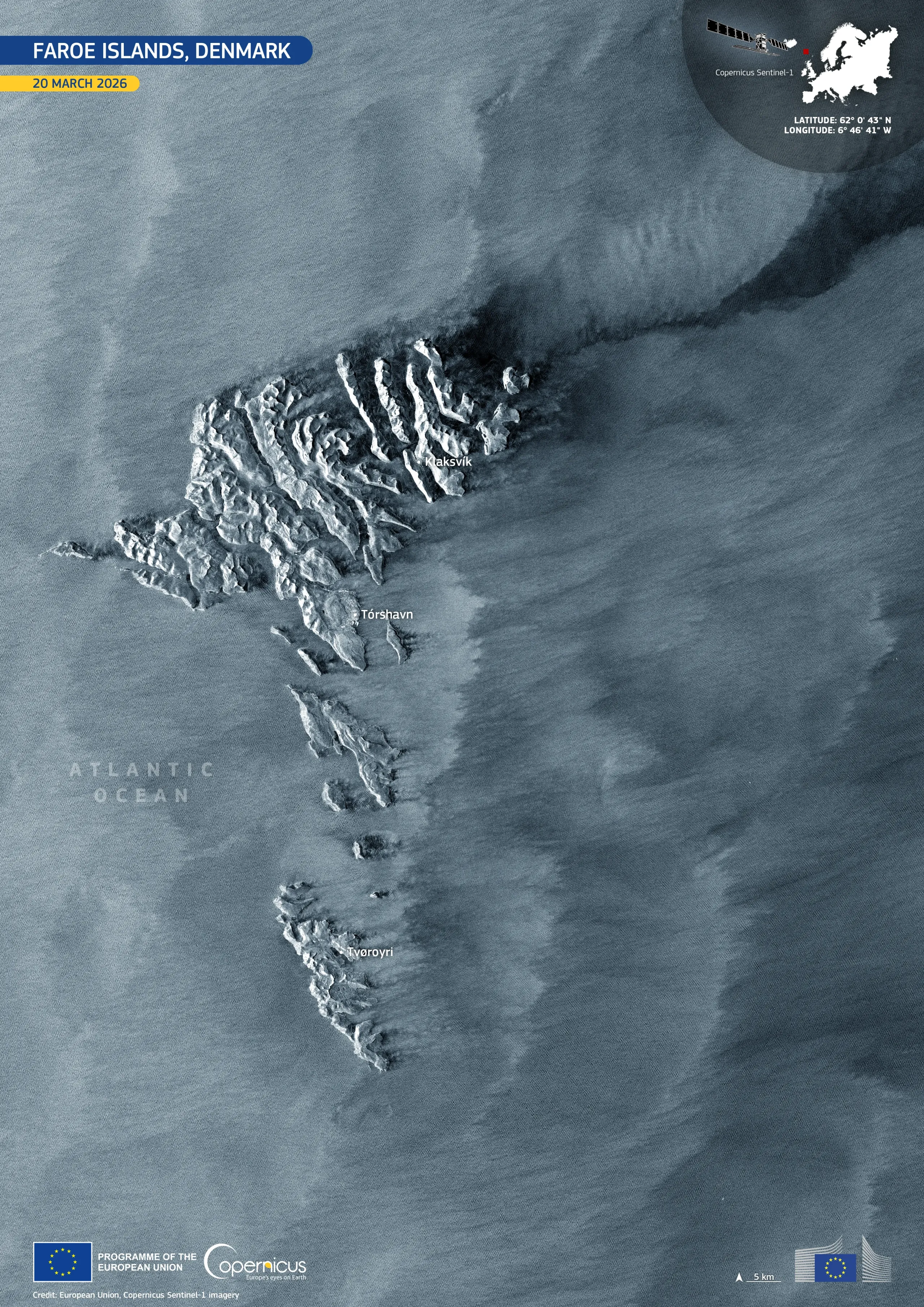
Located in the North Atlantic Ocean between Iceland and Norway, the Faroe Islands are an autonomous territory of the Kingdom of Denmark, characterised by steep volcanic terrain and a highly dynamic marine climate. Their rugged topography strongly influences local weather patterns, producing pronounced ocean–atmosphere interactions at subpolar latitudes.
This image, acquired by one of the Copernicus Sentinel-1 satellites on 20 March 2026, shows the sea-surface roughness patterns generated by strong winds across the Atlantic Ocean. Ridges and fjords are clearly distinguishable across the Faroe Islands' interior, where the contrast between the terrain and the surrounding sea surface is particularly pronounced.
Copernicus Sentinel-1 radar data provide all-weather, day-and-night observations of sea-surface roughness, supporting weather monitoring and a better understanding of coastal and marine processes in northern marine environments.


![Download [WEBP, 4.99 MB]](https://eu-space.europa.eu/sites/default/files/2026-04/20260419_Faroe%20islands.webp)