Strasbourg and the Rhine corridor, France
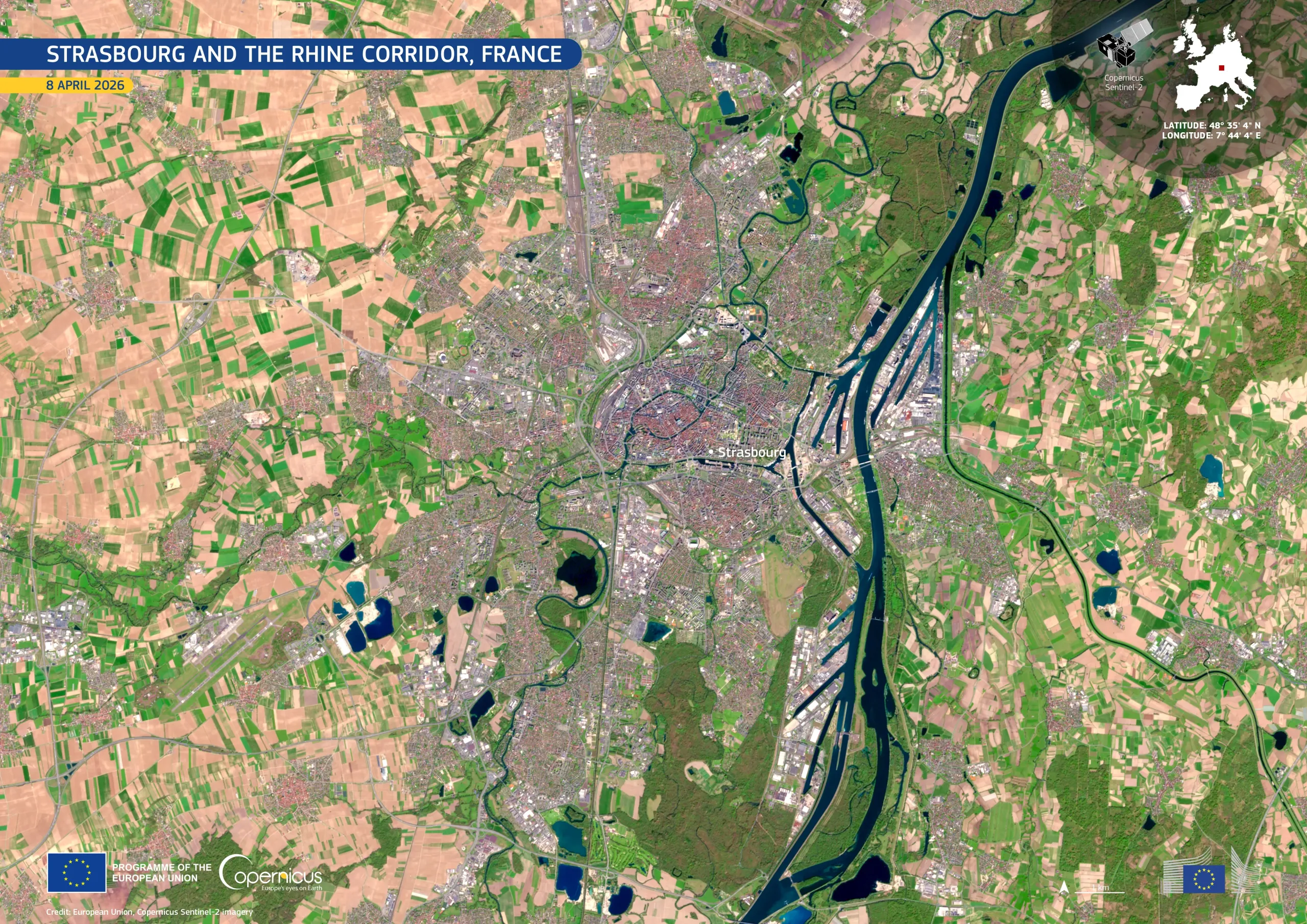
Strasbourg, in north-eastern France near the German border, is a major European administrative centre and a key hub on the Upper Rhine.
In this image acquired by one of the Copernicus Sentinel-2 satellites on 8 April 2026, the dense urban fabric appears in muted grey tones at the centre, surrounded by a mosaic of agricultural fields in light brown and bright green, indicating early seasonal growth. To the east, the dark, sinuous course of the Rhine forms a natural boundary, bordered by linear port basins and industrial infrastructure. Meandering channels and oxbow lakes are visible within the adjacent floodplain.
Copernicus Sentinel-2 data support detailed monitoring of urban expansion, agricultural dynamics, and river environments, enabling land-use planning, flood risk assessment, and cross-border environmental management across the region.
![Download [WEBP, 1.81 MB]](https://eu-space.europa.eu/sites/default/files/2026-04/20260417_Strasbourg.webp)