Corinth Canal
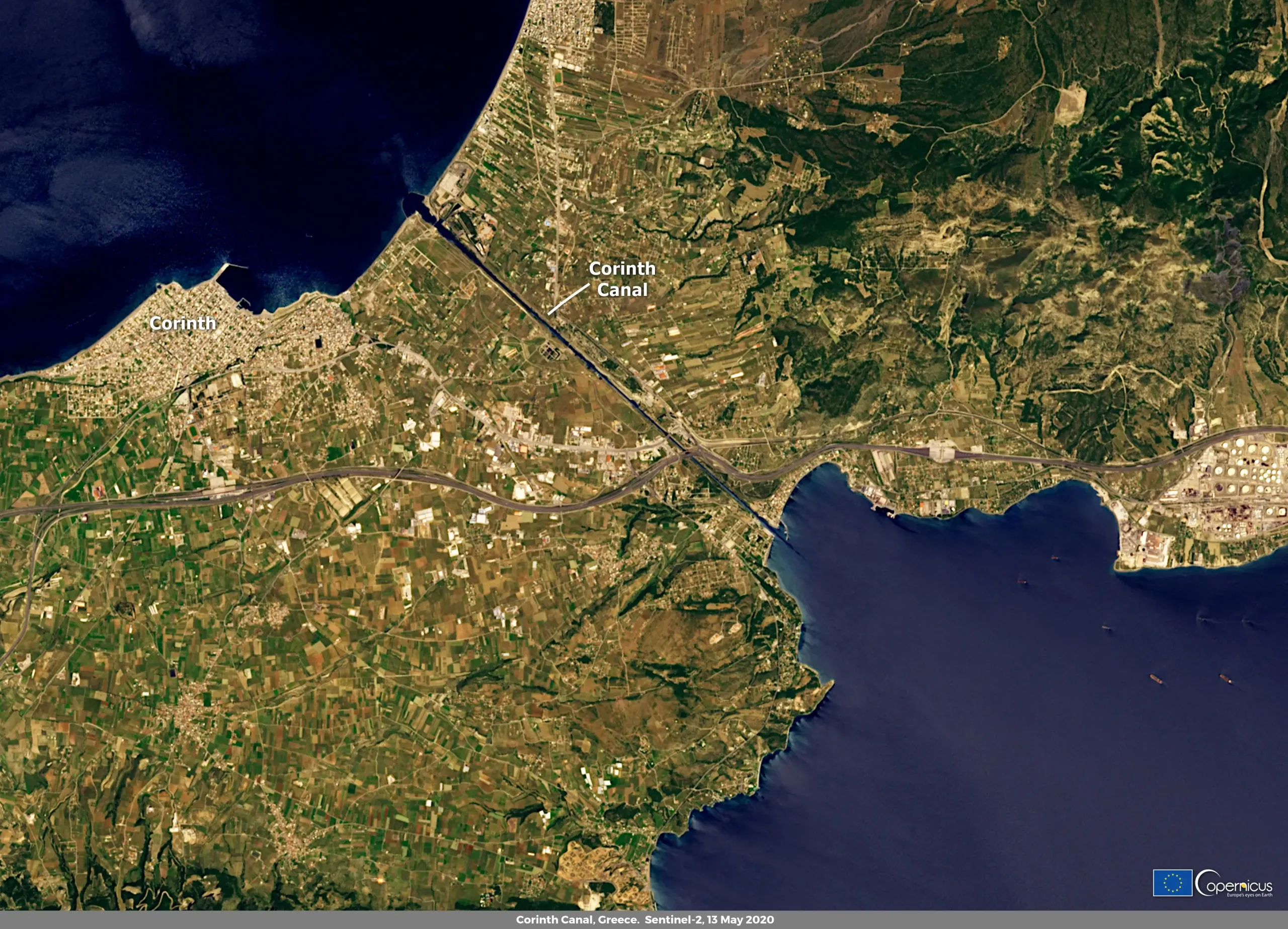
On 13 May 2020, one of the Copernicus Sentinel-2 satellites captured this cloudless image of the Corinth Canal in Greece.
The Corinth Canal is an artificial canal that connects the Gulf of Corinth with the Aegean Sea, cutting the isthmus that separates them in two. It was inaugurated on 25 July 1893, after eleven years of work. It measures 6.3 kilometres in length, just over 24 meters at its narrowest point and has a maximum depth of 9 metres: due to its small size, it cannot be crossed by large merchant ships, but is mainly used for tourist traffic.
The combined use of data provided by the satellites of the Copernicus Sentinel-1 and Sentinel-2 missions provides essential information for maritime surveillance allowing for more efficient and cost-effective use of other security assets, such as patrol aircraft and ships.
![Download [WEBP, 2.51 MB]](https://eu-space.europa.eu/sites/default/files/images/migrated/032.webp)