Cyclone Sinlaku leaves its mark on Micronesia
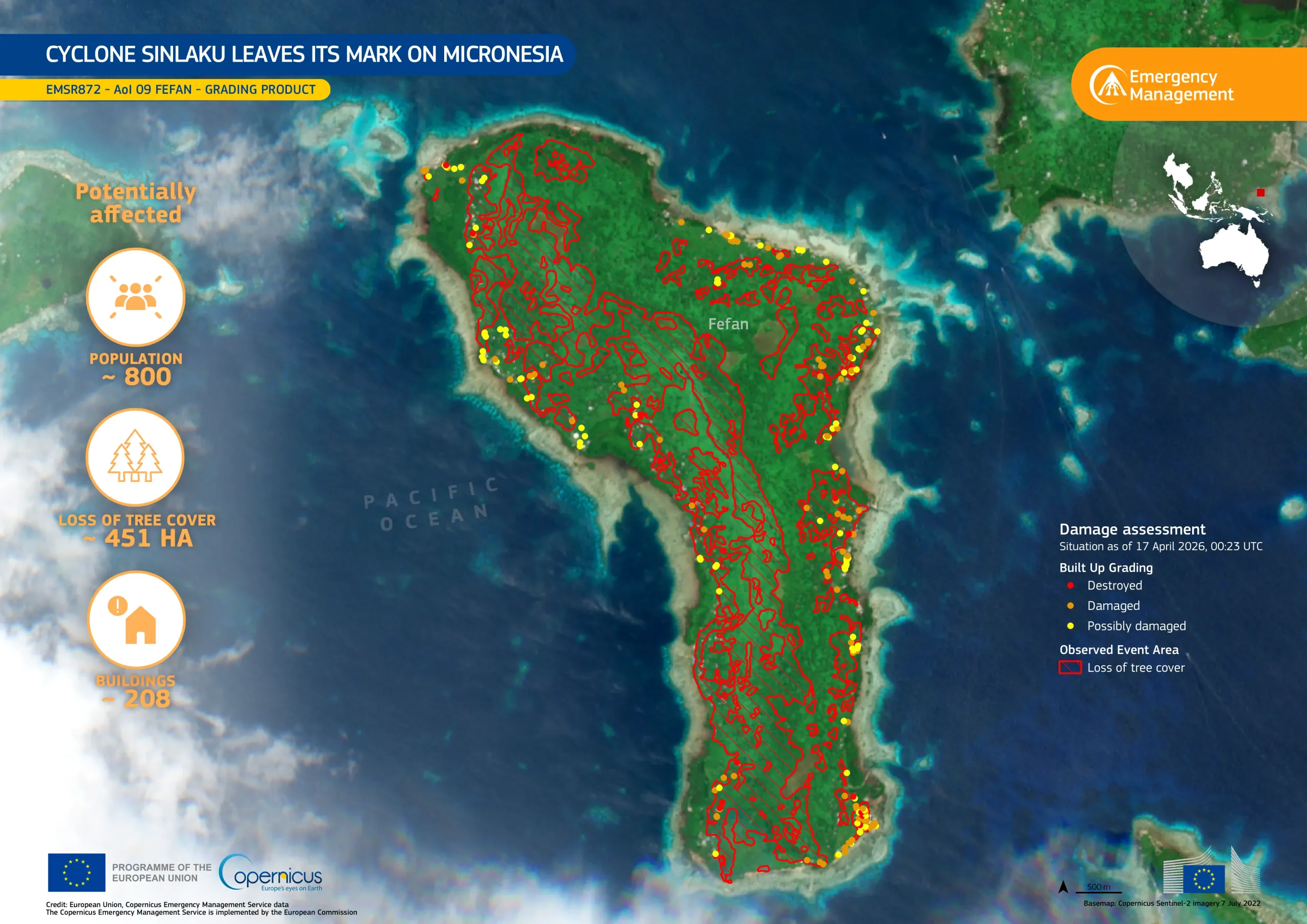
The Federated States of Micronesia, located in the Pacific Ocean north of Papua New Guinea, were heavily affected by Tropical Cyclone Sinlaku in April 2026, which brought severe weather conditions, and in particular strong winds, to the region.
The Copernicus Emergency Management Service (CEMS) On-Demand Mapping module was activated (EMSR872) to support damage assessment and emergency response operations in the region. This data visualisation focuses on Fefan, the third-largest inhabited island of the Chuuk Lagoon in the Federated States of Micronesia. Based on the CEMS damage grading product, it highlights the storm’s impacts on the island as of 17 April 2026. Red hatched areas indicate tree cover loss across the islands, reaching a total of 451 hectares. Meanwhile, the built up grading uses red, orange, and yellow markers to indicate destroyed, damaged, and possibly damaged structures. According to CEMS, approximately 208 buildings were potentially affected, and nearly 800 people may have been exposed to the cyclone’s effects on the island.
Copernicus supports emergency response by providing rapid geoinformation on affected areas, helping to prioritise response and recovery efforts in remote island regions.
![Download [WEBP, 699.99 KB]](https://eu-space.europa.eu/sites/default/files/2026-05/20260521_EMSR872%20AOI9.webp)