Reservoirs and mountain valleys shape Albania’s Drini River basin
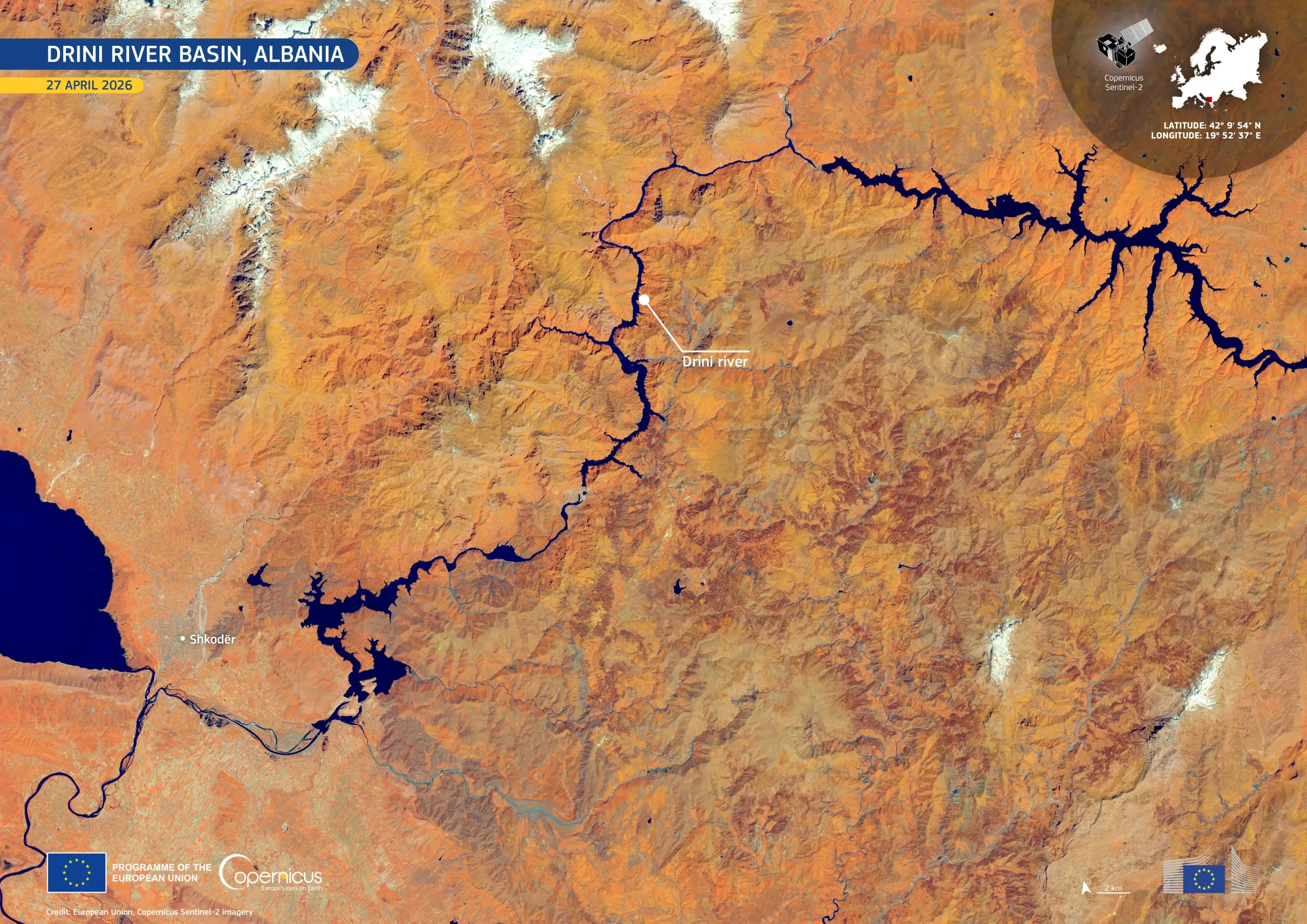
Stretching across northern Albania, the Drini River basin is one of the country’s most important freshwater systems. The river flows through a network of reservoirs and steep mountain valleys, supporting hydropower generation and water management, while sustaining regional ecosystems.
This image, acquired by one of the Copernicus Sentinel-2 satellites on 27 April 2026, shows the Drini river basin, highlighting the contrasts between rugged terrain, water bodies, and vegetation. In this false-colour visualisation, the river and its reservoirs appear in deep blue, tracing a complex, branching pattern through the mountainous landscape, while vegetation appears in bright orange, and snow-covered peaks stand out in white.
Copernicus Sentinel-2 data support regular monitoring of water resources, snow cover, and land conditions across the basin, providing useful information for hydropower management, environmental assessment, and regional planning.


![Download [WEBP, 1.78 MB]](https://eu-space.europa.eu/sites/default/files/2026-05/20260519_Drini%20river.webp)