Southern California wildfires send smoke plumes over the Pacific
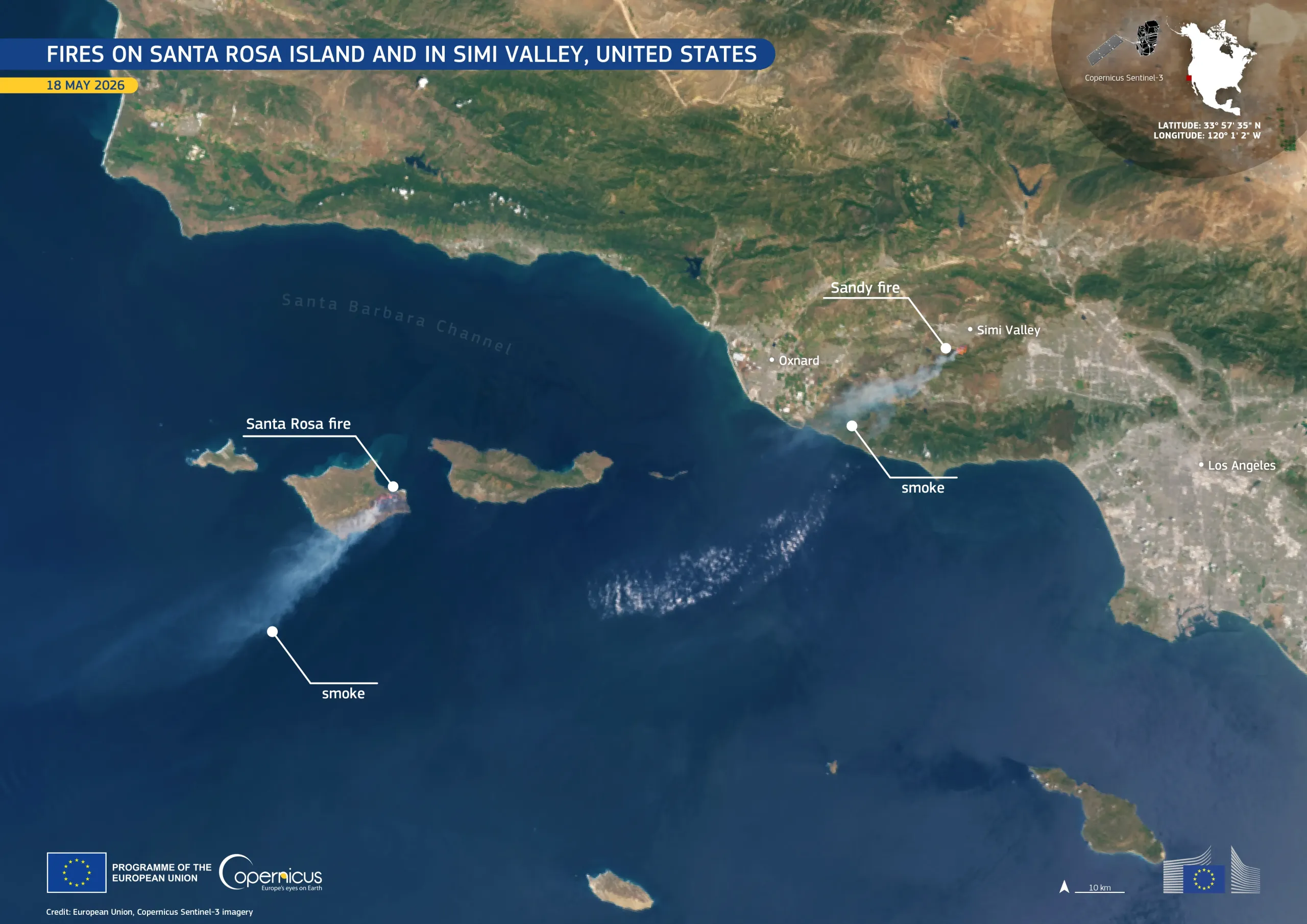
Fires burning across parts of southern California, United States, have affected Santa Rosa Island, off the coast of California, and inland communities near Simi Valley, a city north-west of Los Angeles.
On 15 May 2026, a wildfire broke out in the southern part of Santa Rosa Island, described as the largest blaze recorded on the island in modern history. Three days later, on 18 May 2026, a fire near Simi Valley prompted evacuation warnings.
This image, acquired on 18 May 2026 by one of the Copernicus Sentinel-3 satellites, shows active fires and smoke plumes over parts of southern California. Dense smoke extends more than 70 km south-westwards from Santa Rosa Island, while a smaller but clearly visible 50-km-long plume rises east of Oxnard near Simi Valley.
Copernicus satellite data support wildfire monitoring by helping authorities track fire extent, smoke dispersion, and fire impacts during ongoing wildfires.
![Download [WEBP, 474.89 KB]](https://eu-space.europa.eu/sites/default/files/2026-05/20260520_Fires%20USA.webp)