Ecuador’s diverse landscapes stretch from the Andes to the Amazon
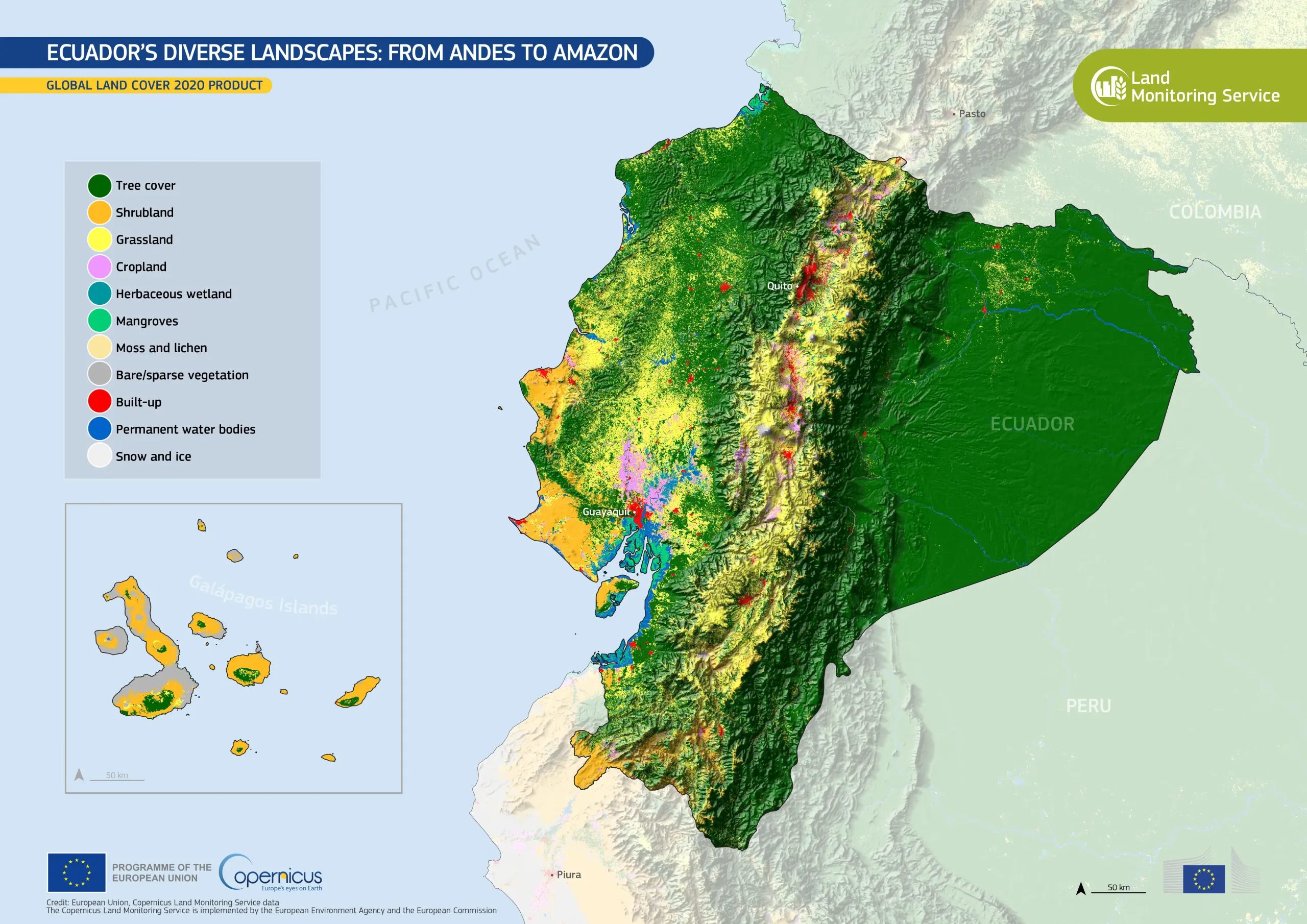
Ecuador encompasses an exceptional range of ecosystems, from the biodiverse Amazon rainforest to Andean highlands and coastal wetlands, many of which are protected under national and international frameworks. The country’s varied land cover reflects the interaction between natural environments and human activity, including agriculture and urban development.
This data visualisation, based on the Global Land Cover 2020 product from the Copernicus Land Monitoring Service (CLMS), shows Ecuador and the Galápagos Islands. Dense forests appear in dark green, covering the Amazon Basin, while croplands and built-up areas appear in lighter tones and red. The Andes form a prominent central spine, with sparse vegetation and grasslands visible at higher elevations.
Based on Copernicus Sentinel-2 data, the Global Land Cover 2020 product provides a detailed map of the Earth’s surface, with a spatial resolution of 10 metres, supporting conservation, forestry, and sustainable land management. More information is available here.
![Download [WEBP, 1.3 MB]](https://eu-space.europa.eu/sites/default/files/2026-04/20260430_Ecuador%20global%20land.webp)