Tidal channels and mudflats of the Bahía Blanca estuary, Argentina
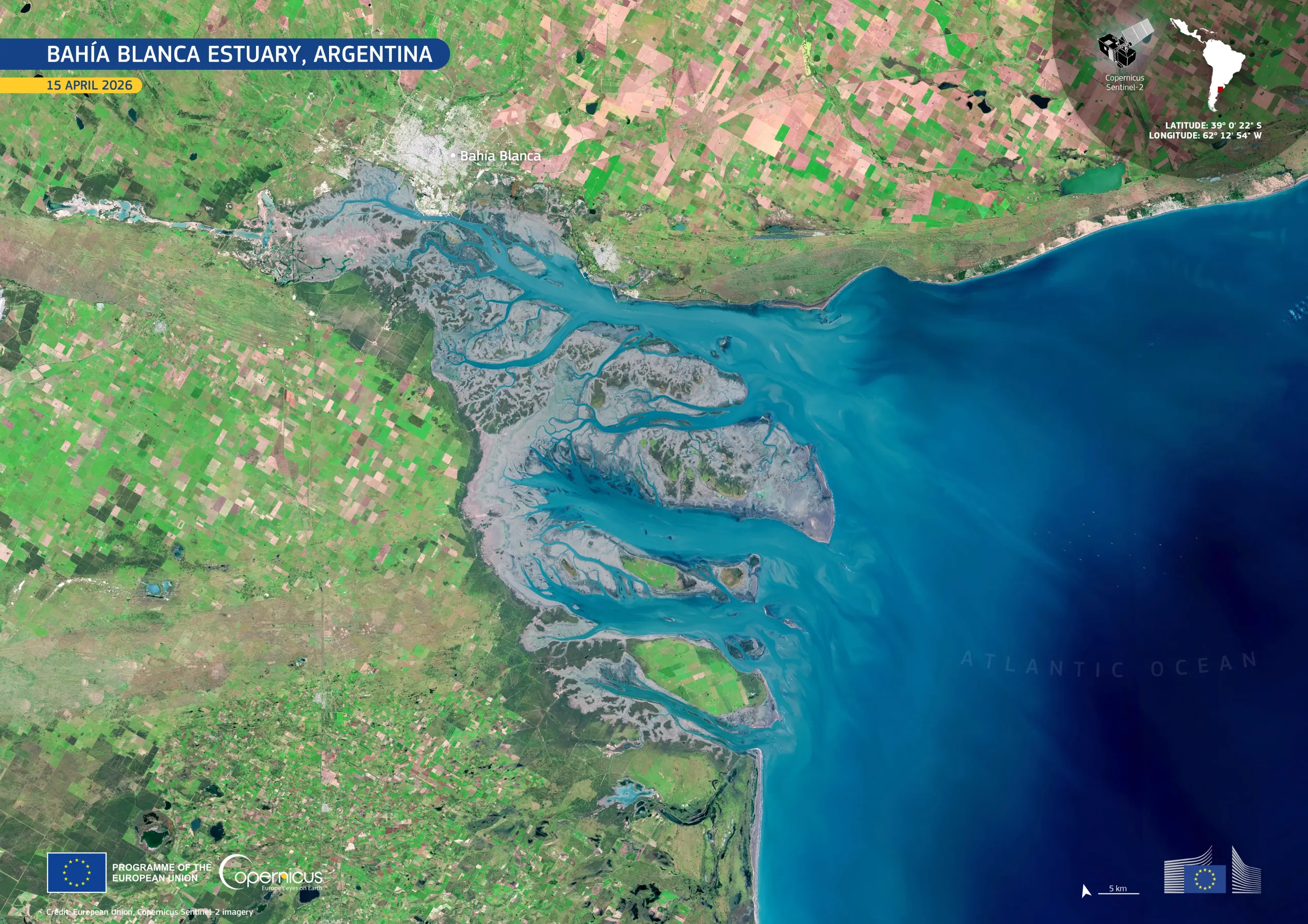
Located on the southern coast of Buenos Aires Province, Argentina, the Bahía Blanca estuary is a complex coastal system of tidal channels, mudflats, and salt marshes, recognised for its ecological importance, regional fisheries, and port activities. Its strong tidal dynamics shape a range of diverse habitats across the estuary.
This image, acquired by one of the Copernicus Sentinel-2 satellites on 15 April 2026, shows intricate branching waterways cutting through extensive grey-blue mudflats. Turquoise tones in the estuarine channels indicate the presence of suspended sediments, while the deep blue of the Atlantic Ocean provides a marked contrast offshore. Surrounding agricultural land forms a mosaic of bright green and pale brown fields, while the urban area of Bahía Blanca is visible to the north.
Copernicus satellite data support the detailed analysis of sediment transport, the evolution of coastal landforms, and the relationship between estuarine processes and surrounding land use, informing coastal management and the long-term monitoring of this ecologically and economically significant environment.

![Download [WEBP, 2.05 MB]](https://eu-space.europa.eu/sites/default/files/2026-04/20260428_Bahia%20Blanca.webp)