Image of the day
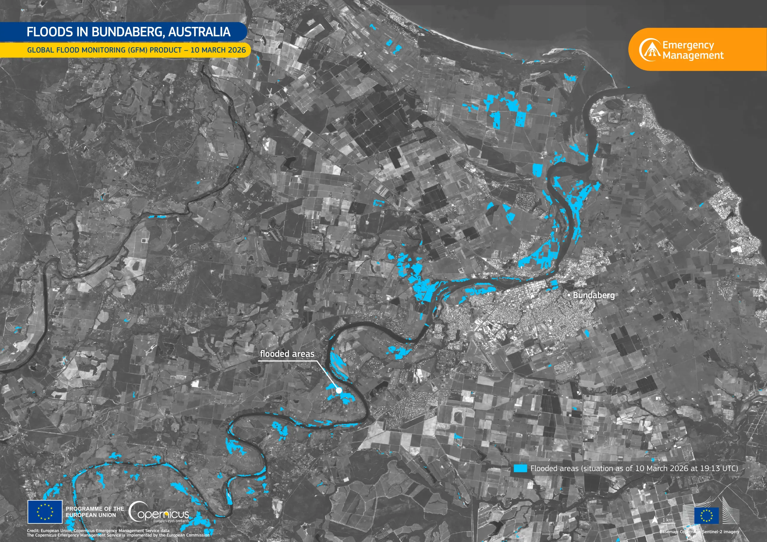
Floods in Bundaberg, Australia
Earth Observation | Copernicus
Floods
Location: Australia
Credit: European Union, Copernicus Emergency Management Service
On 10 March 2026, major flooding affected Bundaberg, a city in the state of Queensland, north-eastern Australia. Evacuation orders were issued and hundreds of residents sheltered in evacuation centres, whilst over 2,000 households were left without power and key bridges connecting the north and south of the city were closed.
This data visualisation, based on the Global Flood Monitoring (GFM) product from the Copernicus Emergency Management Service (CEMS), shows the flooded areas near Bundaberg in blue, as of 10 March 2026, at 19:13 UTC.
The GFM product of CEMS leverages Copernicus Sentinel-1 satellite data to map the extent of flooded areas globally, supporting situational awareness and emergency response operations.

![Download [WEBP, 1.24 MB]](https://eu-space.europa.eu/sites/default/files/2026-03/20260313_Floods%20Australia.webp)