Earthquake causes widespread damage in Colombia
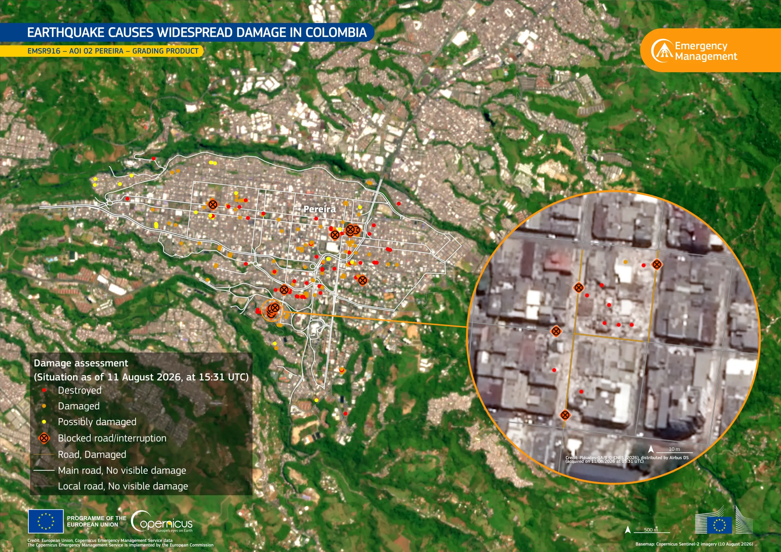
On 10 August 2026, a magnitude 7.4 earthquake struck western Colombia, causing severe damage across the region. According to the latest reports, the earthquake has resulted in 289 casualties and 4,187 injuries.
The Copernicus Emergency Management Service (CEMS) On-Demand Mapping module has been activated (EMSR916) to provide emergency mapping for damage assessment over 7 Areas of Interest.
This data visualisation focuses on ‘Area of Interest 02’, Pereira, and shows the earthquake-related damage. Based on the CEMS Grading product, it highlights the observed impact of the earthquakes as of 11 August 2026. The inset provides a closer view of the mapped damage, showing several affected building and road sections.
More information about this activation is available here.
Credit Inset: Pléiades-1A/B imagery © CNES (2026), distributed by Airbus DS. All images are provided under COPERNICUS by the European Union and ESA, all rights reserved.