European Union flag
English
EU Space Policy

Explore EU Space

Results (2011)
Use Cases
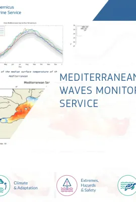
Mediterranean Heat Waves Monitoring
Earth Observation
Mediterranean Heat Waves Monitoring Service The Mediterranean Heat Waves Monitoring Service provides daily and historical information about the intensity and extent of the Marine Heat Waves (MHW) in…
Use Cases
BLUEFIN TUNA MONITORING
Earth Observation
BLUEFIN TUNA MONITORING IN THE MEDITERRANEAN SEA SOCIB (Balearic Islands Coastal Observing and Forecasting System) and IEO (INSTITUTO ESPAÑOL DE OCEANOGRAFÍA) have developed a habitat model for…
Use Cases
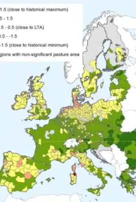
Map of relative index of pasture productivity over Europe, comparing February-March 2018 with the historical statistics (1999-2017)
Earth Observation
CROP MONITORING IN EUROPE The European Commission’s Joint Research Centre (JRC) acquires and shares relevant data and develops tools and methods for Monitoring Agriculture ResourceS (MARS), which…
Use Cases
SPOT – User-friendly oil spill model
Earth Observation
SPOT – User-friendly oil spill model To minimize the terrible impact generated by oil spills in the oceans, it is important to intercept and collect them in time before they spread and reach the…
Use Cases
TIDAL ENERGY ASSESSMENT
Earth Observation
TIDAL ENERGY ASSESSMENT - TIDEA To date, there is no global solution providing a first level of information for ocean renewable energy site assessments for tidal energy devices (tidal current speed,…
Use Cases
Land
Earth Observation
Urban Atlas Green infrastructure will play a key role in achieving EU policy objectives in a variety of interconnected environmental areas, especially when using nature based solutions to preserve…
Use Cases
EGNOS visibility map
Earth Observation
EU-DEM EGNOS visibility map was computed using the Digital Elevation Model over Europe (EU-DEM). The map shows all areas within the Digital Elevation Model over Europe where there is no visibility of…

Showing 2001-2011 of 2011 results