Asset Map of Munich, Germany
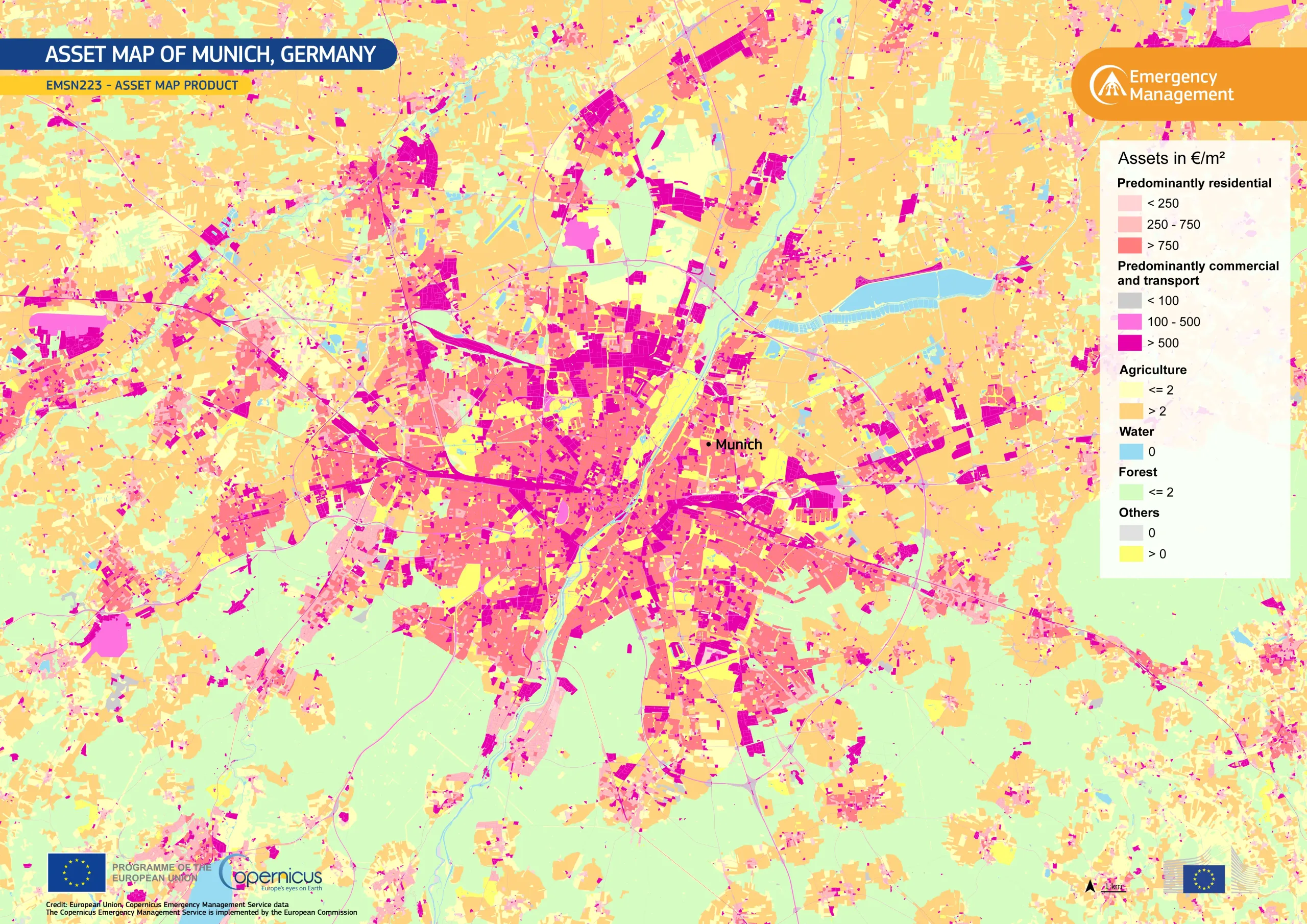
Understanding where economic value is concentrated in a landscape is essential for assessing the potential economic losses caused by disasters, and for managing risks efficiently. To support these efforts, the Basic European Asset Map (BEAM), developed by the European Commission’s Joint Research Centre (JRC), provides an inventory of Europe’s built environment for disaster risk assessment.
In 2025, Germany’s Federal Office of Civil Protection and Disaster Assistance (BBK) requested the Copernicus Emergency Management Service (CEMS) to produce an updated BEAM dataset for Germany.
This visualisation, based on the Asset Map product delivered by CEMS (EMSN223), shows the distribution of economic value in euros per square metre across Munich and its surrounding area, updated for 2025. The central urban area, which is dominated by residential, commercial, and transport assets, shows the highest concentration of economic value, while the outskirts are predominantly covered by agricultural and forest assets.
Through its Risk and Recovery Mapping component, CEMS provides accurate geospatial information which supports disaster risk mitigation, the assessment of economic damage caused by disasters, and recovery planning. More information about this activation is available here.
![Download [WEBP, 1.46 MB]](https://eu-space.europa.eu/sites/default/files/2026-03/20260316_BEAMMunich%20Assets%20map.webp)