Flooding in Gaza Province, Mozambique
Since the beginning of 2026, severe floods have affected southern and central Mozambique, inundating about 290,000 hectares. According to the United Nations High Commissioner for Refugees (UNHCR), the ongoing flooding has forced more than 392,000 people to flee their homes, making it one of the most significant displacement events in the region in recent years.
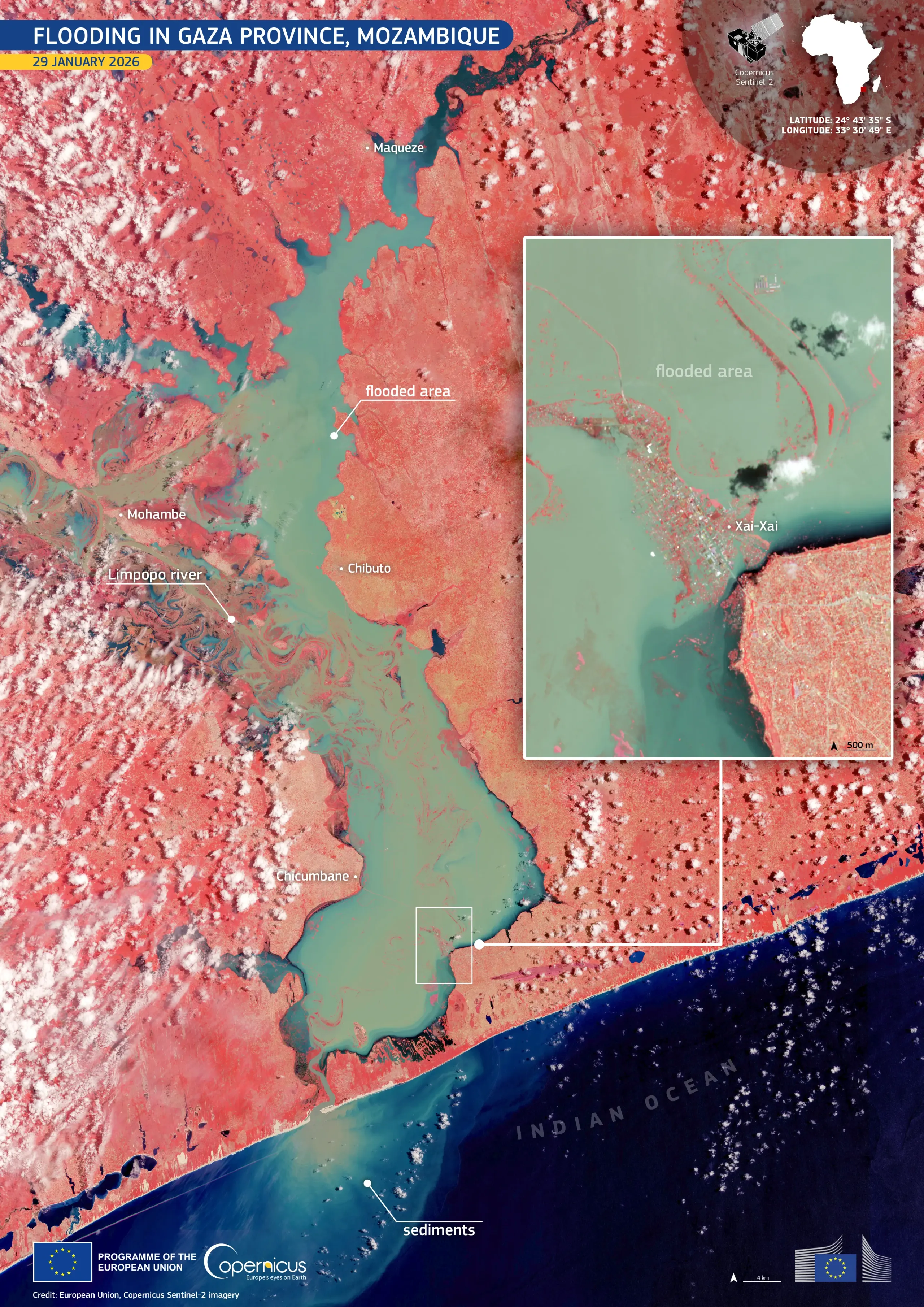
This false-colour image, acquired by one of the Copernicus Sentinel-2 satellites on 29 January 2026, shows the situation in Gaza Province following the floods. Healthy vegetation appears in bright red, while flooded areas are visible in turquoise and blue. Xai-Xai, the provincial capital, is clearly visible as inundated in the zoomed-in view. Offshore, a lighter plume marks sediment-laden water entering the Indian Ocean.
Copernicus Emergency Management Service data support rapid mapping of flood extent, emergency response, and recovery planning by identifying affected communities, infrastructure, and changing river channels. More information about this event is available here.


![Download [WEBP, 1.65 MB]](https://eu-space.europa.eu/sites/default/files/2026-02/20260203_Floods%20Mozambique.webp)