Floods in Albania
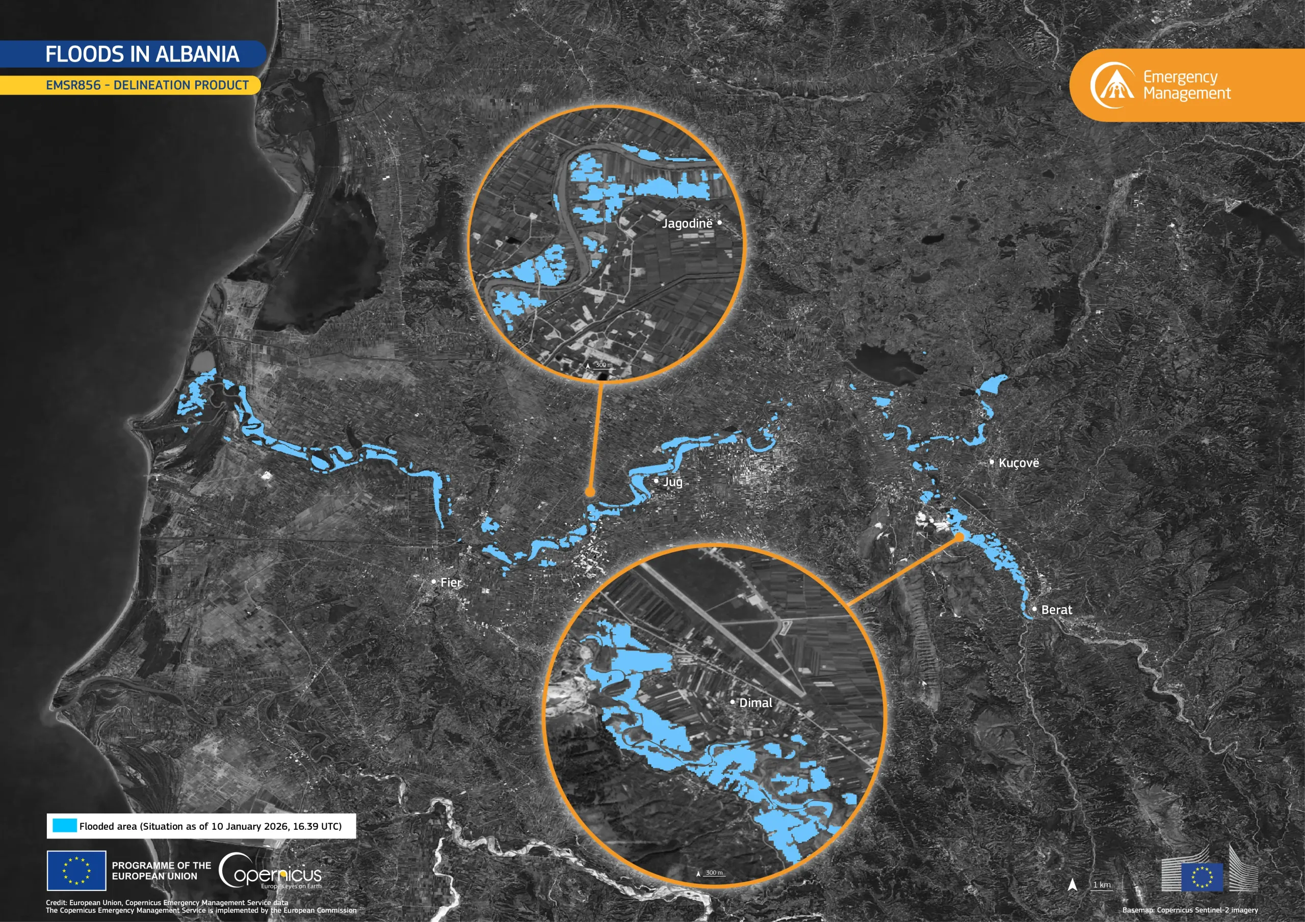
Prolonged heavy rainfall in early January 2026 caused rivers to overflow across parts of central and western Albania, leading to flooding in low-lying areas and along major river corridors. The event affected several cities, including Fier and Berat, where floodwaters inundated agricultural land and disrupted local infrastructure.
The Copernicus Emergency Management Service (CEMS) was activated (EMSR856) on 9 January 2026 to assess the extent of the flooding. This data visualisation, produced using the CEMS delineation product, shows the flooded areas as of 10 January 2026, with the inundated zones represented in cyan.
The information provided by CEMS is crucial for monitoring and mapping disasters. More information about this activation is available here.


![Download [WEBP, 1.39 MB]](https://eu-space.europa.eu/sites/default/files/2026-01/20260117_Floods%20Albania.webp)