Transboundary haze over the Mekong Region
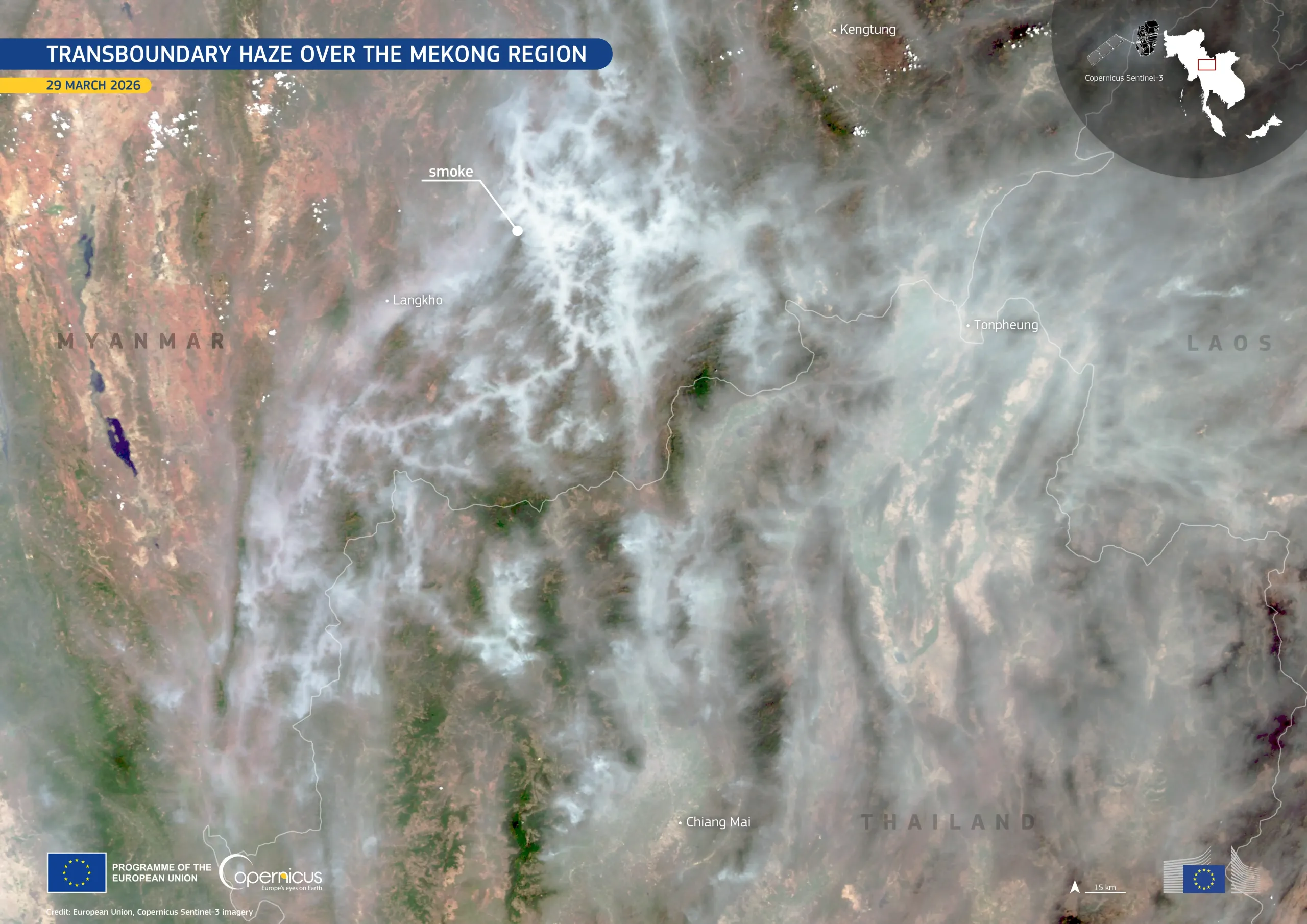
During the dry season, the Mekong Region, encompassing parts of northern Thailand, eastern Myanmar, and Laos, is affected by an increase in fire activity. Widespread burning across rural and agricultural areas is primarily associated with seasonal slash-and-burn practices, in which vegetation is cleared by fire to prepare land for agriculture. At the end of March 2026, over 1,450 hotspots were detected in Thailand alone, severely degrading air quality across the wider region.
This image, acquired by one of the Copernicus Sentinel-3 satellites on 29 March 2026, shows dense smoke plumes spreading across the border region between Myanmar, Thailand, and Laos. Valleys and ridgelines channel the smoke, causing it to form elongated streaks across the landscape.
Copernicus Sentinel data enable near-real-time detection of fire hotspots and the monitoring of smoke transport, providing essential information for air quality assessment, cross-border coordination, and emergency response planning.
![Download [WEBP, 580.52 KB]](https://eu-space.europa.eu/sites/default/files/2026-03/20260331_Thailand%20fires.webp)