Tidal channels weave through the mangrove forests of Pakistan’s Indus Delta
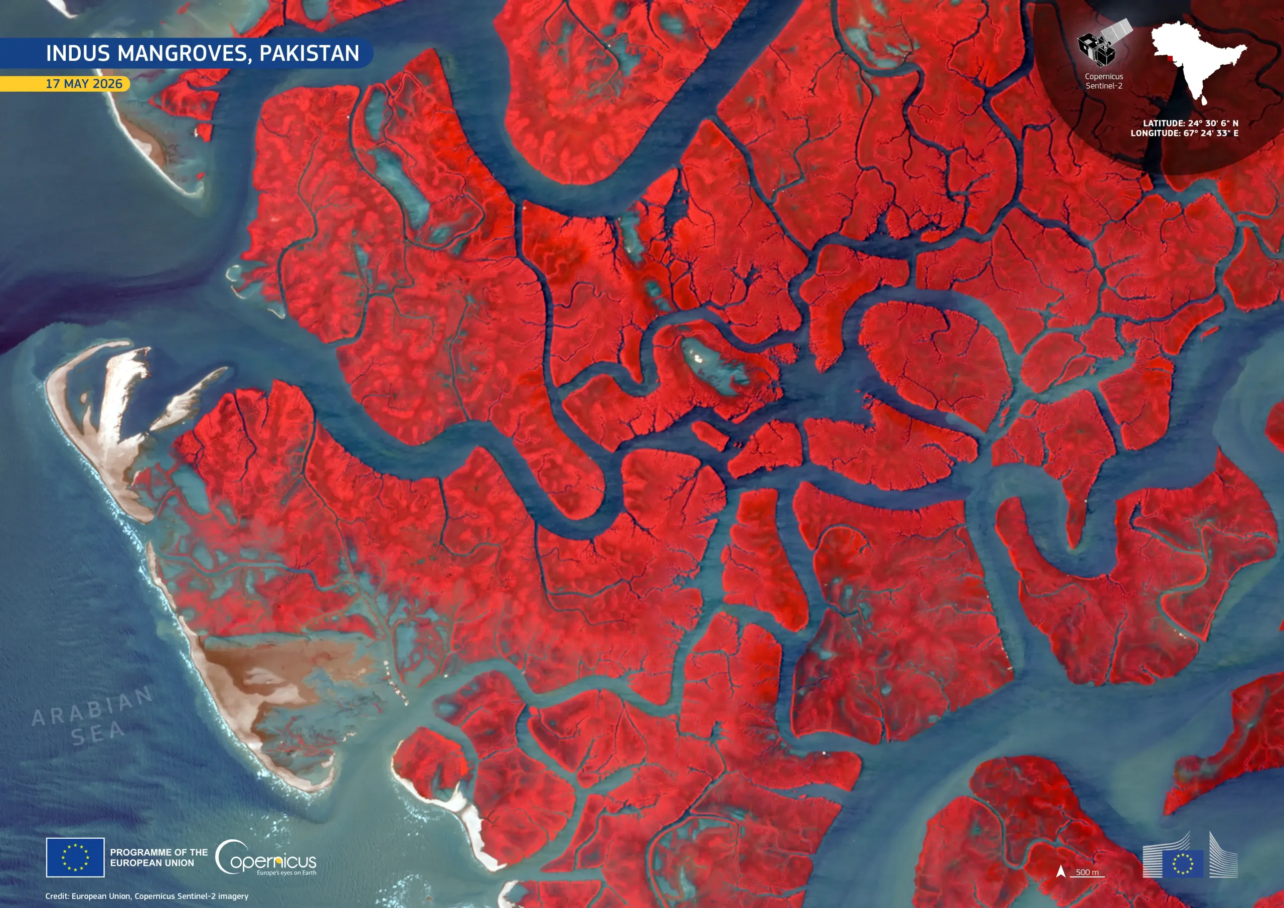
Stretching along the coast of the Sindh Province in southern Pakistan, the Indus Delta hosts one of the world’s largest mangrove ecosystems outside the humid tropics. These wetlands form an important ecological buffer between the Arabian Sea and the lower Indus floodplain, supporting fisheries, coastal biodiversity, and enabling sediment retention in an environment shaped by tidal fluctuation, river discharge, and high salinity.
Acquired by one of the Copernicus Sentinel-2 satellites on 17 May 2026, this image reveals an intricate network of tidal channels cutting through dense mangrove cover shown in vivid red. The dark blue waters of the Arabian Sea are visible at the western edge of the image, where pale sandbanks mark the shifting coastal margins.
Copernicus Sentinel-2 data support long-term monitoring of mangrove extent and health, shoreline dynamics, and sediment transport across the Indus Delta, informing coastal management, ecosystem conservation, and climate resilience planning.
![Download [WEBP, 822.82 KB]](https://eu-space.europa.eu/sites/default/files/2026-05/20260521_Indus%20mangroves.webp)