Naarden’s star-shaped fortress, the Netherlands
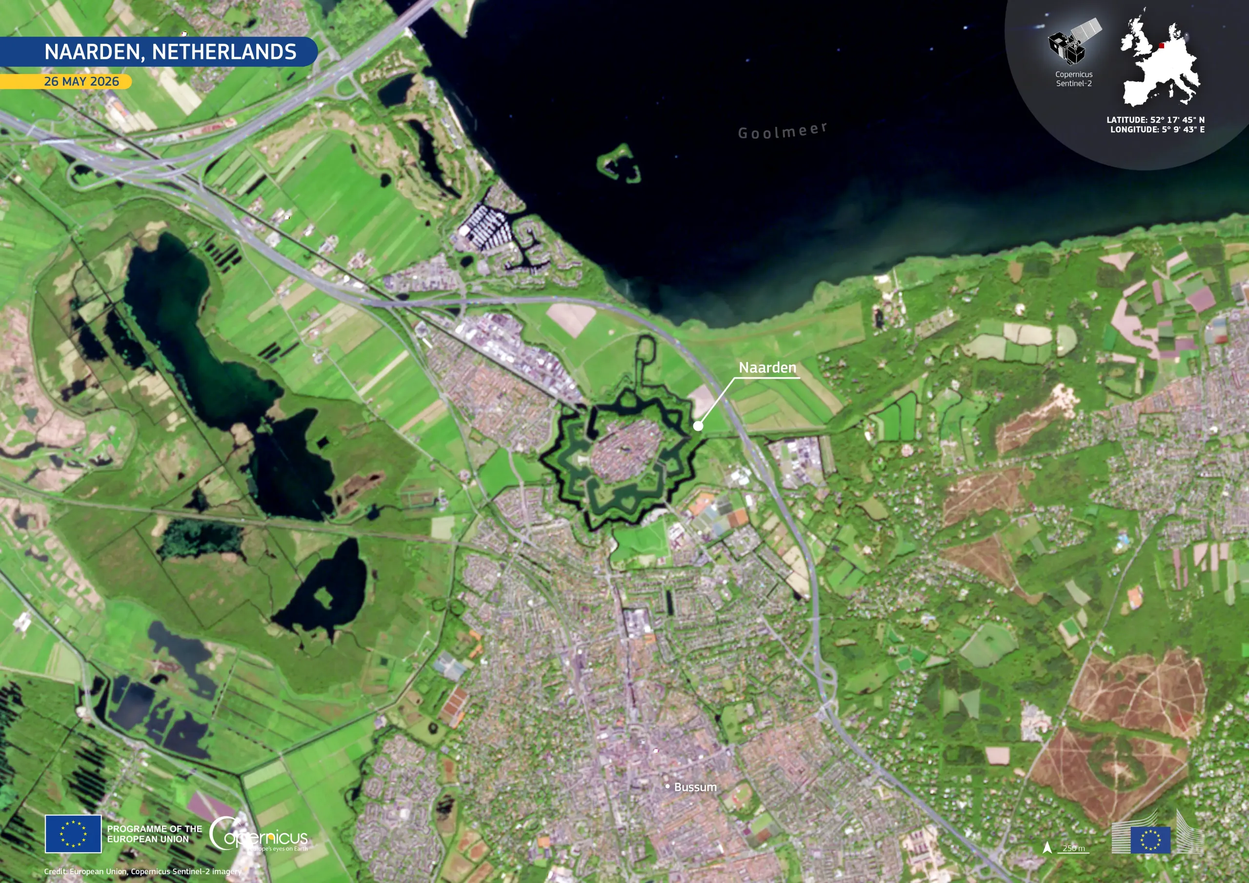
Naarden, in the Netherlands, is one of Europe’s best-preserved examples of a fortified town, with its distinctive star-shaped layout still intact. The historic town forms part of the UNESCO-listed Dutch Water Defence Lines, a vast defensive network which combines fortifications, canals, and the deliberate flooding of low-lying land to protect the region.
This image, acquired by one of the Copernicus Sentinel-2 satellites on 26 May 2026, shows the town’s star-shaped ramparts, bastions, and surrounding moat, which enclose its historic centre. To the south, the city of Bussum appears in pale grey and pink tones, contrasting with the bright green fields and woodland around it. North of Naarden, the dark waters of the Gooimeer border the landscape, while roads and rail lines cross the surrounding tracts of reclaimed land.
Copernicus data support land-use monitoring by tracking changes to the green space and urban areas surrounding heritage sites such as Naarden. These data can help inform the management of culturally significant landscapes, including the monitoring of urban expansion near protected areas.


![Download [WEBP, 827.94 KB]](https://eu-space.europa.eu/sites/default/files/2026-06/20260602_Naarden.webp)