OBSERVER: Digital Ocean Week 2026 charts Europe’s path towards integrated ocean intelligence
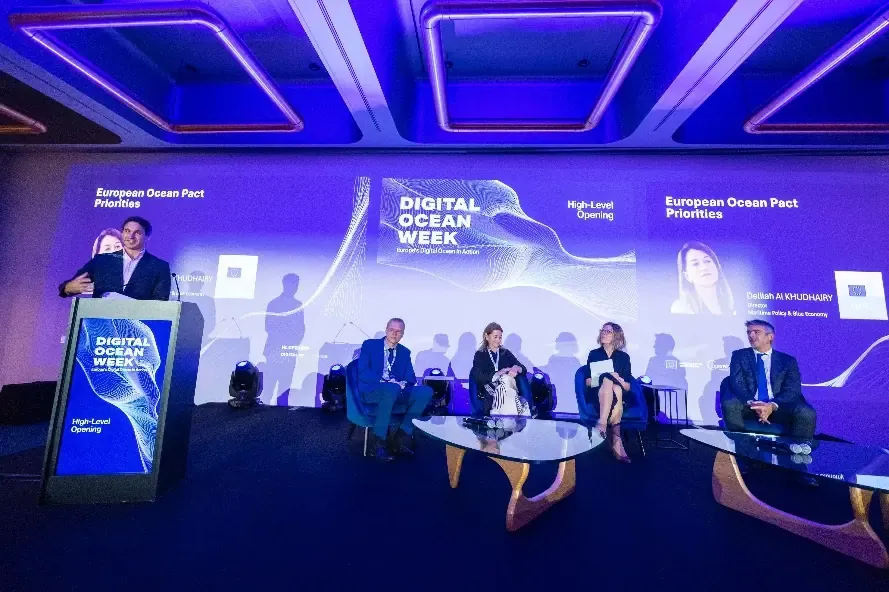
From 8 to 12 June 2026, the first Digital Ocean Week brought representatives from EU institutions and Member States, scientists, industry, and users to Brussels and online to explore the future of Europe’s digital ocean infrastructure. Organised by Mercator Ocean International and opened on World Ocean Day, the week brought together the 9th Copernicus Marine General Assembly, a high-level event on OceanEye, and the first AI Ocean Forum. Together, these discussions showed how ocean observation and forecasting have become a strategic capability for Europe, supporting resilience, maritime security, industrial competitiveness, and strategic autonomy. In this Observer, we look at highlights from the week and how the European ocean knowledge system is becoming more integrated, effective, and user-centred.
The ocean is central to Europe’s climate, economy, security, and international role. It shapes weather and climate, supports maritime activity, coastal livelihoods, and food systems. Public authorities and private users increasingly rely on ocean data for planning, risk assessment, and day-to-day operations. Ocean knowledge is built on many components: satellite observations, in situ measurements, modelling systems, data platforms, and operational services.
Digital Ocean Week brought these elements together into a single conversation. Across five days, participants discussed how Europe can connect ocean observation, marine data, digital infrastructure, and artificial intelligence into an even more coherent system. The programme covered the wider policy context of the European Ocean Pact, the future evolution of the Copernicus Marine Service (CMEMS), OceanEye’s strategic vision, practical demonstrations of the European Digital Twin Ocean, and new AI forecasting and simulation models which could improve access to trusted ocean knowledge.
This made the week more than a showcase of technical progress. It reflected a broader shift in how Europe is approaching ocean intelligence: not as a collection of separate datasets and platforms, but as an integrated and operational capacity which can support better decisions across environmental protection, climate adaptation, maritime safety, security, and the blue economy.
OceanEye as a strategic capability
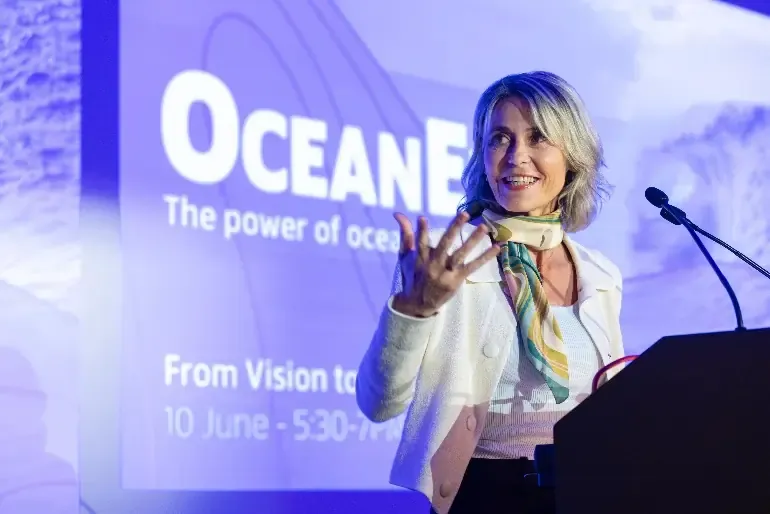
At the centre of this shift is OceanEye, the EU ocean observation initiative announced by President von der Leyen at the 2026 European Ocean Days as a core delivery mechanism of the European Ocean Pact and officially launched on 3 June 2026 by Commissioner for Maritime Affairs and Fisheries, Costas Kadis, and Commissioner for Startups, Research and Innovation, Ekaterina Zaharieva. The ambition of OceanEye is not only to collect more ocean data, but to make ocean observation more coordinated, more operational, and more useful for Europe’s long-term policy, economic, and security needs.
Ocean knowledge is now part of Europe’s wider geopolitical and economic landscape. Maritime transport, offshore energy, fisheries, critical infrastructure, and maritime security all depend on a clearer and more continuous picture of the ocean. As geopolitical tensions, climate risks, and pressure on critical maritime infrastructure increase, sustained ocean observation strengthens Europe’s ability to anticipate change, protect its interests, and act with greater autonomy.
Ocean observations already deliver major scientific and operational value. They are generated through a wide range of infrastructures across Europe and beyond. One of OceanEye’s objectives is to establish a European Digital Ocean System: an integrated system of European marine knowledge services, fed by in situ and satellite observations, which can support operational services, innovation, and value-added applications. OceanEye is therefore designed to help connect ocean observation infrastructures at national, European, and international levels. The initiative also sets a clear industrial and technological ambition. By 2035, the EU intends to provide 35% of global ocean data, secure 35% of the market for ocean observation technologies, and become the world’s leading provider of ocean intelligence. This ambition links ocean science to Europe’s wider competitiveness agenda, particularly in areas such as autonomous sensors, underwater robotics, artificial intelligence, digital twins, and secure data services.
Across Digital Ocean Week, discussions placed these priorities in the context of closer European coordination, international cooperation, and long-term investment. For the EU Space Programme, the connection is direct. Building on Copernicus, OceanEye points towards a more integrated European system in which ocean knowledge supports resilience, security, and informed decision-making.
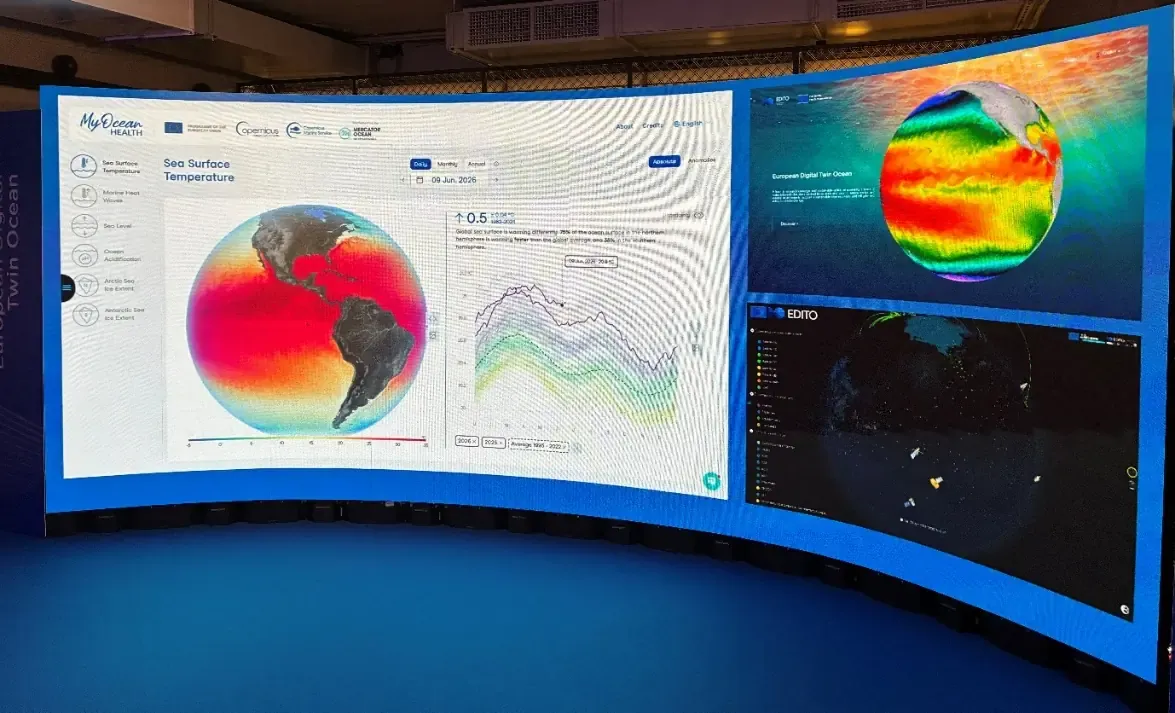
From data to services with EDITO
If OceanEye sets the strategic direction, the European Digital Twin Ocean shows how this direction can become visible to users. Built through EDITO, its core public infrastructure, the Digital Twin Ocean is bringing together ocean data, models, applications, and services in a single digital environment.
For many users, access to data is only the starting point. A coastal planner, port authority, or renewable energy developer may need to understand present conditions, compare them with past trends, and explore possible future scenarios. EDITO is intended to support this shift from access to data towards access to knowledge, helping users to work with integrated marine information to support decision making.
During Digital Ocean Week, demonstrations of the European Digital Twin Ocean showed how users could interact with a more practical digital environment for ocean knowledge, moving beyond data access towards exploration, analysis, and service delivery.
EDITO is especially important because the European Digital Twin Ocean sits at the crossing point between several parts of Europe’s ocean knowledge system. It is closely linked to CMEMS and EMODnet, and draws on the wider European landscape of observations, models, and digital infrastructure.
The same logic prevailed throughout the AI Ocean Forum, during which what-if scenarios and user-facing applications, such as data discovery tools, visualisation interfaces, and AI agents pointed towards a future in which users can move more easily from a question to a usable answer.
Making Copernicus work across service boundaries
An integrated Digital Ocean System also depends on making it easier to combine information from different Copernicus Services around user needs. Digital Ocean Week underlined a simple but important point: users often do not approach Copernicus following service boundaries. They approach it through questions.
A coastal authority, for example, may need information on sea level, coastal flooding risk, hazard, and exposure, land cover, atmospheric conditions, marine pollution, maritime activity, and climate trends. Answering such a question may require information from CMEMS, the Copernicus Land Monitoring Service (CLMS), the Copernicus Climate Change Service (C3S), the Copernicus Atmosphere Monitoring Service (CAMS), the Copernicus Emergency Management Service (CEMS), and the Copernicus Security Service (CSS), including the Maritime Surveillance component implemented by the European Maritime Safety Agency (EMSA). From the user’s perspective, the value lies in the combined answer.
The Copernicus Thematic Hubs respond to this need because they organise information around themes and user needs. For users who are not familiar with all the products of the Copernicus Services, the Hubs can provide a clearer route towards relevant products, use cases, and guidance.
Coastal areas make this especially clear. They sit at the meeting point of land, sea, climate, emergency risk, maritime activity, and human pressure, making them a natural focus for cross-service cooperation.
This cooperation is already taking shape. CMEMS works with C3S on essential climate variables, draws on river flow information from the European Flood Awareness System (EFAS), part of CEMS, to help represent freshwater inputs into ocean models, and connects with CLMS at the interface between land and sea. Copernicus Marine Service data are also used by EMSA for maritime surveillance, including information on sea surface temperature, wave height, ocean currents, and sea surface height. The next step is to make these connections easier for users to find, understand, and apply.
For Europe’s Digital Ocean System, the value of Copernicus grows when its Services are easier to connect around real-life user questions. This means helping users move from a large and complex portfolio of products and data towards clearer answers across environmental, climate, maritime, and security needs.

AI as the next operational layer
Discussions on the exponential development of artificial intelligence added another layer to the Digital Ocean Week discussion. Across the AI Ocean Forum, the strongest message was that AI can help a trusted ocean knowledge system work faster, at higher spatial and temporal resolution and accuracy, and closer to the questions users ask themselves.
Several examples made this concrete. AI models were presented as a tool to accelerate ocean forecasting, improve downscaling, explore scenario testing, and support ecosystem monitoring. Other tools focused on the user interface, including AI agents which can help users search, calculate, visualise outputs, and translate complex marine information into more direct answers. For users without specialist technical knowledge, this could become an important bridge between Europe’s digital ocean infrastructure and practical use.
The same discussions also made clear that speed is not enough. Ocean information is used in contexts in which errors can matter, from coastal risk assessment and maritime safety to climate services, environmental monitoring, and public policy development. AI systems therefore need reliable observations, transparent methods, and robust scientific validation. Benchmarking initiatives, including OceanBench, point to how AI ocean models can be tested for numerical performance, and for their ability to realistically represent ocean processes and support operational use.
While OceanEye brings together complementary ocean observation data streams, platforms, and services, AI can help make the resulting system easier to search, interpret, and use. For Europe’s Digital Ocean System, the value of AI lies in helping users work with trusted ocean knowledge, not in replacing the scientific and operational foundations on which that knowledge depends.

Towards a more integrated Digital Ocean
Digital Ocean Week 2026 showcased a European Digital Ocean System taking shape. OceanEye provides the strategic direction, and the Copernicus Services, the Copernicus Thematic Hubs, the European Digital Twin Ocean through EDITO, and emerging AI tools point towards a more coordinated European capacity for ocean knowledge. Together, they can turn Europe’s observation, modelling, service, and digital capabilities into trusted information which users can act upon.