OBSERVER: What impact does drought have on vegetation, and how does Copernicus help?
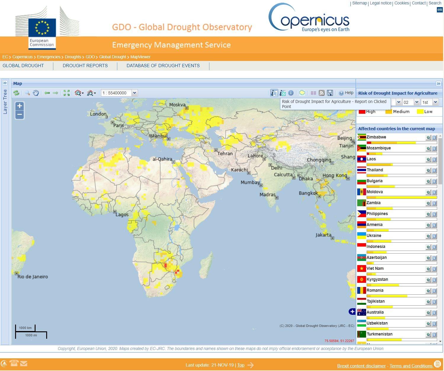
In Europe, drought is a recurring phenomenon, affecting extended areas and large populations every year. Across the world, millions of people are annually exposed to droughts that seriously affect economic development and the environment. With advancing climate change, droughts are more likely to become more severe and frequent than any other extreme weather hazards. Thus, future impacts are expected to present a major threat for society and the environment. For example, Zimbabwe, Zambia and south Mozambique have been facing a severe drought since the beginning of 2020.
According to a February 2020 report from Copernicus EMS’ Global Drought Observatory “Food insecurity is already widespread and the low yield expectations for the 2020 harvest loom over the next months. Food prices are increasing. In addition, water supply is intermittent and unsafe. Major damages to the economy of the involved countries are reported, also in relation to the low water level at the Kariba dam which is threatening power supply to both Zambia and Zimbabwe.”
Frequently, drought conditions remain unnoticed until water shortages become severe and the adverse impacts on the environment and society become evident. To improve risk management and adaptation strategies, droughts and their impacts (resulting damage and economic losses) must be functionally linked to the monitoring of the drought’s severity. While it is not possible to control droughts, the resulting negative impacts can be mitigated to a certain degree.
Drought - what it is and what it isn’t
First, we need to talk about two related phenomena that need to be distinguished from drought: aridity and water scarcity. While drought is seen as a natural disaster, aridity is a permanent climatic feature of a given place. We don’t usually say that there is a drought in the Sahara desert, because aridity in this area is the normal state of the climate. Drought is therefore relative to a “normal” state. For example, what could be seen as a disastrous drought in France could be considered as a relatively humid situation in Uzbekistan.
On the other hand, water scarcity is a situation where water resources do not meet water demand. Drought can cause or accelerate water scarcity, but an insufficient amount of water is not automatically a drought. Driven by the growing use of freshwater and the depletion of usable freshwater resources, water scarcity causes the deterioration of the quantity and quality (eutrophication, pollution, saline, etc.) of water available.
Now that we know what drought, isn’t, let’s look at what it really is and how it affects vegetation.
Usually, drought is defined in four main ways: 1) meteorological drought, 2) agricultural drought, 3) hydrological drought and 4) socioeconomic drought. Meteorological drought occurs when there is not enough rain. Hydrological drought is seen as a low level of water in streams, reservoirs and groundwater. Agricultural drought happens when soil moisture is low and insufficient for plant growth, resulting in crops drying out. Socioeconomic drought is defined as the impacts that drought has on society and the quality of life.
Drought and vegetation
Measuring the impact of drought on vegetation is one of the main ways to assess whether there is an agricultural drought. A lack of precipitation can be seen immediately, but it can also be averted with new rain coming. On the contrary, drought is a much larger problem. Farmers will be worried about drought when soil water supplies are not able to meet crop water demands. Consequently, crops with insufficient water cannot grow.
Monitoring the impacts of drought on vegetation is therefore key for ensuring food security and correct yield estimations. Correctly evaluating potential agricultural losses allows farmers to react and prepare for an upcoming crisis. This is especially important in areas where food consumption relies heavily on local agricultural production. Drought indicators can signal timely food assistance from aid programmes to populations at risk of starvation. Low precipitation can limit crop yields that drive up food prices and access. These negative impacts often remain hidden to subsistence farmers until after crops fail to produce. If this occurs, food assistance will not reach a population in time to prevent starvation completely. The critical warning that drought monitoring provides saves lives and combats food insecurity across the globe.
The impact of drought on vegetation
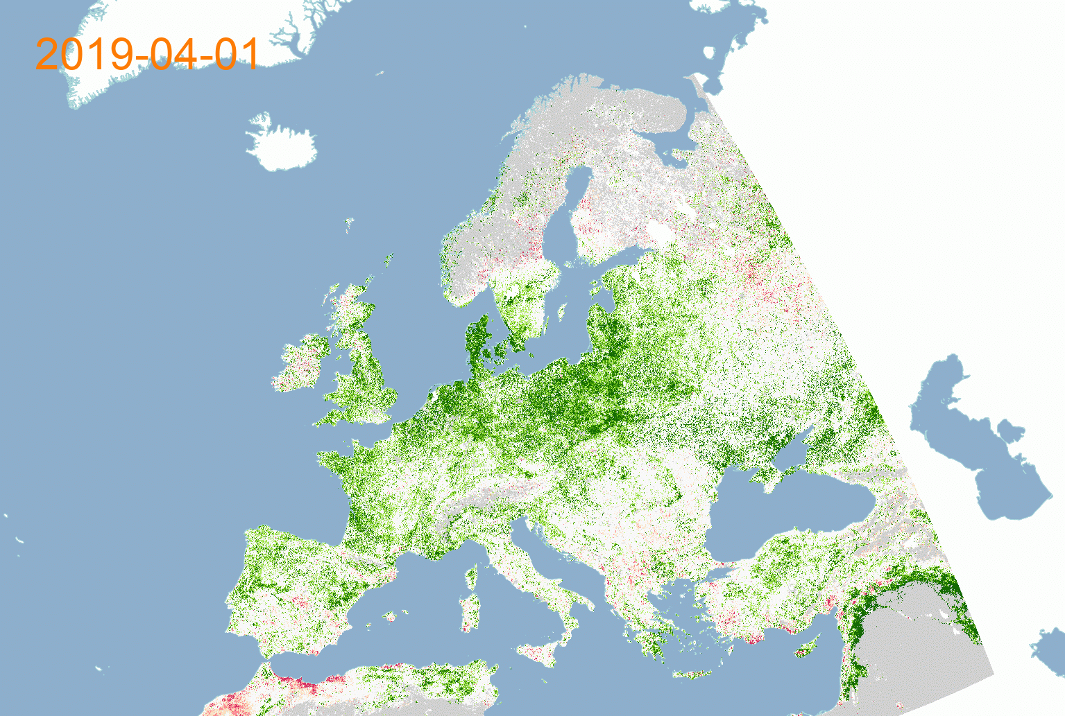
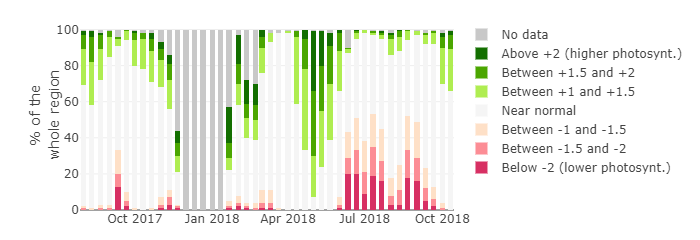
Did you know that dry plants generally have a lower capacity to absorb solar radiation? This is one of the reasons why plants under water stress do not grow so well. They simply do not process enough solar energy for effective photosynthesis. The Fraction of Absorbed Photosynthetically Active Radiation (FAPAR) indicator is being used to monitor this. It can be monitored by satellites with a multispectral sensor, such as Sentinel-2. Unlike basic vegetation indices such as NDVI, FAPAR is a more complex biophysical variable representing the ratio of solar radiation that is absorbed by vegetation for photosynthesis. In this way, FAPAR is very effective for detecting and assessing the impacts of drought on vegetation, and consequently agricultural drought.
EDO and GDO
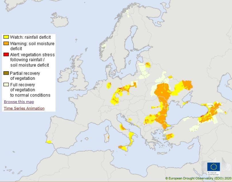
The European Drought Observatory (EDO) is part of the Copernicus Emergency Management Service and provides current and up-to-date information on droughts. It is a comprehensive drought related monitoring system powered by Copernicus data. EDO monitors and analyses a set of drought related indicators derived from precipitation, soil moisture, and vegetation, producing the Combined Drought Indicator (CDI). This is done in respect to the specific impacts of drought on agriculture and ecosystems.
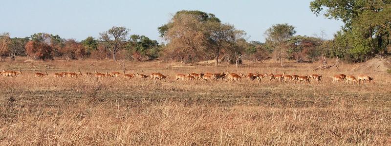
The landlocked Republic of Zambia is home to diverse ecosystems and landscapes. Geospatial information helps predict and monitor drought conditions that benefit multiple areas of society such as agriculture, biodiversity and national parks. Photo: Gregoire Dubois 2008
Apart from this report, you can also read through all the reports generated since year 2011. Moreover, you can try the new web application that can generate a drought report for any region in the world by selecting the "Report on Clicked Point" icon and clicking in the point of interest in the map (see picture below); the report can then be sent directly to your mailbox.