A global Urban Climate Architectural Database
How to produce climate projections or adaptation studies in cities that consider the variety of architecture in the world?
Accurate urban climate models are essential for quantifying climate projections in cities and supporting adaptation efforts. These models require input data on urban form, materials, and function. However, existing frameworks, such as Urban Atlas, only provide land cover, from which urban morphological parameters can be derived, but lack detailed information on building materials and systems.
To address these limitations, a novel crowdsourcing approach was used to build an Urban Climate Architectural Database (named UCAD). This approach gathers comprehensive building data worldwide at the country level. A global survey, translated into 11 languages, was conducted to characterize buildings by typology, according to its form, use, and country. This approach captures significant architectural and construction trends by collecting key data on building systems and envelope characteristics (e.g., walls, roofs, windows, and insulation).
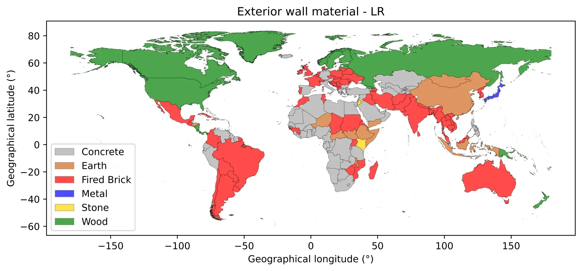
The survey yielded 521 responses from 141 countries, demonstrating substantial global coverage. A multi-step imputation strategy was applied to create a comprehensive global database, and residential building typologies are defined for each country. The figure displays, as an example, the typical wall material of Low-Rise residential buildings in each country. This architectural dataset provide a valuable resource for urban climate modeling and facilitate more accurate climate assessments on a global scale.
The main achievements are:
- An open-source global architectural database
- Covers all countries on Earth, and contains crucial architectural data presently missing for atmospheric impacts and climate models
- Use friendly GIS format maps
- Freely available at: doi.org/10.5281/zenodo.16096963
- A scientific article is submitted: De Carvalho Araujo et al (2026) (link will be updated when available)
- Description of the methodology, that could also be applied to refine infra-country scale information with the same survey (that includes all administrative regions within each country)
- Provides all physical parameters (e.g. heat capacity) for urban models depending on each architectural feature (e.g. each type of wall material)
- Description of how to use this architectural information with Urban Atlas land cover.
Further information can be found here: https://doi.org/10.5281/zenodo.16096963
Related Activity