Image of the day
Bjørnafjorden, Norway
Earth Observation | Copernicus
Water Resources

Location: Norway
Credit: European Union, Copernicus Sentinel-2 imagery
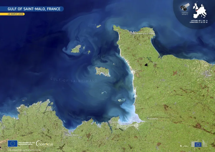
Bjørnafjorden is Norway’s widest fjord, located in Vestland county. Its calm, expansive waters stretch between steep, green hills and rugged cliffs, providing a scenic environment for outdoor activities such as camping, hiking, and water sports.
This cloud-free image, acquired by one of the Copernicus Sentinel-2 satellites on 20 May 2025, shows part of the fjord from above. The administrative centre of the Bjørnafjorden municipality, Osøyro, as well as the coastal village of Strandvik are visible.
Free and open data from the Copernicus Sentinel satellites provides information on coastal areas around the world, delivering insights to inform policies regarding sustainability, biodiversity, and environmental management.
![Download [WEBP, 642.57 KB]](https://eu-space.europa.eu/sites/default/files/images/iotd/20250707_Bj_C3_B8rnafjorden.webp)