Sediment patterns in the Gulf of Saint-Malo, France
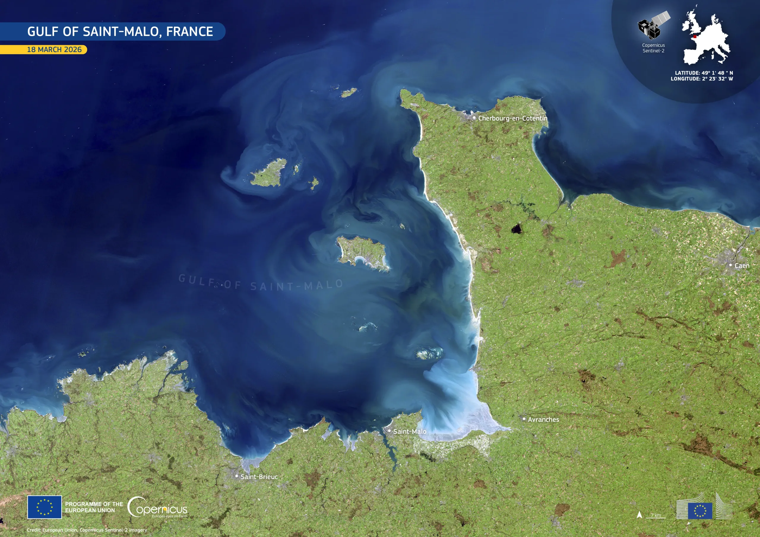
The Gulf of Saint-Malo lies between Brittany and Normandy, in north-western France. It is known for strong tidal dynamics, which influence coastal waters, sediment transport, and the surrounding marine environment.
This image, acquired by one of the Copernicus Sentinel-2 satellites on 18 March 2026, shows sediment plumes and striking water colour variations across the Gulf of Saint-Malo. The image highlights the transport and mixing of suspended sediments, which form swirling patterns throughout the gulf, while the Channel Islands are visible near its centre.
Ocean observation is critical for protecting and restoring marine ecosystems, improving climate forecasting, and supporting activities such as fisheries, offshore energy and shipping. Yesterday, the European Commission adopted OceanEye initiative, which aims to strengthen ocean observation and Europe’s marine knowledge base, building on the data and services provided by the Copernicus Marine Service and other European services into a broader European Digital Ocean System.
More information here.
![Download [WEBP, 1.81 MB]](https://eu-space.europa.eu/sites/default/files/2026-06/20260604_Gulf_of_Saint-Malo.webp)