From drought to rainfall in Northeastern Morocco
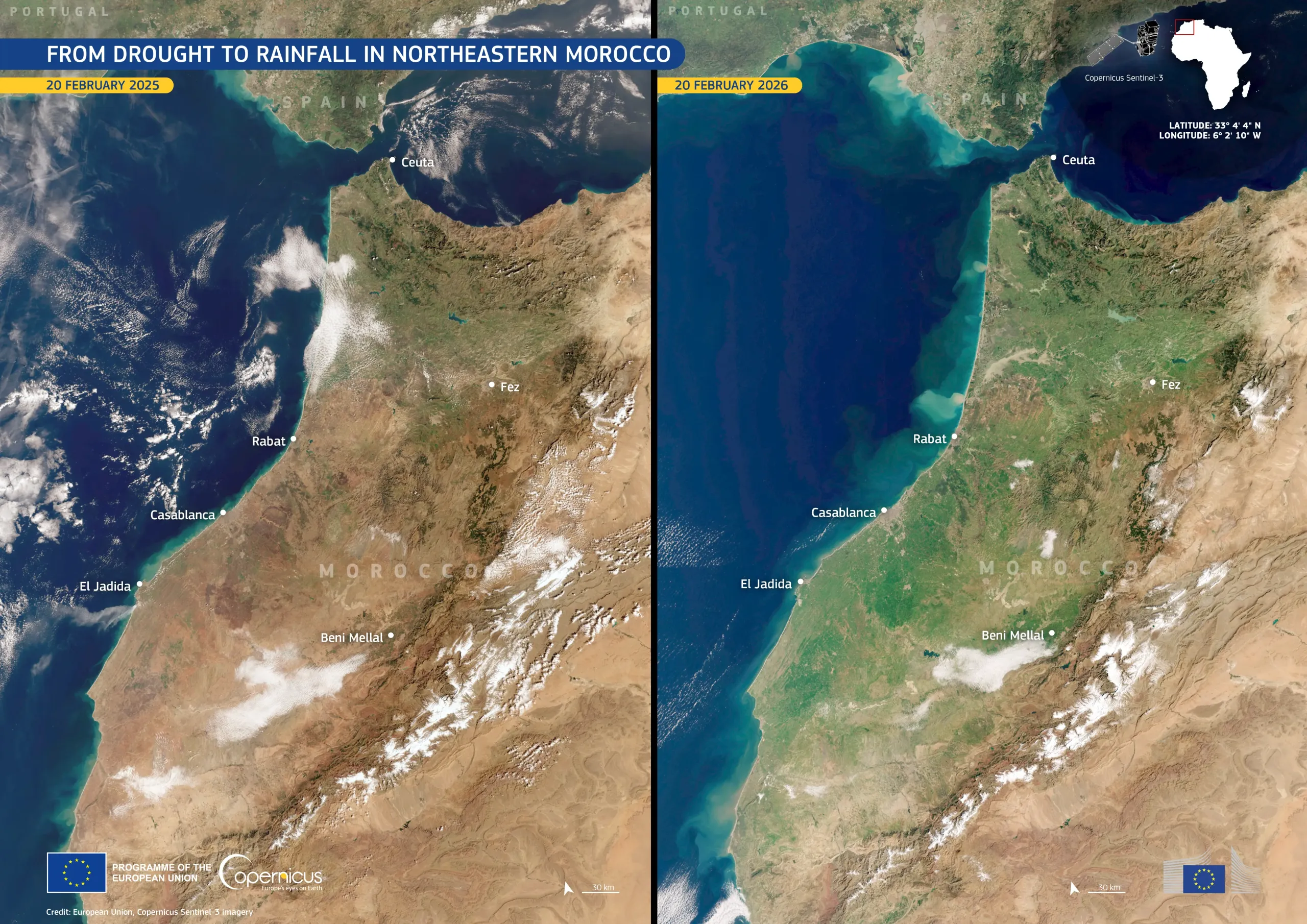
In mid-February 2025, northeastern Morocco was affected by severe drought, with sparse vegetation visible across the landscape.
One year later, the same region appears markedly different in satellite imagery. Following two months of intense rainfall, previously dry terrain has been transformed into an expanse of green vegetation.
These Copernicus Sentinel-3 images illustrate this contrast. The image on the left, acquired on 20 February 2025, shows widespread drought conditions. In contrast, the image on the right, acquired on 20 February 2026, reveals extensive vegetation, visible in shades of green, following winter rainfall. As of 20 February 2026, available water resources reached 11.8 billion cubic metres, representing an increase of approximately 155% compared with the same period in 2025. Reservoir storage in Morocco reached 70.7% of total dam capacity.
Copernicus satellite data provide consistent information to monitor vegetation recovery and reservoir levels, supporting national water management and drought monitoring efforts.
![Download [WEBP, 1.45 MB]](https://eu-space.europa.eu/sites/default/files/2026-03/20260223_Morocco.webp)