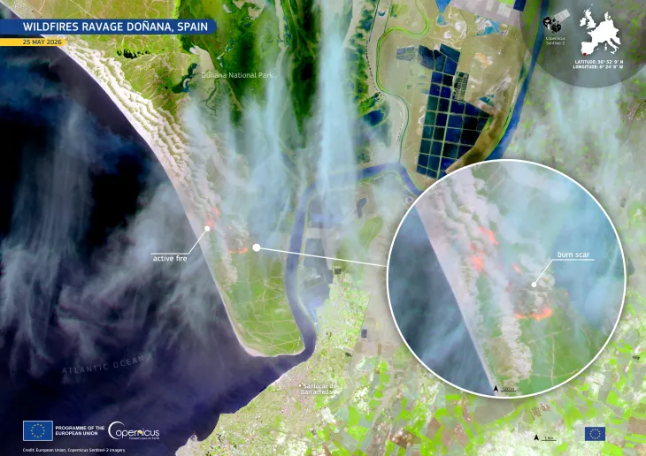
Læsø island, Denmark
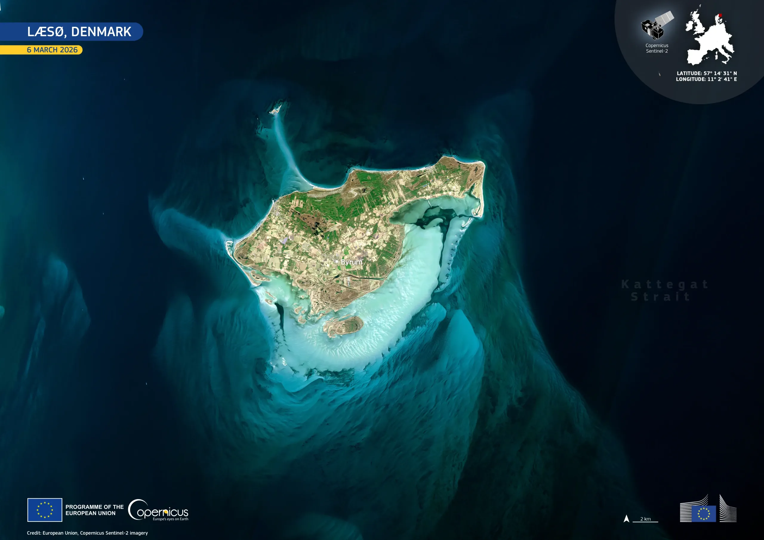
Læsø, a low-lying Danish island in the Kattegat Strait, is a Natura 2000 protected area, recognised for its unique coastal habitats and dynamic geomorphology. The island is characterised by salt marshes, dunes, and extensive intertidal sandbanks, which provide important breeding and feeding grounds for migratory birds and marine species.
This image, acquired on 6 March 2026 by one of the Copernicus Sentinel-2 satellites, shows Læsø surrounded by vivid turquoise waters. Shallow sandbanks and submerged ridges are visible in light blue, while forest appears in green and cultivated land in pale tones.
Copernicus satellite data support regular monitoring of coastal dynamics, helping with habitat conservation, shoreline management, and the assessment of climate change impacts on fragile coastal ecosystems.
![Download [WEBP, 422.23 KB]](https://eu-space.europa.eu/sites/default/files/2026-03/20260325_L%C3%A6s%C3%B8%20island.webp)