Valletta and the urban mosaic of eastern Malta
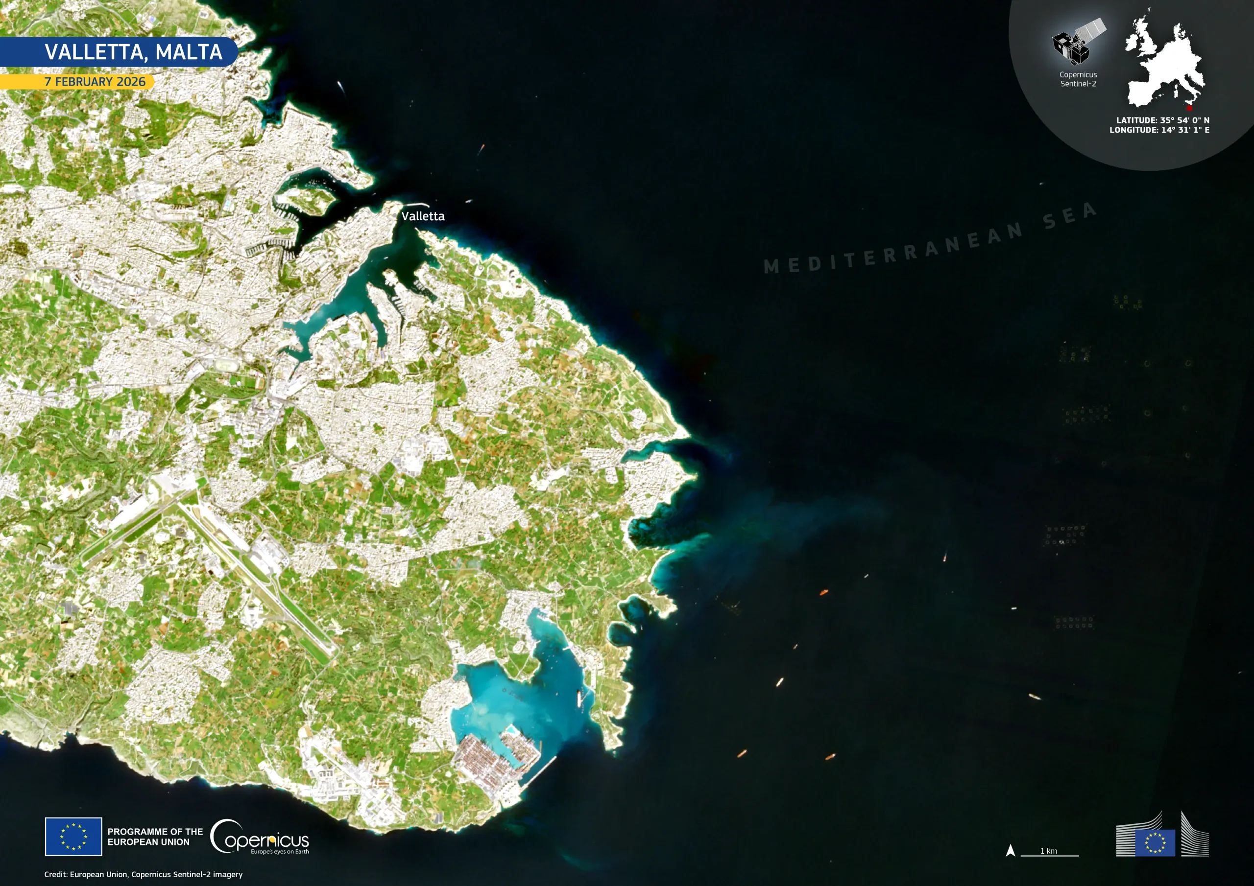
Valletta, a UNESCO World Heritage Site, lies at the centre of one of the Mediterranean’s most densely urbanised islands. Built on a narrow peninsula between two natural harbours, the Maltese capital is surrounded by historic fortifications, marinas, and compact residential districts. Despite its predominantly urban character, the wider landscape includes patches of agricultural land and fragmented natural habitats, which support biodiversity and help regulate coastal microclimates.
Valletta, located on the north-eastern coast of Malta, is visible in this Copernicus Sentinel-2 image acquired on 7 February 2026. Built-up areas appear in pale grey and beige tones, cultivated fields appear in bright green, and the surrounding Mediterranean Sea appears in deep blue, with lighter turquoise shades marking shallow coastal waters.
Copernicus Sentinel data support urban planning, coastal management, and the monitoring of land-use change in rapidly developing regions. These data help authorities assess urban expansion, infrastructure pressure, and environmental impacts over time.
![Download [WEBP, 907.55 KB]](https://eu-space.europa.eu/sites/default/files/2026-02/20260215_Valletta.webp)