Wildfires in the Biobío and Ñuble regions, Chile
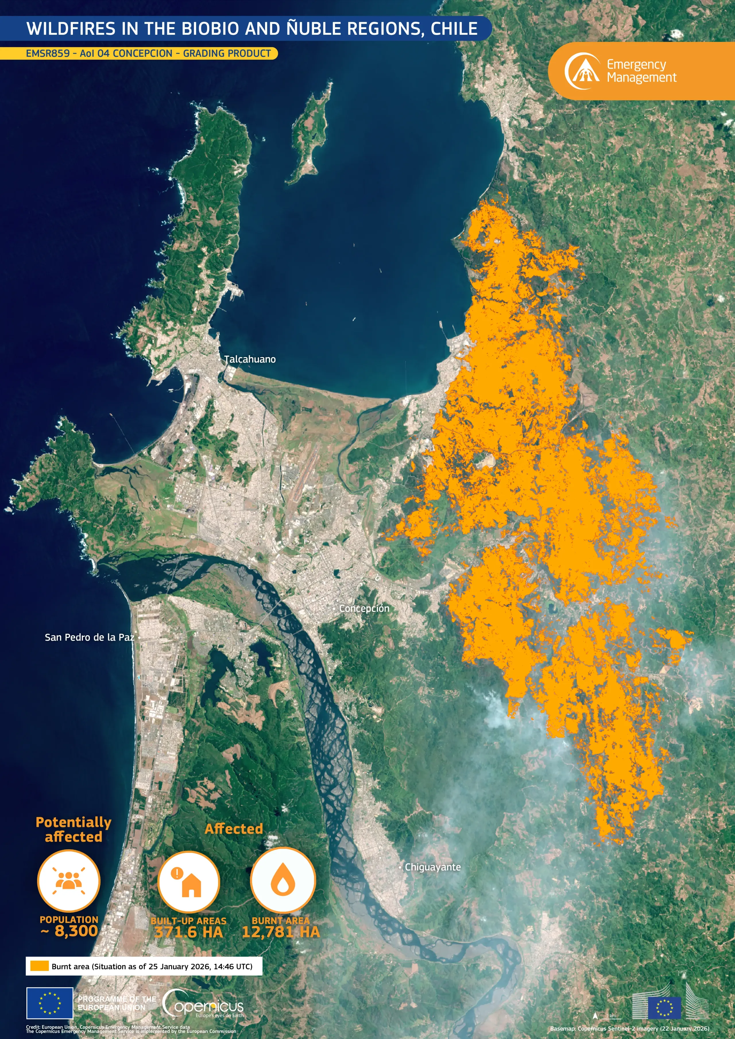
On 16 January 2026, wildfires broke out across central Chile, prompting authorities to declare a state of emergency in the Ñuble and Biobío regions. The fire resulted in at least 19 casualties, while evacuations and emergency response operations continued across affected areas.
The Copernicus Emergency Management Service (CEMS) was activated on 21 January 2026 (EMSR859) to provide emergency mapping of wildfire extent. This data visualisation, produced using the CEMS grading product for the Concepcion Area of Interest, shows the area affected by the fires in orange as of 25 January 2026.
Open data provided by the Copernicus Sentinel satellites and Copernicus Services support the monitoring and mapping of wildfire extent and impacts worldwide. Additional information on this activation is available here.
![Download [WEBP, 1.34 MB]](https://eu-space.europa.eu/sites/default/files/2026-01/20260128_Wildfires_Chile_EMSR859_1.webp)