Earthquake lifts the seabed and exposes coral reefs in Mindanao, Philippines
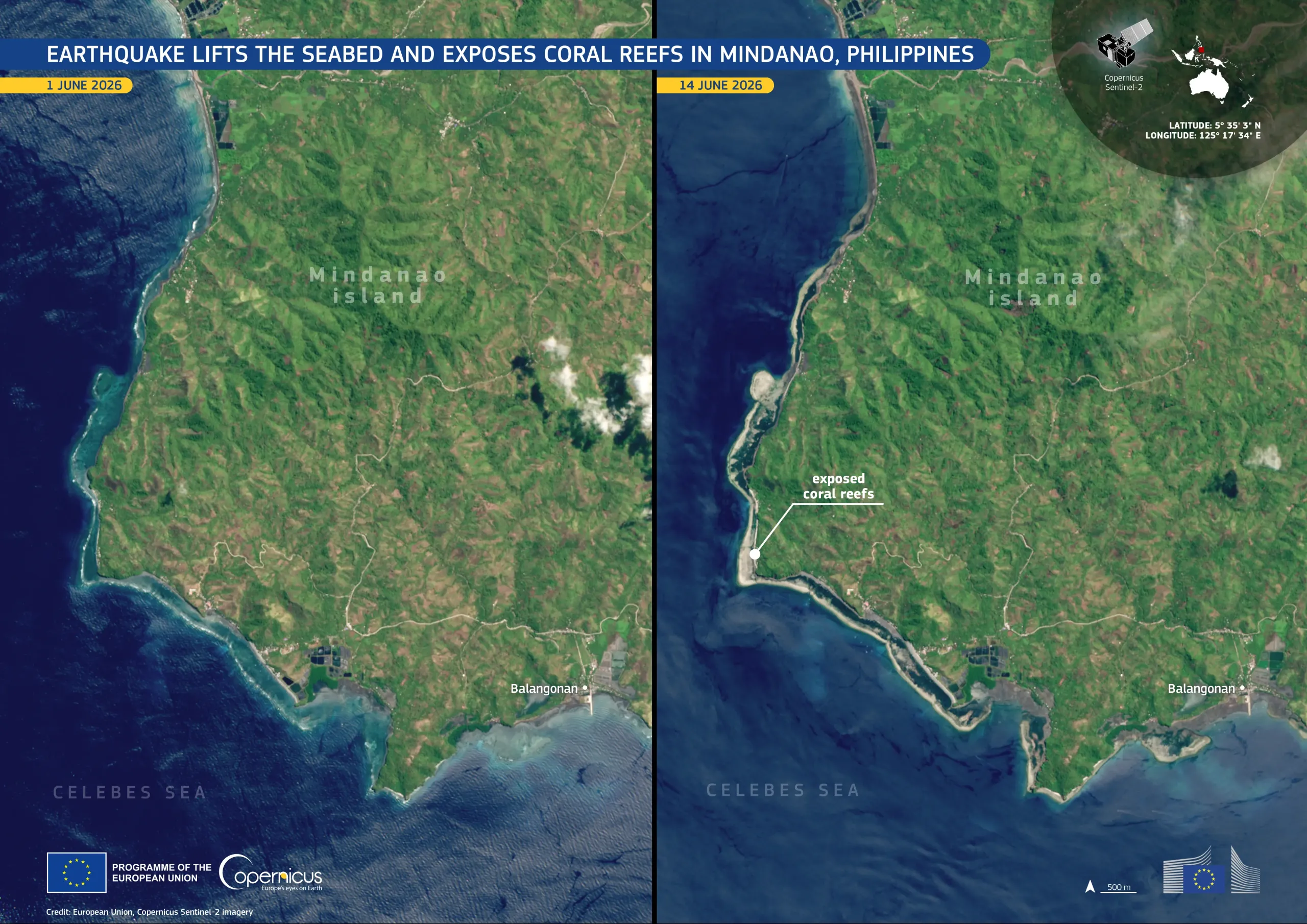
On 8 June 2026, a magnitude 7.8 earthquake struck the island of Mindanao in the southern Philippines. The earthquake uplifted sections of the island’s southern coastline, raising the seabed by up to 2 metres, and exposing coral reefs and other previously submerged areas, and affecting the local marine environment.
The image on the left, acquired by one of the Copernicus Sentinel-2 satellites on 1 June 2026, shows the coastline of southern Mindanao before the earthquake. The image on the right, acquired on 14 June 2026, depicts the same area after the earthquake, with newly exposed reefs and seabed.
Copernicus Sentinel-2 data support the monitoring of sudden landscape and coastal changes following seismic events, helping authorities, scientists, and environmental agencies assess impacts on coastal zones and marine ecosystems.


![Download [WEBP, 908.01 KB]](https://eu-space.europa.eu/sites/default/files/2026-06/20260616_Mindanao%20seabed.webp)