Shipping lanes thread through Indonesia’s Mahakam River
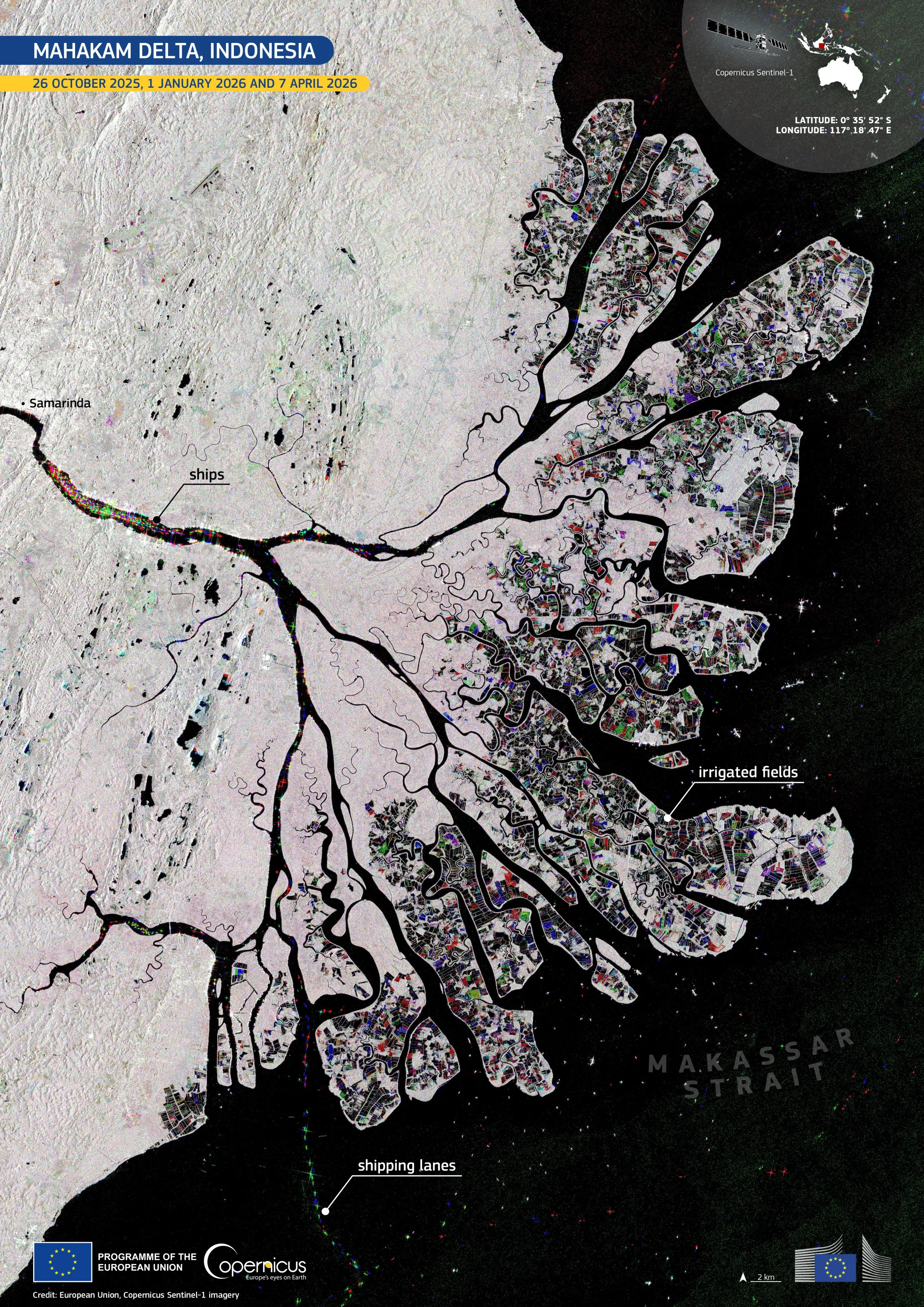
The Mahakam Delta, located on the eastern side of Borneo in the Indonesian province of East Kalimantan, is one of the major river deltas draining into the Makassar Strait. Its network of distributary channels, mangrove-fringed islands, aquaculture ponds, and cultivated land makes it a dynamic coastal landscape, shaped by natural sediment movement and human land use.
This multitemporal image, created from data acquired by the Copernicus Sentinel-1 satellites on 26 October 2025, 1 January 2026, and 7 April 2026, shows the entire delta. Dark channels mark open water, while the delta’s islands appear in pale tones, with a mosaic of coloured patches indicating surface changes between acquisition dates on the irrigated fields. Linear features and scattered points along the Mahakam River, near Samarinda, and out at sea, indicate the presence of vessels and maritime activity. Vessels present across different dates appear in distinct colours, reflecting their position at each point in time.
Copernicus Sentinel-1 radar data support reliable monitoring of delta environments, vessel activity, and land-use change, even in cloudy conditions.
![Download [WEBP, 3.7 MB]](https://eu-space.europa.eu/sites/default/files/2026-06/20260607_Mahakam%20Delta.webp)