Tidal landscapes of the Bijagós Archipelago, Guinea-Bissau
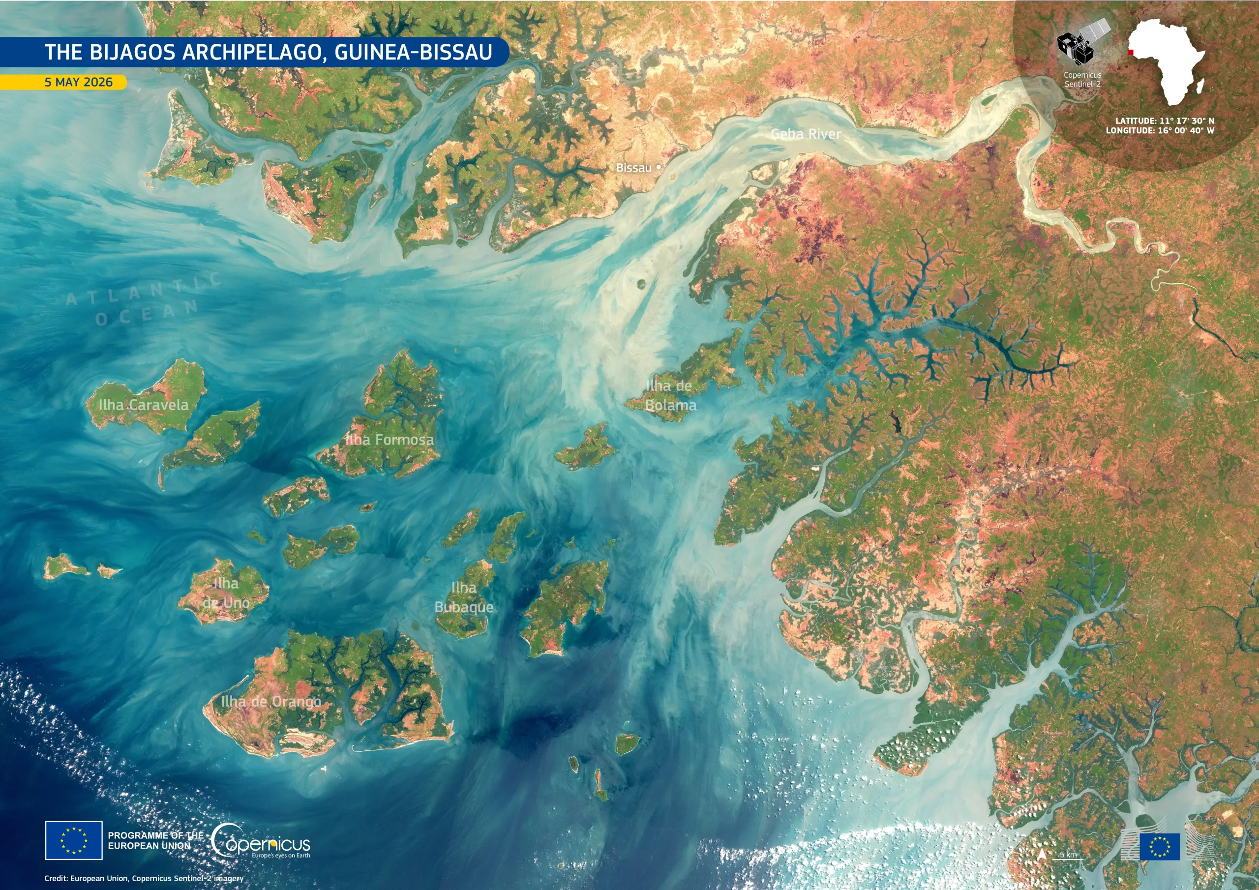
The Bijagós Archipelago, a system of 88 islands off the coast of Guinea-Bissau in West Africa, has been designated by UNESCO as the Bolama-Bijagós Biosphere Reserve. Its mangroves and surrounding waters support rich birdlife, fish, reptiles, mammals, and important green sea turtle nesting sites are highly sensitive to environmental change.
This image, acquired by one of the Copernicus Sentinel-2 satellites on 5 May 2026, shows islands including Caravela, Formosa, Uno, and Orango surrounded by shallow, sediment-rich waters. To the north, the Geba River flows past Bissau, the capital of Guinea-Bissau, into the Atlantic Ocean, with pale sediment plumes visible across the estuary and adjacent coastal waters. Vegetation appears bright green, while exposed soil appears in pink and ochre. Dark tidal channels cut through mangrove-lined coastal areas, contrasting with pale turquoise sandbanks.
Copernicus Sentinel-2 data support the monitoring of coastal habitats, shoreline change, sediment dynamics, and land-cover patterns across this biodiverse and environmentally sensitive archipelago.
![Download [WEBP, 2.07 MB]](https://eu-space.europa.eu/sites/default/files/2026-06/20260628_Bijagos%20Archipelago%20Guinea.webp)