Wildfire sweeps across Sierra de Alcubierre, Spain
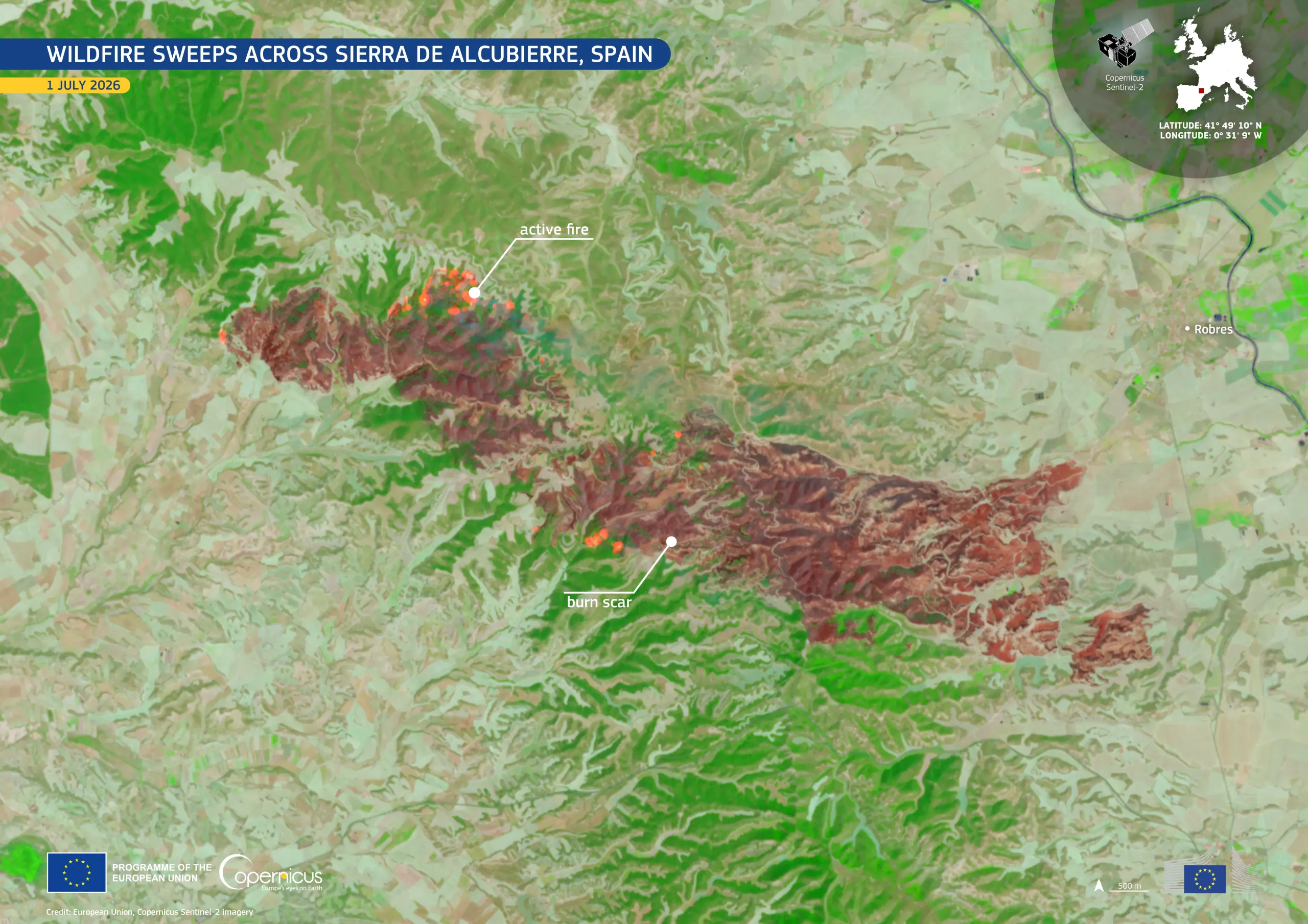
On 30 June 2026, a wildfire began burning in the Sierra de Alcubierre, located in the Aragón region of north-eastern Spain. The day after, the fire spread across forested hillsides and protected areas of natural and historical value, including parts of the Ruta Orwell, a trail preserving Spanish Civil War trenches linked to the British writer George Orwell.
This false-colour image, acquired by one of the Copernicus Sentinel-2 satellites on 1 July 2026, shows the extent of the affected area. Active fire fronts appear as bright orange hotspots, while the burn scar is visible in dark reddish-brown tones, contrasting with the surrounding green vegetation.
Copernicus provides high-resolution observations which support authorities and analysts in monitoring wildfire activity, mapping affected areas, and carrying out post-event assessments.

![Download [WEBP, 737.84 KB]](https://eu-space.europa.eu/sites/default/files/2026-07/20260704_Wildfire%20Aragon.webp)