Two earthquakes leave severe damage across northern Venezuela
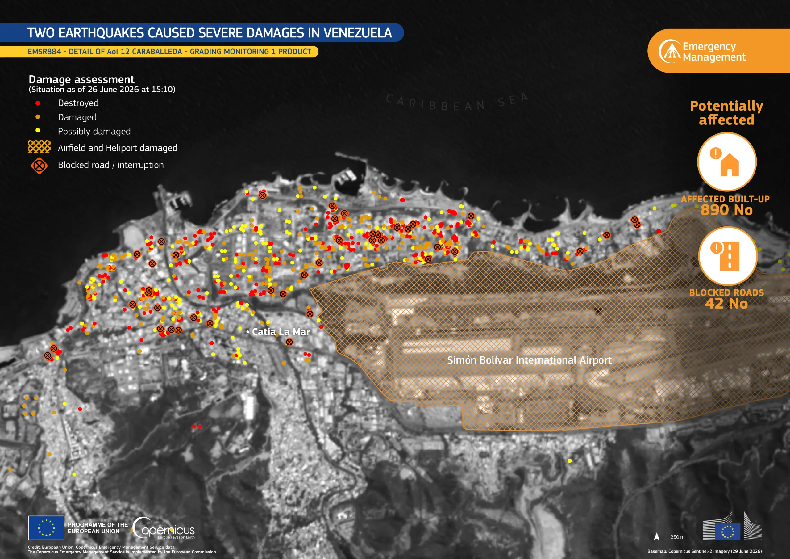
On 24 June 2026, two earthquakes measuring magnitude 7.2 and magnitude 7.5 struck northern Venezuela, causing significant damage across the country. According to the latest bulletins from local authorities, the earthquakes resulted in 1,943 casualties and 10,571 injuries.
The Copernicus Emergency Management Service (CEMS) On-Demand Mapping module has been activated (EMSR884) to provide emergency mapping for damage assessment in 13 Areas of Interest.
This data visualisation focuses on a section of Area of Interest 12, Caraballeda, and shows earthquake-related damage. Based on the CEMS Grading Monitoring 1 product, it highlights the observed impact of the earthquakes as mapped on 26 June 2026. Within this view, the product identifies 890 built-up structures as affected and maps 42 roads as blocked or interrupted. It also identifies damage at Simón Bolívar International Airport.
More information about this activation is available here.


![Download [WEBP, 877.25 KB]](https://eu-space.europa.eu/sites/default/files/2026-07/20260702_Venezuela.webp)